
Arizona Trail Thru-Hike Journal
 I hiked along the 800-mile Arizona Trail from March 17 to April 28, 2012 traveling from the Mexico border near the Coronado National Monument to the Utah border about 40 miles west of Page, AZ. This trek took 33 days of hiking and 10 days of rest due to weather and tired legs.
These pages are a composite journal of my adventure. Starting with my daily blog entries, I've added more pictures, details, and things I learned on the trail. You can click any picture to view a larger version of it, if you want.
I hope you enjoy the tale, learn a bit about planning your own hike, and pick up a tip or two. Please holler if you have questions or want more information about something you read here.
Day 01 to 11 - Mexico to Molino Basin
Day 12 to 20 - Molino Basin to Roosevelt
Day 21 to 31 - Roosevelt to Mogollon Rim
Day 32 to 43 - Mogollon Rim to Utah
04/17/2012
Day 32 - Alone Again
 I walked 53863 steps and covered about 25 miles today.
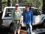
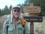
The amazing Kyle gave me a ride to General Springs to resume my trek. This is him with his untouchable Safari Ferrari - it breathlessly navigates high mountain curves on muddy dirt roads, needing no more than two tires in contact at any time.
The high plateau is amazing!
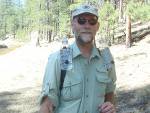 I walked for 9 hours on a carpet of pine needles under a vaulted cathedral of towering Ponderosa while the breeze freshened the day with a cool pine scent. This day reminded me completely of running through the Idaho woods as a boy and my legs didn't tire under the spell of the day. I finally made camp as the sun began to set so I had an abundance of time to eat, relax, and enjoy the evening.
The sun is now casting light until 7pm and the dusk light lasts nearly to 7:30. This extra hour since the beginning of the trek means more time to hike and cover more miles as long as the legs and feet can handle it.
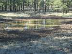 I was surprised by the scarcity of water today.
There was no water good enough to filter in any of the dirt stock tanks I passed. Water in puddles in the trail was much better than the brown muck in the tanks. I got water from East Creek which was flowing nicely. I then hiked an extra 1.75 miles to get water from the Blue Ridge ranger station. Got to talk to a couple nice ladies there for a few minutes and dumped my small bit of trash. WIthout that small detour, it would have been a very bad day.
 PapaBear will be happy to hear that I kicked a lot of sticks off the trail and reset 7 AZT signs that had been knocked down - good turns for the day.
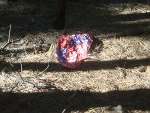
I also made a startling discovery today. When people buy mylar balloons for baby congratulations, birthday parties, graduations, and all that, they often 'accidentally' get released. Where do they go? You just see them float up, up, up, until they disappear but where to they finally go? I found out!
They get sucked into the wilderness and fall to earth to be popped by sharp things. This is the third mylar balloon I've found on the trail - one in Four Peaks wilderness, one in Mazatzal wilderness, and this one. I picked up this one and one other, but the last was too far into cactus for me to reach.
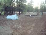 Well, it's now dark enough to head to bed.
Hopefully, the dozen deer and 15 elk I saw today won't come to visit. There's a coyote yapping somewhere in the distance but the wind has calmed so I expect a sound night's sleep. I've got nothing better to do than hike, so I might reach Mormon Lake tomorrow.
04/18/2012
Day 33 - Mormon Lake
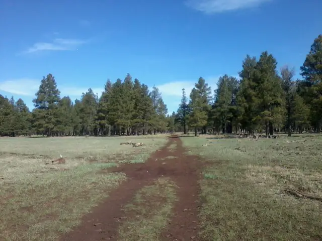 I walked 57317 steps and covered about 27 miles today.
This was the view for most of the day. The high pine forests continued and gradually thinned at times. I wore shorts the past two days for the first time on this trek since there were no prickly, poky, scratchy plants up on the higher plateau. It's so much more comfortable!
Tip: [Hiking with your fly open when it's very hot out can help keep you more cool and comfortable, especially when you're off in places where you won't offend anyone.]
I woke to a chorus of coyotes reminding me of a gang of teenagers running around getting into mischief. When I woke up, I realized the condensation of my breath in my shelter had frozen and I had my own personal indoor snow storm. My sleeping quilt and down jacket kept me plenty warm all night, but it was hard to get moving this morning. Once I was moving, I made good time but didn't reach Mormon Lake until 4:30 - that's important.
When I dropped onto the main road in town off a logging road I was walking, I could turn left or right with buildings each direction. Not knowing which way the Mormon Lake Lodge would be, I chose left and started walking with high hopes that I'd find the lodge and a room for the night. After a bit, a guy in a Mustang came toward me and I (somewhat frantically) flagged him down. Fortunately, he stopped. I asked where the Mormon Lake Lodge was and he said just ahead of me - whew, I had chosen the correct direction. Then he asked me, "Why?"
"Well, I'd like to get a room for the night", I replied.
"The lodge closes at 4pm", he said.
Remember I got there at 4:30? Rats - looks like I'll be camping. But wait - he gets out his phone and makes some calls and then I noticed his shirt had the lodge name on it. He arranged for me to get a small room and pay in the morning! I just LOVE the flexibility of small town businesses where every customer is important.
Now, the dining area and store are closed, but at least I've got a shower and bed. Since everything's closed, I made hot water in the coffee maker in my room and used that to rehydrate my dinner. It wasn't the big burger I was hoping for, but it was fast, clean, and easy, so no complaints. I was so looking forward to a big meal, but a comfortable bed and hot shower are good enough.
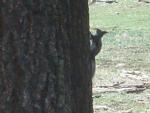 I saw some more elk as well as a strange squirrel-like critter that had a white tail and tufted white ears. Since I didn't see a gila monster on this trek, this is the only new animal that I've never seen before so far. (I found out later it is a Kaibab squirrel and only lives in northern Arizona.)
If you remember, I tore off the inside half of my left heel's sole going into Roosevelt about 12 days ago. Since then, every step on my left foot has been at a slant to the right without that support. Combine that with rough terrain and longer days and I've developed a very deep blister on the bottom of my left heel. I'm afraid I might have to do something about it soon, but I'm leaving it alone right now because my wife has sent a new pair of shoes to Flagstaff. We'll see how tomorrow goes.
The other minor blisters I've gotten have all been left alone and just dried and toughened up on their own.
04/19/2012
Day 34 - Still Snow Up Here
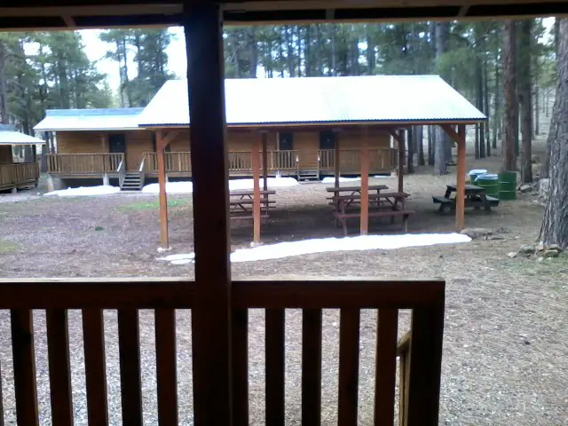 I walked 64735 steps and covered about 35 miles today.
The view out the door of my room at Mormon Lake Lodge this morning. Notice they still have snow from 5 days ago. I hiked through a lot of soft ground but only a couple patches of snow getting here.
The office opens at 8am, I check out and pay my bill (ouch! glad it's still off season), and I'm on my way to Marshall Lake where there will hopefully be a bit of water left at the end of this day. Then it's a short Friday into Flagstaff, planning to arrive around noon. I've been told there's 10 days of completely clear weather forecast so I'm getting excited to reach Utah.
Rails to Trails
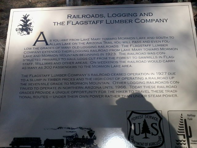 I'm following an old railroad grade toward Flagstaff for the next few miles. It's very cool to see the old railbed ties on a raised grade from so many years ago. Logging of huge pine trees has been a key industry in these parts.
Just a glorious morning of hiking with birds, breeze, and a good trail. I could really get used to this - it's such a treat compared to Four Peaks and HardScrabble Mesa!
AZ Trail Bike Race
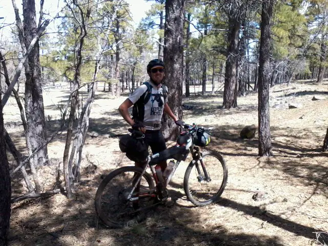 Kurt S. just passed me on the trail riding north. Scared the beejeebers out of me! He is the lead rider in a race that started Friday at the southern end of the AZ Trail. He expects to finish in 2, maybe 3, days. 9 days to cover what will probably take me 7 weeks. :-)
Ride On, Kurt!
They can't actually ride the entire AZ Trail because the wilderness areas are off limits for bikes. So, they start at Parker Canyon Lake instead of the Mexico border due to the Miller Peak wilderness. They also skirt the Saguaro Nat'l Park, Four Peaks wilderness, and Mazatzal wilderness. They have to carry their bikes through the Grand Canyon.
Distant Mountains
 Do you remember these San Francisco Peaks from Day 25? I could see them from south of LF Ranch and I've been gradually making my way closer, day after day.
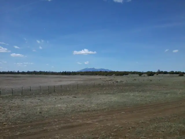 These are the same mountains at 1:30 this afternoon. They are still an awful long way off and don't look much closer in this picture, but they are much more clear - just wait until this evening!
The miles are melting away this morning so I call PapaBear to see how he's doing when I'm around Horse Lake. After a short talk, we decide PapaBear will be picking me up at the end of the trail. He's still resting in Tempe and there's no way he can get back on the trail but he wants to help me out - great guy! Most things have worked out well on this trek - this is the one major setback that just doesn't go well.
Since PapaBear can't join me to hike from Flagstaff, I've decided to alter my plans yet again. I feel I can make it to Flagstaff tonight, take my zero day tomorrow, and get back on the trail on Saturday instead of Sunday. This will get me a day closer to finishing the trail.
I call my scouting friend in Flagstaff and ask if I can change things up yet again. He says 'No Problem', so I stretch my legs a bit further through the afternoon.

Here's the last picture of the San Francisco Peaks before I reach Flagstaff. They are still 10 miles away, but my next hiking day will bring me right onto their shoulder. The one peak is actually the highest point in AZ but I'm not going to the top this trip. But, I AM getting to Flagstaff today!
Trail Angel
I was surprised to find that it's all gradual uphill to Flagstaff - I'm used to hiking down to a town, but Flagstaff is all up until the last 1/4 mile. I do need to clarify that this is the resupply route into Flag rather than the main trail that skirts the town to the east.
I came flying down a short hill into Flagstaff with about 1/2 inch of water left in one bottle and feeling pretty parched. I've come nearly 35 miles from Mormon Lake on the three liters I filled in my hotelcell room. Right in front of me, I see a beautiful pond with ducks and cattails. It's about 1.5 miles to the McDonald's where I've planned to meet my scouting friend so I'm very tempted to filter a small bottle here - but I skip it. As I walk around the pond on the developed city trail system, I see a sign stating "Do Not Drink - Contains Sewage Effluent" or some such statement.
Dear City of Flagstaff: Please put an identical sign on the other side of the pond so thirsty AZ Trail hikers don't drink it.
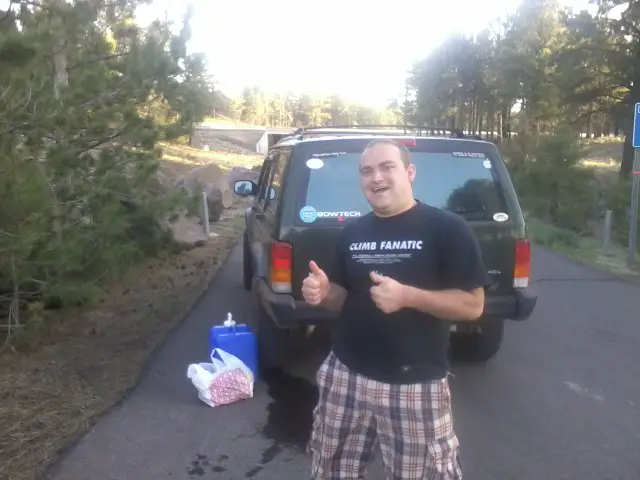 Just as I found my way into Flagstaff I was walking up off the local trail system onto a city street. A jeep pulled up and I thought maybe it was the folks I'm to stay with tonight.
I was wrong. It was David L. who goes to NAU in Flag. He saw my blog and real-time map showing I was just getting to town, and came to do trail magic.
Out of the blue, for no reason other than to make a hiker feel good, he met me with cold water and snacks (and his 2 dogs). How cool is that?!
Someone that gives trail magic is called a trail angel.
It doesn't take much to make a tired, thirsty hiker happy. That cold water was awesome since I just had a couple swallows of overheated water left.
Thanks, David!
I came flying down a short hill into Flagstaff with about 1/2 inch of water left in one bottle and feeling pretty parched. I've come nearly 35 miles from Mormon Lake on the three liters I filled in my hotel
Dear City of Flagstaff: Please put an identical sign on the other side of the pond so thirsty AZ Trail hikers don't drink it.
 Just as I found my way into Flagstaff I was walking up off the local trail system onto a city street. A jeep pulled up and I thought maybe it was the folks I'm to stay with tonight.
I was wrong. It was David L. who goes to NAU in Flag. He saw my blog and real-time map showing I was just getting to town, and came to do trail magic.
Out of the blue, for no reason other than to make a hiker feel good, he met me with cold water and snacks (and his 2 dogs). How cool is that?!
Someone that gives trail magic is called a trail angel.
It doesn't take much to make a tired, thirsty hiker happy. That cold water was awesome since I just had a couple swallows of overheated water left.
Thanks, David!
A Long Day
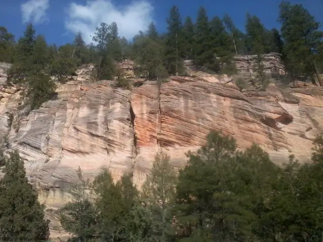 Mormon Lake to Flagstaff is too far for 1 day. I set a new record for myself - about 35 miles in 10 hours. The flat terrain and cool temps made it possible but I don't plan on doing days this long again. It's too hard on joints, muscles, and feet for a guy my age.
 There were some great sights today, including this cliff just coming through a canyon east of Flag.
I never did see another bike rider so I think the guy I saw about seven hours earlier in the day has it pretty much won as long as he completes.
 If you look real close, you might see some of the 50 elk that thundered across the trail ahead of me on the prairie south of Marshall Lake. That was a very cool thing to see.
I was hoping to reach McD's at 7:00 but got there by 6:30 so I ordered a chocolate shake and called my host. Just as I finished, he arrived and took me home for dinner. I felt way weird stinky and dirty right off the trail to a very nice meal with his family, but at least I got to change into my 'town clothes' and wash my face and hands. His wife made an amazing chicken dinner!
I'm now at a different Scouter's home resting after a shower because the first family has plans for the next two days. Tomorrow is a zero day to get groceries and rest my aching feet.
I've got a replacement pair of shoes which I hope help me along. The deep blister on the bottom of my left heel has grown so I decided to drain it. Not quite a gallon of liquid came out, but it feels better. I hate doing that to deep blisters because of the risk of infection, but I'm clean now and cleaned it well afterward so we'll see how it looks tomorrow.
04/20/2012
Day 35 - Water Cache
Just an uneventful zero day to recuperate. My host took me out to Cedar Ranch trailhead to cache a gallon of water. From the maps, it looks like there's no reliable water for almost 60 miles, from Alfa Fia tank to Russell tank. I don't want to take a chance on some 'possible' or 'seasonal' water sources out on the desert.
Had some great Arby's roast beef, curly fires, and milk shake along with a Netflix movie for dinner - that was nice.
I replaced items I needed from my bounce box which was waiting here in Flag and got food for the next few days. Since I'm going to try and go longer days, I'm trying to lighten my load as much as possible. I'm leaving my umbrella and cooking set as well as a few other trivial things. I'll be eating just cold food for the rest of the trek. I'm leaving the bounce box here and we'll pick it up after I finish and we drive through Flag on our way to Phoenix.
My plan to send food ahead and bounce a box of replacement items evolved a lot on this trek. I first planned to send boxes from MN to about 6 different post offices, but that was way too expensive. Then, I planned to buy all my food in Tucson and send the boxes from there, saving lots of postage. But then my friend in Tucson said I could take a zero with them after about 8 days so I just left my bounce box and extra food at their home. On my zero day, I decided it looked like there were more opportunities to buy food along the way so I just mailed one food box to Roosevelt Marina and the bounce box with extra food to the Pine post office. Once I teamed up with PapaBear, the Roosevelt drop was no longer needed, but I had already sent it. After that, I left the bounce box in Flag and figured I'd just buy food along the way.
Tip: [There are many different ways you can plan your food for a long hike, but keeping plans as flexible as possible is key to a successful trek.]
04/21/2012
Day 36 - High Point
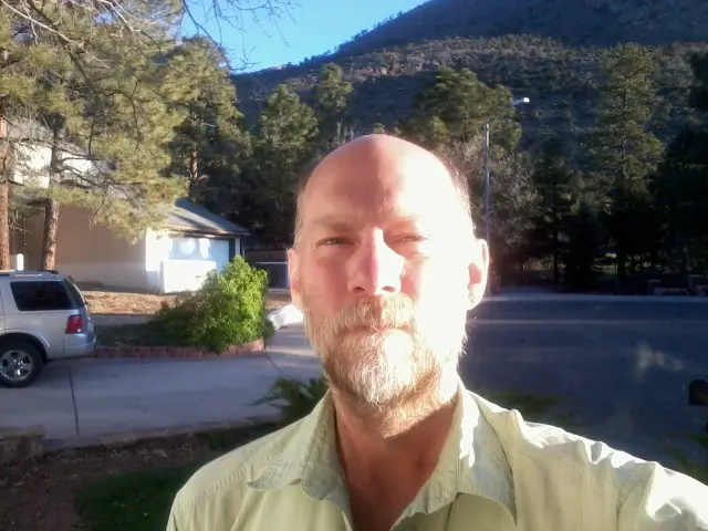 I walked 63784 steps and covered about 30 miles today.
Ready to start hiking again at 6:30am on Saturday. Everything but my left heel feels great - it's still sore but getting better. I drained it again.
I have high hopes that my replacement shoes will help out as I hike out of Flagstaff up onto the mountainside.
 I believe I'm at the high point of the AZ Trail here, at about 9400 feet on the side of the San Francisco Peaks. I took the Kachina Trail instead of the new AZ Trail route because it is higher, cooler, shorter, and more scenic. The reroute is for mountain bikers and I think alternate sections just for hikers should be continued.
OOPS and WHEW
 I was getting water from Alfa Fia tank at mile 603 north of Flagstaff. It's a beautiful pond with great water and possibly the only good water for almost 60 miles.
As I reached out with my 1quart zip-loc to scoop up some H2O, PLUNK went my cellphone from my shirt pocket into the pond. It took me less than 3 seconds to get it out, but that was long enough. I dried it but could not power it off. I opened it and set it in the sun.
Still not able to turn it off and other buttons doing crazy things, I put it in a mesh pocket of my pack and kept hiking figuring all was lost.
Mountains Once More
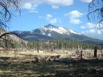 Remember those mountains from yesterday? Well, I'm on the north side of them now. It is just amazing how much territory can be covered by just placing one foot in front of the other, mile after mile, hour after hour, day after day.
 So far, my heel blister is cooperating and I'm covering miles.
Unplanned Long Day
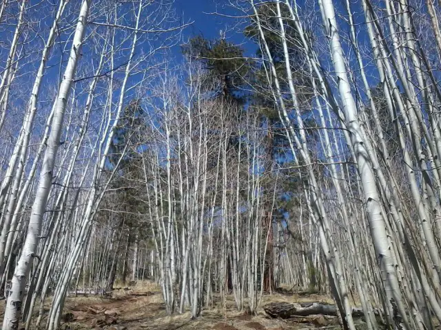 Taking the higher trail, I passed through some stands of aspen. Once I got to Alfa Fia tank for water, the trail was a gradual downhill for the rest of the day - so I just kept walking. I made it to mile 620 which is nowhere, nowhere at all. The next 80 miles or so are just a long, gradual uphill, gaining maybe 1,000 feet so it should be fairly easy walking.
Whoever laid out this section of trail really felt it was important to experience the forest. About 4 miles meandered all over similar to switchbacks, but with virtually no elevation change. Weird! It could have been done in about 1 mile.
Now that I'm not cooking, my menu is lots of candy bars, poptarts, and peanut butter and honey on crackers. I found out that I love PB & H on crackers! I've also got Tusayan, Grand Canyon Village, and Jacob Lake where I can get hot meals.
04/22/2012
Day 37 - Day of Blessings
 I walked 80000 steps and covered about 40 miles today.
I found out my pedometer stops counting at 65000 steps in a day so I have to estimate for today.
I started my day feeling great, but bummed that my phone wasn't working. Last night, the screen was a weird green color and nothing worked. But, this morning, it was black. I decided to wait until this afternoon to try it, plugged in my solar charger from Northern Star Council and gave it a shot. BAZINGA! It works. Whew! Now I can take pics and blog again.
 With some water left from yesterday, I started hiking at 6:30. By a bit after 9, I had covered 10 miles and reached my cached water hidden by the trail.
Some people cache water and then leave the empty jug. Seems wrong to me, so I packed mine out. Besides, there was still about a quart in it that I sipped on for the next 5 miles.
There was no water available all day until I reached Russell Tank 40 miles from my start point! I can't believe I did 40 miles. I got a couple small blisters and my legs are very worn out, but I should be good to go tomorrow.
I went this far because I believe I can reach the Grand Canyon in 3 days from Flagstaff since yesterday went so well. Tomorrow will be a 35 mile day to make it happen.
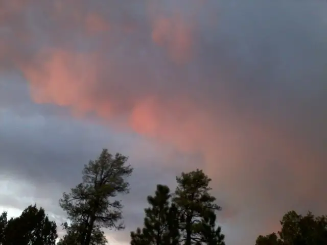
While hiking, I was hoping for a small cloud to move under the sun so I could get some shade - it was HOT today. Well, the cloud grew into a thunderstorm but I only got a little wet along with a little worried from all the thunder I heard and lightning I saw.
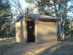 At Russell Tank, there's actually a trailhead with a very clean, large toilet. Guess where I'm sleeping tonight? It's warm, flat, dry, and no critters. Practically a free hotel with protection if it does rain.
The trail data said Russell Tank is muddy so I was concerned about getting water. But, it is just fine and had lots of water. The water jug I packed out came in handy to scoop water.
It was a long day of challenges that turned one by one into blessings. I even got to wash up in the pond so I went to bed tired, clean, full, and happy - can't beat that.
My big heel blister is still bothering me so I drained it again tonight. Some really thick, tan goop came out but nothing like infection. I think it was just the liquid thickening, but pretty gross. :-)
04/23/2012
Day 38 - the GC
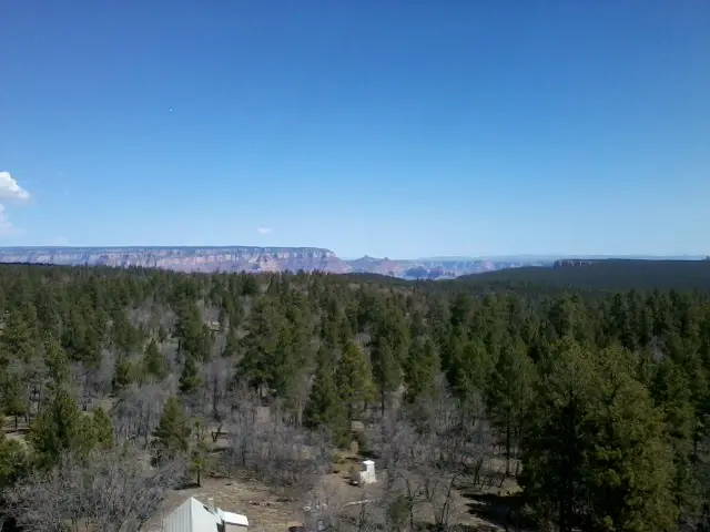 I walked 70000 steps and covered about 35 miles today.
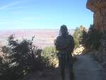
View from the top of the GrandView lookout tower! This was my first view of the Grand Canyon. I climbed to the top but the trapdoor is locked, so it's not QUITE the top.
A couple gallons of water are cached here for any AZ Trail thru-hikers to use - very cool! I took about a half gallon and left a note on the jug saying when I opened it.
I'm heading to Grand Canyon Village now and should get there this evening.
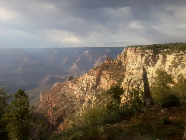 On today's hike, I saw my first antelope and a bunch of elk. Sprinted (well hobbled) into Tusayan and got a chicken sandwich at McD's.
Met a couple cool NPS employees at the park entrance and they said, 'Hey, anyone ever tell you that you look like...'
I said, 'Yep, all the time.'
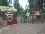 There are thousands of people going in and out of the Grand Canyon entrance - but I'm the only one on foot! I walked up the road to the park entrance gate because I wanted to get a map and ask where camping is. The road goes right past a ranger station where a USFS employee was just finishing putting up a camera mount so people could take their picture with Smokey. I was the first person to test it out and I chatted with him for a few minutes.
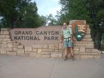 I also met a guy from Michigan, a Bulgarian couple living in Chicago, and a couple from Ontario. The Bulgarians took my picture by the G.C. Park sign. I'm getting better at starting conversations with strangers, obviously. :-)
The AZ Trail entering the park is a wide gravel roadway and there are elk all over the place. Many of them looked awful rangy and grubby compared to others I saw out in the wilds.
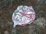 I found yet another mylar balloon in the woods today - that's 1 balloon every 200 miles now.
Made it to the South Kaibab trailhead by 6:00 this evening. That is the starting down point for the Grand Canyon. Then I took a free shuttle back to Grand Canyon Village to figure out camping or hotel. The silly GC Visitor Center closes at 5pm - how dumb, so no help there. Finally found Mather campground which is just $6/nite for a tent - cool!
I met two guys, Jose and Scott, each doing their own bicycle tour around the country - one has been going 11 months, the other 13. Makes my 6 weeks seem paltry.
Tomorrow hopefully sees me getting a permit to hike the canyon or else I wait here a day. The word on the street is another storm is on the way and will probably hit on Wednesday and get worse on Thursday - rain here and winter mix on the higher north side of the G.C.
04/24/2012
Day 39 - Into the Canyon
 I walked 36103 steps and covered about 14 miles today.
So many things keep coming together and working out on this trip, it's amazing. I went to the Back Country office for a permit so I could camp in the canyon. I took a free shuttle from the campground and arrived at 7am but it doesn't open until 8am - I wanted to be first in line and I was. While waiting, I chatted with two guys from Dallas. They were waiting for the shuttle to the trailhead and already had a permit for three people. They said if I couldn't get a permit, I could camp with them at Bright Angel campground - great insurance in case I fail, but I'd really like to camp at Cottonwood since it is 7 miles closer to the north rim.
Everyone I met said I 'might' get a permit for the next day, but no way for today. Once the office opened, I got the first number available. A bunch of people didn't show up to get their permits so I DID get one, and it was for TODAY, and it was for COTTONWOOD! So it shaved 1200 feet off tomorrow's climb.
I headed back to camp, packed up, grabbed a sandwich and trail food for three days at the store, and hopped on a shuttle to the trailhead. The last weather I hear is that the storm is on track and will hit Wednesday night.
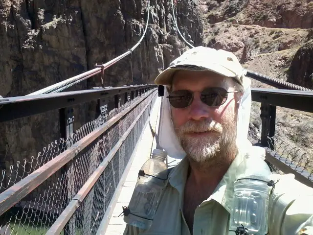 After all the permit work and packing, I finally got started down the South Kaibab trail at about 11:30am - awful late start for a 14 mile day. I was hoping to spend a longer day in the canyon, but this will be fun.
 It was awful hot at the bottom of the canyon. After a tough 7 miles up to Cottonwood Camp, I was beat, but happy.
There was a campsite waiting that was perfect for me.
I got plenty of water - which I didn't have to filter.
I got to rinse off my shirt.
 The big rattlesnake some people startled right by my site didn't bite me.
It doesn't take much to make a hiker happy. :-)
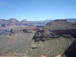
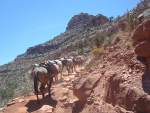
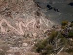
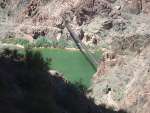
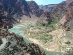
The Grand Canyon is much more than you see from the paved paths on the South Rim. An astounding amount of work has gone into the trails and structure. I did finally discover where all the dust from our vacuum cleaner bags goes - they pour it on the South Kaibab trail to make it soft for the mule trains.
OK, I took dozens and dozens of pictures while hiking in the canyon and here are a handful to share...
Canyon Pics
Marshal the Biker
 You may remember I was passed by a biker on the trail days ago and he was racing the entire trail. Well, I met another one hiking down into the canyon and chatted with a little bit as we both descended. His name's Marshal. Since they can't ride through the canyon, the bike racers have to 'hike-a-bike' for about 20 miles from the south rim to the north. Marshal was planning to do this in one shot since he didn't have a permit to camp in the canyon. It was around noon when I caught up with him still heading down and he'd have 14 more miles of UP, carrying about 50 pounds, and he looked pretty tired out from his days of racing.
After passing him, I tried to figure out how I could help. I tried to call the number on my permit to see if I could change it from 1 to 2 people - no coverage. I kept my eyes out for a ranger that might change it for me out here in the field - none around. Finally, when I got to Cottonwood camp, I asked the individual campsites there if they possibly had a permit for more people than were actually in their group, just like those two guys from Dallas - jackpot! A group of 4 had an extra spot. Their campsite was pretty crowded but I had plenty of room, so I left an open area, figuring Marshal could rest there. Then, I did all my camp chores and waited for him to walk up the trail. And waited. And waited. Finally, it was dark and time for me to hit the hay so I figured he must have just decided to hide out in the brush along the trail and get some rest.
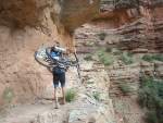 I got up and started hiking out of the canyon. On the way up, I see Marshal trudging along ahead of me! Turns out the guys in the other campsite stopped him and had him sleep with them, gave him dinner and breakfast, and he headed out very early. We talked as we walked for an hour or more which made the hike less arduous, but no less steep. He gave me some 'RockTape' for my sore leg and I eventually moved on ahead when he took a break. I continued on, up, and out.
Once he reached the rim top and he could ride, he overtook me on the way to Jacob Lake where he decided to spend the night in a hotel.
How do I know? Well, I hitch hiked and got a ride and bummed his spare bed! More about all that next.
04/25/2012
Day 40 - Out of the Canyon
I walked 44426 steps and covered about 27 miles today.
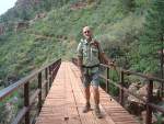 After a very warm night down in the canyon, I hiked out the north rim. Simply spectacular scenery the entire way out of the canyon. The trail was terrific and the hike went quickly even though my left leg is nearly shot. I don't know if it was due to the long hike down yesterday, or just pounding on it since Pine, or favoring my heel blister, but the lower leg muscles on the outside and front are pretty painful.
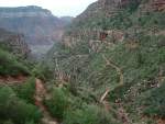 On the north Kaibab, it was completely overcast and there is usually still snow this time of year. There's less this year, so I took off on the trail - immediately hitting some drifts, but not too many and I can see the trail just fine.
To get water, I dropped off the trail to the road where there was a small lake since there seems to be little water even though there's plenty of snow. That's when Marshal, the biker, caught up to me so it was fortunate I did that bit of road walk.
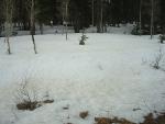 I rejoined the trail at the National Park entry station, heading east back into the forest. Immediately, I hit more snow and saw only 1 set of faded footprints through it. I followed for almost 3 miles over mostly clear ground but some knee-plus deep drifts.
If it was sunny weather, I would have continued but it was sprinkling all day, temperature dropping, wind picking up, and forecast of fairly severe storm coming. So far, my experience with the AZ weather folks is that they are spot on, at least with the last two snow storms. I wasn't concerned about camping out in the bad weather, but if it snows tonight, I know I won't be able to find and follow the trail tomorrow since the tracks will be gone and there are very few trail markings. Being a wimp and opting for safety, I bailed off the trail and walked 10 miles down some forest roads to the main Hwy 67. I walked it for a few miles until a couple guys doing work on the rim stopped and gave me a ride to Jacob Lake - my first ever hitch-hike! They were 2 Navajo men heading home to NM and were great to stop and help a stranger. Thanks, guys!
So, when I got to Jacob Lake, I phoned Marshal from the lobby, got a burger dinner, and then a great bed and shower.
All in all, not a bad day even though I roadwalked a part of the trail. We'll see what tomorrow brings.
 After a very warm night down in the canyon, I hiked out the north rim. Simply spectacular scenery the entire way out of the canyon. The trail was terrific and the hike went quickly even though my left leg is nearly shot. I don't know if it was due to the long hike down yesterday, or just pounding on it since Pine, or favoring my heel blister, but the lower leg muscles on the outside and front are pretty painful.
 On the north Kaibab, it was completely overcast and there is usually still snow this time of year. There's less this year, so I took off on the trail - immediately hitting some drifts, but not too many and I can see the trail just fine.
To get water, I dropped off the trail to the road where there was a small lake since there seems to be little water even though there's plenty of snow. That's when Marshal, the biker, caught up to me so it was fortunate I did that bit of road walk.
 I rejoined the trail at the National Park entry station, heading east back into the forest. Immediately, I hit more snow and saw only 1 set of faded footprints through it. I followed for almost 3 miles over mostly clear ground but some knee-plus deep drifts.
If it was sunny weather, I would have continued but it was sprinkling all day, temperature dropping, wind picking up, and forecast of fairly severe storm coming. So far, my experience with the AZ weather folks is that they are spot on, at least with the last two snow storms. I wasn't concerned about camping out in the bad weather, but if it snows tonight, I know I won't be able to find and follow the trail tomorrow since the tracks will be gone and there are very few trail markings. Being a wimp and opting for safety, I bailed off the trail and walked 10 miles down some forest roads to the main Hwy 67. I walked it for a few miles until a couple guys doing work on the rim stopped and gave me a ride to Jacob Lake - my first ever hitch-hike! They were 2 Navajo men heading home to NM and were great to stop and help a stranger. Thanks, guys!
So, when I got to Jacob Lake, I phoned Marshal from the lobby, got a burger dinner, and then a great bed and shower.
All in all, not a bad day even though I roadwalked a part of the trail. We'll see what tomorrow brings.
04/26/2012
Day 41 - Jacob Lake
 Here at the Jacob Lake Inn, I've met a few of the nicest young folks on my hike. It's a small and comfortable inn with souvenir shop, small 'junk food' store, and fun diner area.
Jake was handling the diner when I came in. I sat as far from everyone else as I could since I hadn't showered. ;-)
Jake was friendly, efficient, and extremely helpful. He's a college student in Idaho. The food was good, especially the chocolate shake.
Walt does registrations and (as far as I can tell) pretty much everything else as needed. I've never met anyone as conscientious, carrying for the comfort of others, and seeming to enjoy their job as Walt. His fast smile is contagious and his efforts to make everyone welcome is admirable. He got weather forecast info, showed me the way to a local lookout tower, and even insisted I use his personal cellphone to call home when mine had no coverage.
A couple girls working here seemed just as good as Walt and Jake, but I didn't really talk with them.
A funny thing - these guys have just started working here as summer jobs so they are still learning. When I ordered my shake, neither Jake nor Walt knew how to run the shake machine so they got another buddy to do it. I have to say, it was one of the best chocolate shakes I've had. Thanks, guys!
 It's pretty cold today. No snow materialized, but just some rain.
Marshal left at about 4:00am to finish his bike race - there is a window of good weather until about 9:00am and he wants to finish before the trail turns to red soup. I get up around 7:30 and pack up with just my dayhike essentials and emergency items. My plan is to slackpack from where I caught a ride yesterday back here to Jacob Lake and spend another night in the Inn. I go to the front desk and get this set up, then have breakfast and take my time getting ready to go.
Walt told me there's a lookout tower just a mile south, right on the road, so I hike down there with the hopes of getting cell coverage. Even at the top of the tower, there's no T-Mobile (yeat again) but, more importantly, my leg is not cooperating and giving me some pain. I return to the Inn.
Outside the front door of the lobby, someone calls out my name. It's HappyFeet, another thru-hiker that I had corresponded with online. He is just stopping for a break and will be moving on, but I buy him an early lunch in exchange to hear about his trail so far. He tells me that he just ran into PapaBear at a trail crossing and PapaBear is wondering where I'm at. We can't figure out a way to get word to PapaBear, but HappyFeet is absolutely, positively sure PapaBear is coming to the hotel later in the day.
It takes very little self-convincing - my left leg hurts, the weather sucks, I'm not sure where PapaBear is, and I decide my body could really just use a day to rest. So, I hang around all day instead of hiking. That turns out to be a very good choice.
I leave word with the front desk that my friend is expected and I'd like them to have him call my room when he shows up. Late in the afternoon, PapaBear arrives and I breath a big sigh of relief. He gets a shower and then we head to Kanab to the Spur Grill for dinner and exchange of stories. It's hilarious to hear how PapaBear was chasing me all over Arizona and just missing me the whole way - I'll add that at the end. The important thing is that we've got a plan for the final two days and I should be finished on Saturday.
04/27/2012
Day 42 - Smelling the Barn
 I walked 56314 steps and covered about 28 miles today.
PapaBear drove me to where I hitched a ride. I walked back up to the trail and hiked it to Hwy 89a trailhead which was half the distance left. Now I just need to do 28 more miles tomorrow.
I feel kind of like the farm animals getting close to home and getting anxious to finish up. I even spent a considerable amount of time while hiking today figuring out how late at night it would be if I hike all the way to the end - getting there at 1am wouldn't be fun. :-)
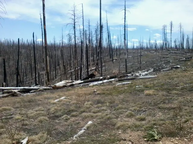
I saw a small herd of 8 or 9 deer. Other than that, most of the day was spent walking through this big burned out area.
It was fun to stop and have lunch at a trailhead with PapaBear, then off hiking through the afternoon. He met me at Hwy89a and we camped there.
04/28/2012
Day 43 - Final Steps
 I walked 54461 steps and covered about 28 miles today.
I'm Done!
I reached Utah at 2pm today and PapaBear was waiting to take me to Phoenix - we're on our way now.
I really overdid it the past few days and my legs really hurt with each step. The last 4 hours today, I had to force myself to work through the pain and it was actully the longest stretch of time I've ever had to do that.
The actual hiking today was fairly easy and the painted desert at the end was beautiful.
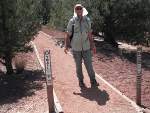
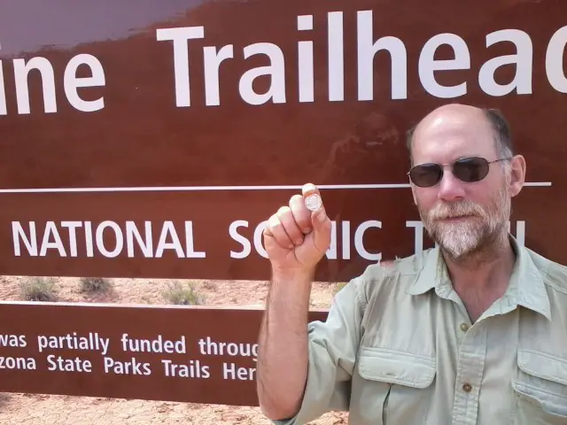 This picture is of me at the end of the trail holding a solid silver 1961 quarter that a scout in my troop and his dad gave me for my trip. They said it might come in handy for trading since it is silver. I carried it the whole way and it often reminded me of everyone back home that were rooting for me and I would see soon. It will forever remain one of my favorite things I've collected over the years. It's extra special because it was made the year I was born.
05/02/2012
Epilogue
 Now that my little 800-mile hike through Arizona is over, I'm back home.
I took about 1.7 million steps to travel about 800 miles. Four of the first 23 days of hiking were longer than a marathon and 8 of the last 10 were. I hiked alone for 13 days and with a buddy for 21 days. When hiking with someone, average miles per day was 19.3 but, when alone, it was 27.9
I rested for a couple days in Tempe with PapaBear and his step-dad.
It was awfully hot in Tempe. PapaBear and I went to a local pub and won a Trivia Night contest - actually, he won it and I just tried to help. We took his step-dad out to a chicken wings place for his birthday.
And, I ate a lot.
My plane brought me home today. I made the reservations from Flagstaff and gave myself a couple extra days in case of weather or problems. The flight had a 4-hour layover in Milwaukee which was great because my parents and brother met me there and bought me lunch at Culver's!
My left lower leg is still swollen, but getting better. I'm just resting and icing it. Other than that, I'm doing very well.
Now, to start planning the next hike. That might be to hike with PapaBear for two weeks when he goes back to finish the AZT, or it might be doing the Ice Age Trail through Wisconsin - I'm really excited to do that one.
Hike On
11/08/2013
What About Papa Bear?
I was asked if Papa Bear ever completed the Arizona Trail hike after being forced off due to medical concerns.
In the spring of 2013, he joined up with another of his hiking buddies and finished off the last 350 miles. He's now completely hiked the Pacific Crest, Arizona, and Ice Age trails!
In the spring of 2013, he joined up with another of his hiking buddies and finished off the last 350 miles. He's now completely hiked the Pacific Crest, Arizona, and Ice Age trails!
All Comments:
Jul 25, 2013 - The Woodpecker
Congratulations on hiking the Arizona Trail. I enjoyed reading the day to day journals. I was wondering what it was like to hike the whole thing. Thanks to you I can kind of picture the reality of it all. Sorry you had to struggle with the blister at the end. Bad break with your boot sole so early on. I was hoping you'd pick up some new boots in Payson. Couldn't believe you made it to Flag with the bad boot.
Great read, thanks again.
Jul 26, 2013 - Hiking Dude
@Wood - Thank you! It was a wonderful trip - hopefully my first of many long hikes. I really do need to share "what it was like" more and I plan to do that on my Ice Age Trail hike starting next week.
I was very nervous starting the AZT because water could be scarce, strange animals, prickly plants, extreme heat, LOTS of elevation changes. After a few days on the trail, the logistics were routine and it became more comfortable. After a couple weeks, routine became monotonous. That's when you either ignore the monotony and enjoy every new thing, or leave the trail.
Reaching the end was great since my friend was waiting for me. But, I really enjoy the 'DOING' of something, not the 'completing' or 'having' something. I was looking ahead to my SHT hike the day the AZT ended. :-)
A long hike is really just a lot of 3-day to 7-day backpacking trips strung together - it was easier for me to think of it that way.
Hike On
Sep 28, 2013 - Bobbie Surber
Nov 08, 2013 - Hiking Dude
@Bobbie - The AZ Trail Association has a great map set and documents about water sources. That's what I used.
Water is the #1 concern on this trail. You'll get in trouble if you haven't planned out your water stops.
Other than that, I think the AZ Trail is perfectly fine for an experienced solo hiker, male or female.
Jan 11, 2014 - Rick 'Handlebar' Ostheimer
HikerDude, Congratulations on completing the AZT. I enjoyed reading your journal and blog. I'm planning a hike of the AZT for fall, 2014 with a man now living in AZ. I've got 10,000 hiking miles under my boots, so I don't anticipate any problems. Cheers!
Apr 29, 2014 - Sonja Scheuermeier
This Day journal is for me very helpful. My daughter and her husband are hiking the trail at the ,moment.
I can look there they stay every day. Thank you for the informations.
Sonja Scheuermeier
Apr 30, 2014 - Orville Bongat
I live in Tucson and just started hiking Mt Lemmon and am planning on working my way to someday hiking the AZT. Your website/journal has been very helpful in my preparation. Thank you.
Jun 18, 2014 - Tom Plouffe
Hiking Dude -- Congratulations on finishing the AZT. I'm planning on doing it from Utah to Mexico starting the end of Aug. 2014. I'm 62 and trying to get in shape for the hike --- should be able to hike at least 20 miles a day. My only real concern is water. Any Suggestions for exercise and water. Thank you.
Tom Plouffe
Jun 20, 2014 - Hiking Dude
@Tom - That sounds early to me and it may still be awfully hot with very little water.
Water was my biggest concern also, so I prepared for it. You really need to get the AZTrail water guide which lists all water sources and their reliability.
Aug 12, 2014 - Martin (Ozzy) Osborne
Thanks for the great info. I to am 61 years of age been doing a lot of local hikes and am dreaming of the AZT. Completed a rim to rim on my 61st B day and was really happy about that. What you and others have done is amazing and is a wealth of info for the rest of us prepping to do this hike also. So thanks again and hope to see more blogs in the future.
Aug 12, 2014 - Martin (Ozzy) Osborne
This message is to Tom Plouffe. Can you e-mail me and let me know when you are planning on going. I do not go back to work until OCT. 1st and would like to maybe do it with you. If you are going alone and would like someone with you. My wife does not want me going alone, I don't blame her. Hope to hear from you soon.
Jun 13, 2015 - Michael H
Thanks for sharing your adventure
Dec 27, 2015 - Dave Meraz
Planning to do this hike in April 2016. South to North.
Mar 23, 2016 - Bob Carter
Great posts and tale of your adventure on the trail. I look forward to using your advice and
experience to try this trail in the future.
Apr 14, 2016 - Jared Smith
Thank you SO SO SO MUCH for this blog! I am starting much later than you on May 15th
and have changed much of what I am bringing to deal with the intense heat and sun of the
first half! I will be the largest man ever to do the trail at over 350lbs! can't verify that but it
is probably true:) Because of my size I have to prepare to the utmost degree and really,
really appreaciate your advice and experience. from the right shoes, to the umbrella, to the
RockTape, to the flexibility to the miles. Thank you!
Apr 17, 2016 - Hiking Dude
@Jared - May 15 is dangerously late to be starting a hike at the
Mexico border. High temps and little water are going to be very
tough.
Feb 09, 2017 - Christopher Rumm aka "Daddy Long Legs"
Hiking Dude, Thanks SO much for your blog! I will starting March
17-18th or so with a buddy of mine. My wife is meeting me at
Roosevelt with hopes of completing the northern section..I will be
going slower as I would like to get to the Grand Canyon after May
15th-plenty of layover's planned in all the appropriate places
8<))
Feb 10, 2017 - Hiking Dude
@Daddy LL - That's a leisurely pace, for sure. Snow should surely
be gone from the north rim by the time you walk through. Mid-May
and it can be getting pretty warm, too. Hope you have a fantastic
adventure!
Mar 20, 2017 - Joe
Great read, HD. Thanks. I'm training for the Colorado Trail; starting July 15 Lord willing. Maybe AZT
next!
Ask a Question
Find more Hiking Resources at www.HikingDude.com


Follow Me
Recent Comments