

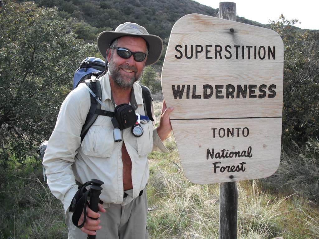
2012 Arizona Trail Thru-Hike Journal
 I hiked along the 800-mile Arizona Trail from March 17 to April 28, 2012 traveling from the Mexico border near the Coronado National Monument to the Utah border about 40 miles west of Page, AZ. This trek took 33 days of hiking and 10 days of rest due to weather and tired legs.
These pages are a composite journal of my adventure. Starting with my daily blog entries, I've added more pictures, details, and things I learned on the trail. You can click any picture to view a larger version of it, if you want.
I hope you enjoy the tale, learn a bit about planning your own hike, and pick up a tip or two. Please holler if you have questions or want more information about something you read here.
Day 01 to 11 - Mexico to Molino Basin
Day 12 to 20 - Molino Basin to Roosevelt
Day 21 to 31 - Roosevelt to Mogollon Rim
Day 32 to 43 - Mogollon Rim to Utah
03/28/2012
Day 12 - Alone
 I walked 53867 steps and covered about 23 miles today.
BIG Thank You to Janet and John for letting me rest up with them. And to John for the ride to Molino Basin campground to restart my hike.
I met Sandy and her husband on a day hike this a.m. and a young guy, girl, and dog at the end of the day. Sandy and hubby had done the AT for their honeymoon many years ago and are just starting to hike again. The young couple were just scrambliing around on a multi-day adventure. Lots of different folks on the trail.
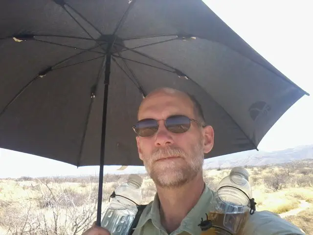
 It's just me now and I have about 630 miles to go. I used my umbrella much of the day walking through the hot Sabino Canyon area. I did make it to Summerhaven this evening, high on Mt. Lemmon at about 8000 feet. Unfortunately, there's no place to stay and the couple stores close early. Who'd of thunk a pizza place and grocery store would close at 4pm? So, I begged some water from the fire station and am camped nearby. It's pretty cold and windy, but a nice spot to camp. Tomorrow, I backhike a mile to the Summerhaven Community Center to get water since it's dry to Oracle. It's also almost all downhill so I hope to get there early and find a room and buy 4 days of food.
I really covered a lot of ground today, considering a large part of it was uphill over some rough terrain on the Wilderness of Rocks trail - aptly named, I would say. Since I had plenty of water to start, I only got water out of Lemmon Creek a few miles before Summerhaven because I wasn't sure I'd make it here by nightfall.
03/29/2012
Day 13 - Oracle Chalet Village
 I walked 50480 steps and covered about 21 miles today.
I spent half the day walking across 11 miles of very hot, dry desert after I descended 10 miles down the rocky, steep, and rough Oracle Ridge from Summerhaven. I also had a 1mile backhike for H2O first thing and a 2mile offtrail roadwalk into Oracle, so a pretty long 23 mile day.
I met Graham on the Oracle Ridge. He had hiked south to Summerhaven yesterday and was now hiking back north to the American Flag trailhead. I let him borrow my cellphone to check in with his wife back home and we chatted a bit.
The tips of my trek poles are wearing out too fast. They are inexpensive, but I would expect them to last more than 200 miles. This might be a problem as the trail progresses, but they're working for now. I really use them a lot on big Ups for extra lift and on big Downs for absorbing shock.
There was absolutely no water from Summerhaven to Oracle that I could find. Good thing I drank a liter and took 2 with me this morning. I've found that I can go about 10 miles on a liter if I'm hydrated to start and it's not terribly hot. I've also figured out that I walk at a fast enough pace to do 30 mile days, but my legs get tired and I don't have enough energy to go that far.
Tip: [Snacking as you walk throughout the day keeps fuel in your tank and energy in your legs. It's better than eating three big meals. Sips of water with the snacks also helps digest the food and get it to your muscles.]
I hiked around the east side of Oracle to the Highway 77 intersection so I won't need to do that section in the morning. Most people drop off the trail right into Oracle - I don't know if they just skip part of the trail or backhike a couple miles and continue on.
I had to hike a couple miles into Oracle on highway 77 but I'm too shy to hitchhike since I'm going just a mile or so. That's a sure sign of a newbie thru-hiker, I bet! When I finally drug my feet into town, I found the Oracle Market and asked if there was any place a person could get a bed for the night. They said the Chalet Village was on the west end of town - great. (This was my first effort at trying to solicit help from strangers and obviously I'm no good at it yet. I was hoping to maybe get a place to stay or a ride to the hotel. Oh well, keep practicing) When I stepped outside, Graham pulled up in his vehicle and said 'Hi' - what luck! He gave me a ride to the Chalet Village but had plans to meet friends when I offered to share a room with him.
So, I spent the night at the Chalet Village in Oracle. Jim is a wonderful host and the little cabins are clean and simple - a perfect overnite for hikers. Jim drove me back to the Oracle Market after I took a shower so I could stock up. After a great night's rest, he took me to the trailhead bright and early. Now, I call that Hiker Friendly! They also have a nice thru-hiker discount, TV, and even T-Mobile cell coverage.
I resupplied for 4 days at the store which should get me to Superior and another bed!
03/30/2012
Day 14 - Big Miles
 I walked 61374 steps and covered about 30 miles today.
My first 30 mile day ever! It completely wore me out and I don't think I'll be doing any more days this long. From Oracle to the Freeman Road water cache, I enjoyed the shade of my umbrella in the 90+ degree heat.
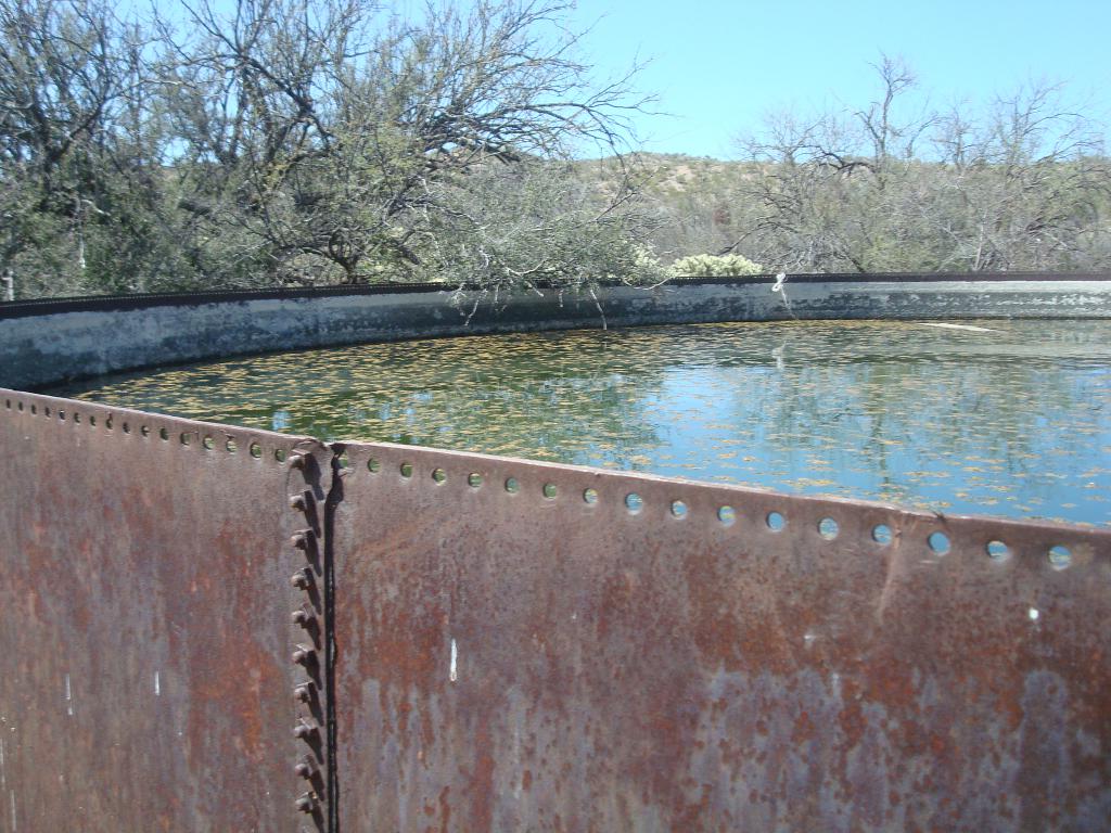
I started with 5 liters of water and the only water source was Beehive Well at 21 miles, pictured here. Fortunately, there was plenty of water with about a billion bees in, on, and around the water, some live, some dying, and some dead. My Sawyer filter worked just great and I had plenty of water. This was easily the ugliest water I've ever had to drink, but it was fine after filtering.
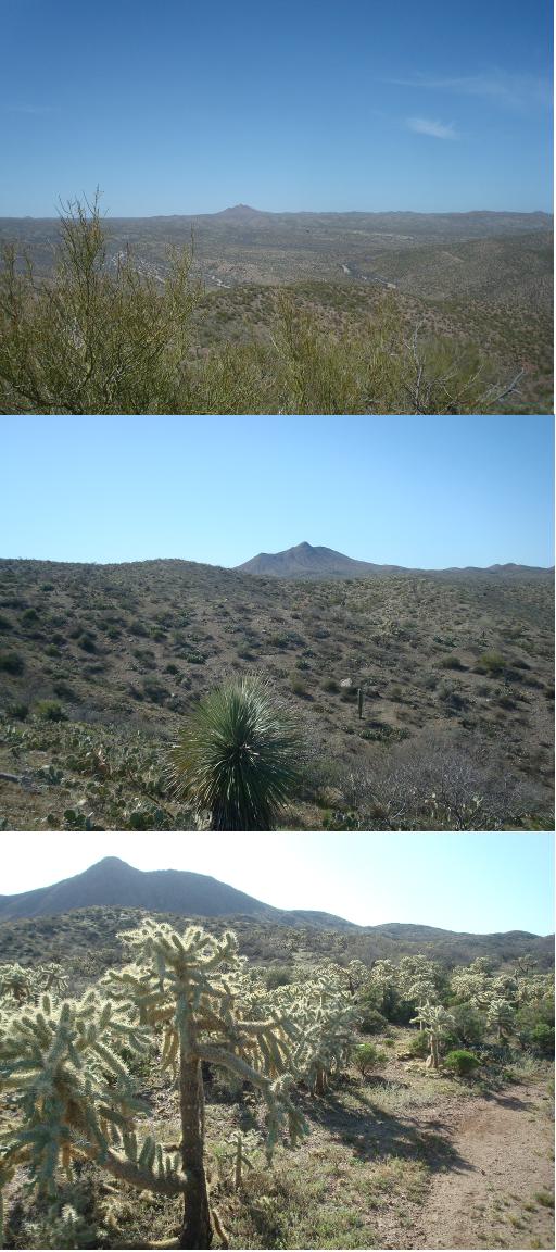 I met two trail stewards on horse and chatted a bit with them. I actually used their hoofprints to help follow the trail in a few sketchy spots. The long, long desert stretched before me. In the distance, I could see Antelope Peak gradually looming larger as the day wore on. I finally made my way around its north side late in the day and knew I was near my destination. For some reason, I had my sights set on the Freeman Road water cache for today's goal. As it turns out, that was the most significant decision I made on this trek.
When I reached Freeman Road, there was already a tent there and some guy was hanging around. A cheerful greeting and offer of water met me as I first met PapaBear. He was all set up here and had been resting today, hoping to possibly have a friend drive out and hike with him a bit. The friend never showed up, so we decided to hike together a bit tomorrow and see how it goes. He's section hiked the PCT and is a wealth of stories, tips, and advice. It works out great, because I'm a lot better at listening than talking and he has no problem talking. :-) Besides, he made me mashed potatoes for supper and they were most excellent!
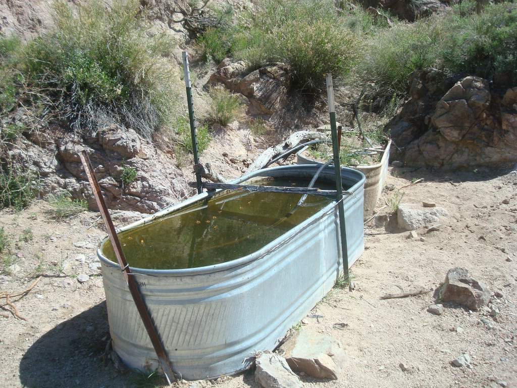
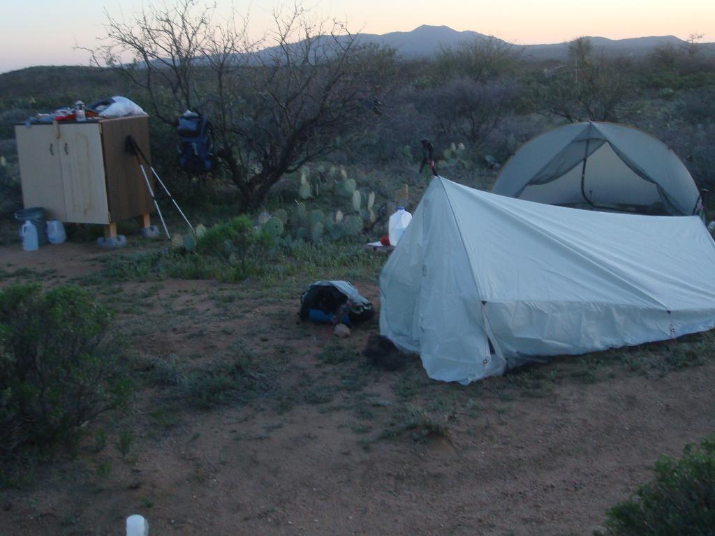 Freeman Road is currently the only permanent water cache on the Arizona Trail. The trail steward of this passage keeps it stocked with water - there was over 20 gallons in it when I camped there. A new cabinet has been set up as you can see in the photo which protects the water jugs from UV damage and keeps the place looking clean. There may also be a hiker box of leftover food, but I wouldn't count on that.
Tip: [If you have access to a vehicle, caching your own water (and maybe food) along the trail can make your hike easier and safer. You carry less water and know that water waits for you. Your cache should be hidden so it is not vandalized or taken, and be sure to clean up your trash after your hike. Don't just leave empty water bottles for someone else to pick up.]
There's also a guy named Eric behind me that might catch up tomorrow or next day - he's moving pretty fast and started about six miles behind me out of Oracle because he stopped at American Flag trailhead instead of hiking around the east side of town to Highway 77.
03/31/2012
Day 15 - My New Friend
 I walked 42762 steps and covered about 18 miles today.
I actually hiked more like 20 miles but the rounding of miles the past two weeks has pushed the total a bit higher than reality.
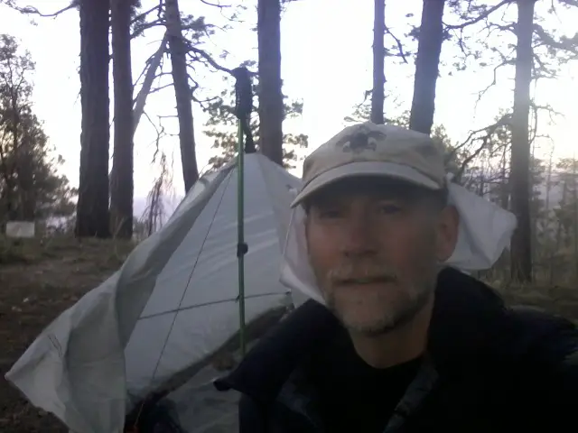
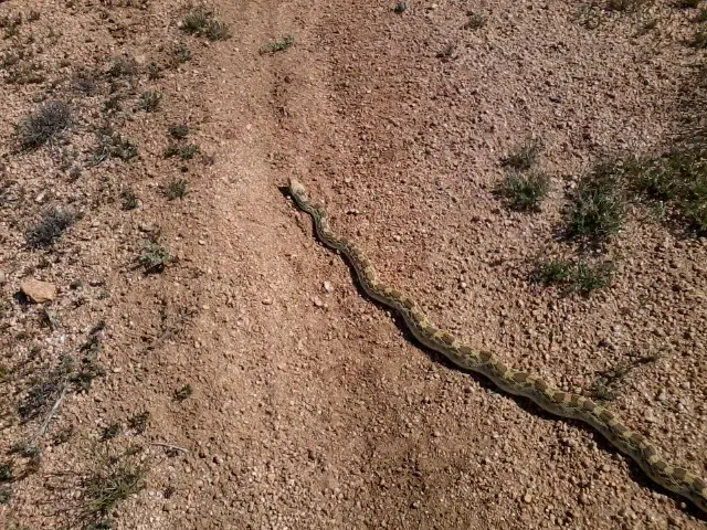
How do you like my little friend I met on the trail today?
Actually, I hiked with my new buddy, PapaBear, today. He's from Seattle and a strong, well-prepared long-distance hiker. Our paces seem to match fairly well so we're planning to hike two more days, take a rest day, then see how it goes.
 It's so hot a bit after noon that we decided to rest here in the shade before tackling an open, south-facing hill. There's a constant drone of bees, flies, and whatnot but none really bothering me.
I did just notice two buzzards circling so maybe we look tasty laying here.
Tip: [Taking a siesta in the afternoon is a good idea on hot days. By resting in the hottest part of the day (around 2pm to 4pm) you conserve water and energy, and the hike is more enjoyable. You might cook your big meal of the day then also so you don't have cooking smells at your campsite. If the trail is easy and you have a good light, hiking at night is also an option to take advantage of the cool air, but it's not something I've done.]
 The only water from Freeman Road to the Gila River by Kelvin is a w2 on the map at Ripsey Wash. On the hike through, we looked hard for it but just could not find it. On a low ridge out of the wash, we stopped in the shade of a lone saguaro to figure out our options on this hot, sunny day with 10 miles to water and not much in our bottles. While PapaBear watched our gear, I took our empty water bottles in my pack back down the trail to search for the water source.
Well, coming from the north, you can't miss it - this metal trough right in the dry creek bed. But, from the south, the trail winds behind brush and it's hidden. Pretty gnarly water with huge yellow wasps and algae, but it filtered just fine. I went up the hillside a bit looking for the source but had to come back to the trough.
My umbrella and filter are my two favorite items so far. The tips of my trek poles have worn off so I have to figure that one out - buy new poles, tips, or go without.
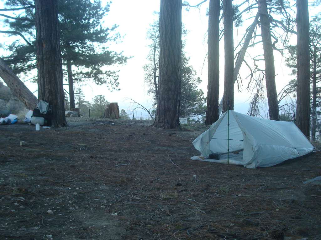
That afternoon rest break today was a great idea. We climbed the hill when it was a bit cooler and the hill kept going and going. We camped on a ridge above Kelvin and the hot wind was gusting late into the night. My little shelter held up just fine!
We also got buzzed by two military helicopters zooming past - pretty cool.
Awesome teriyaki rice and tuna for dinner, plus Oreos for desert!
The water sources are identified on the AZ Trail data book and maps as W0 through W4:
- w0 - not reliable, probably no water
- w1 - seasonable, may have water but maybe not
- w2 - probable water
- w3 - fairly reliable
- w4 - definite water, such as a faucet or river
One other thing about water in Arizona - on maps, there are blue lakes, rivers, and creeks but that doesn't mean there is water! Most blue lakes and creeks on the map are actually dusty depressions or rocky gullies in real life.
04/01/2012
Day 16 - Real AZ Scenery
 I walked 54864 steps and covered about 21 miles today.
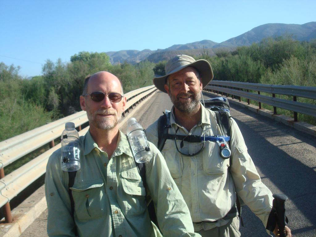
Passed over the Gila River at about 7:30am on Palm Sunday. The bridge is the lowest point on the AZ Trail, so it's all uphill from here to Utah! Here's PapaBear and I standing on the bridge.
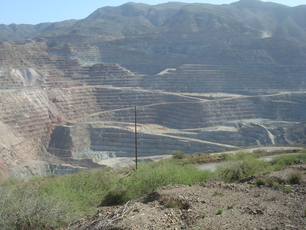
Spent a very enjoyable break with Lloyd at Wilson Trailer Ct in Kelvin. It's also a super spot to get some great, cool water from the spigot in the front yard. He gave us a personal tour of the open pit copper mine which was amazing and definitely worth the 2.5 hours of hiking we lost.
Tip: [Whenever you get a chance to chat with a local, don't pass it up. If the scenery is the icing on the cake, then the people you meet on and along the trail are the sprinkles on the icing!]
After our open pit copper mine tour, Eric caught up with us and hiked awhile. But he was in a hurry and went on ahead.
Met Lee and David who have helped create many miles of the trail. They were just out on a day hike.
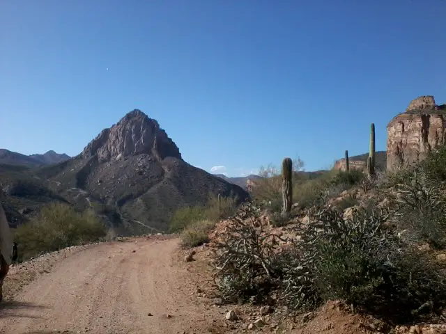
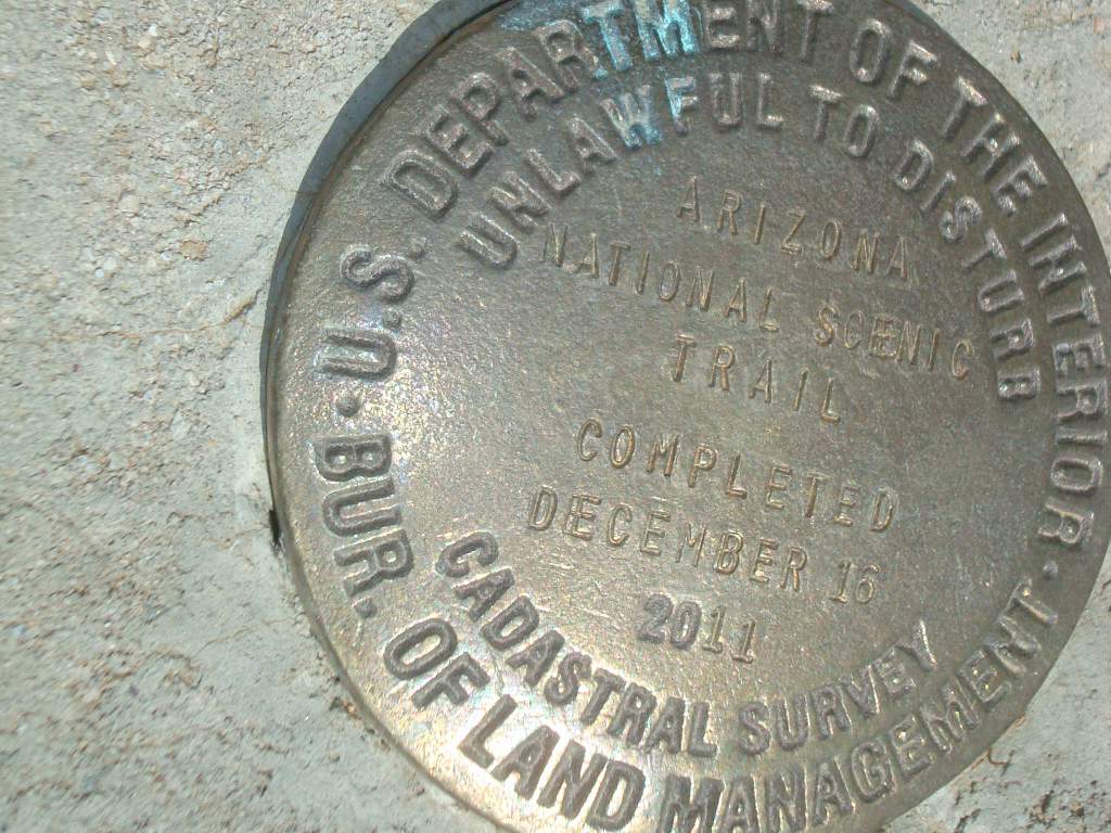
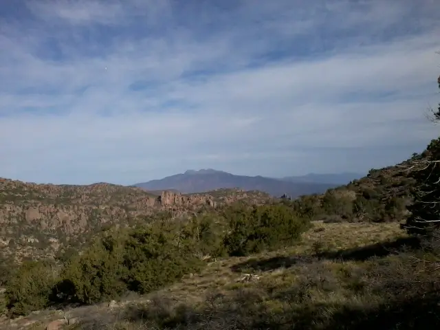
 Covered the new portion of trail west of Kelvin which was beautiful, especially the view of the old train tressle. This is a postcard perfect image of what I expected the Arizona landscape to be - hills covered with cactus, under a blue sky with the bright sun burning down, and a train trestle leading the tracks around a bend. I was just waiting for a smoking locomotive to chug into view and have masked gunmen on horses gallop up and rob it!
This is the last section of trail to be completed and there is a very cool geological marker beside the trail marking the completion of the trail.
We could not find the new trail at Walnut Canyon so wound up going the old way past the artesian well which is guaranteed water (and much nicer than sucking out of the contaminated Gila River). I think this old section is probably better since it's shorter, has water and shade, and great cliff scenery.
All in all, a terrific day on the trail capped off with Mexican Rice and a Snickers bar. Our camp spot is high in a canyon with cliffs around and stars overhead. Tomorrow should get me to a real bed and shower!
Here are some pictures from the day...
04/02/2012
Day 17 - Picket Post Trailhead
 I walked 29416 steps and covered about 13 miles today.
Nothing better than a choir of songbirds waking you up just a few minutes before the alarm goes off.
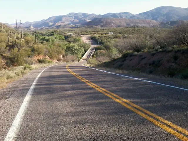
Here's the view from my room this morning.
The Hilton doesn't have a lobby like this!
 We met these veteran hikers on the trail, heading southbound. Each of them have over 10,000 miles under their boots and 3 have done the Triple Crown. I'm such a newb! Great guys out exploring at their own pace.
Not long after these guys, we met three mountain bikers heading south - one was the prettiest girl since the Mexico border, well since before that even I guess. My wife said I couldn't meet any 'hiker' chicks but nothing about 'biker' chicks. They were fun to chat with and see that hikers and bikers can share a trail just fine.
 Picket Post Mountain trailhead was the end of today's hike, close to Superior AZ. I was planning on a hotel in Superior, but PapaBear's step-dad is taking us to Tempe instead - score! An early start got us walking in cool temps but some cactus needles in a leg, overgrown trail, chatting with hikers and bikers slowed us down a bit. At one point, I told PapaBear that if we run into any more people we'll never make it! We got to the trailhead just fine, got phone coverage, and our ride to Tempe picked us up.
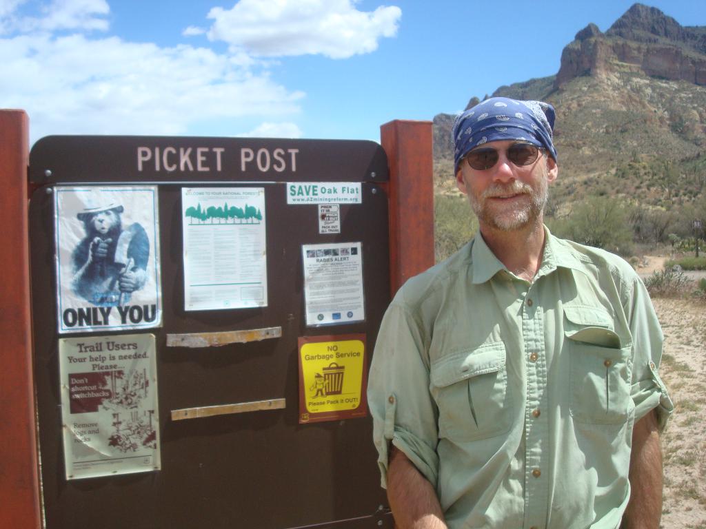 So, another short backpacking trip is complete. After resting a day, I'll start a week long trip to Pine.
Tip: [Instead of being overwhelmed by taking on a 7-week or 7-month long trail hike, just think of it as a bunch of long weekend or 1-week backpacking trips. For example, I hiked from Patagonia to Tucson in 5 days, Tucson to Oracle in 2, Oracle to Superior in 4 days - just a string of short hikes with bed and shower between.]
04/03/2012
Day 18 - Rest Day
Spent today with PapaBear in Tempe trying to regain some lost weight and get a few things taken care of.
Chuck at REI in Tempe was very helpful with the tips of my trek poles which ahave worn out. He found a spare part that fit so I have one good tip and one bad tip, with a spare for when it finally fails. A few more ounces to carry, but some insurance.
Got 2 days of food to get me to Roosevelt Marina where I've already sent a 4-day food box. It's about 50 miles. So, for the next couple days, I'll have a light 2-day food load while PapaBear is carrying 6 days.
To gain weight, I had a large DQ chocolate shake, onion rings, bacon, eggs, biscuits, peanut butter, milk, clam chowder, apple, banana, 2 oranges, snap peas, grapes, and am now having a dinner of chicken, cowboy beans, french fries, and cake. That should help a little!
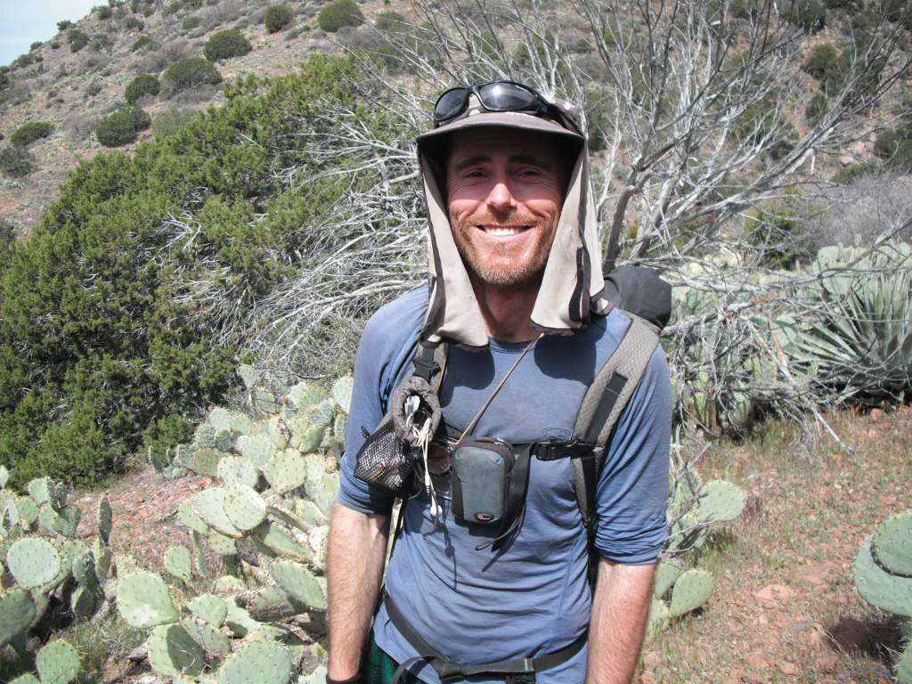
I'll tell you more about PapaBear later.
Chuck at REI in Tempe was very helpful with the tips of my trek poles which ahave worn out. He found a spare part that fit so I have one good tip and one bad tip, with a spare for when it finally fails. A few more ounces to carry, but some insurance.
Got 2 days of food to get me to Roosevelt Marina where I've already sent a 4-day food box. It's about 50 miles. So, for the next couple days, I'll have a light 2-day food load while PapaBear is carrying 6 days.
To gain weight, I had a large DQ chocolate shake, onion rings, bacon, eggs, biscuits, peanut butter, milk, clam chowder, apple, banana, 2 oranges, snap peas, grapes, and am now having a dinner of chicken, cowboy beans, french fries, and cake. That should help a little!
I'll tell you more about PapaBear later.
04/04/2012
Day 19 - Reavis Creek
 I walked 59531 steps and covered about 26 miles today.
Back on the trail to Utah after a wonderful rest in Tempe. It's about 50 miles to Roosevelt, AZ so we did half today and hopefully half tomorrow. I have a food box waiting for me there.
The climb up Montana Mountain was grueling but the rest of the hike was good. Reavis ranch was a known water source so we pushed on into the dark, hiking longer than I could see. I only brought my prescription sunglasses so I can't see well enough to night hike. We didn't make it to the old ranch, but found water in Reavis Creek and a flat spot in the trail to stop - we set up tents right in the trail. It was a long day.
 The trail through the Superstition Wilderness was pretty good. On it, we met some folks out doing botanical research by the trail and asked them about cactus and other plants. Also passed a family that had gotten lost but were now on their way back to the trailhead.
Since we've gained elevation, it is cooling off quickly tonight - we're around 5,000 feet versus 2,500 feet at Picket Post trailhead.
04/05/2012
Day 20 - Roosevelt Campers
 I walked 58968 steps and covered about 26 miles today.
Another marathon day but with much more fun and adventure.
I had to reach the Roosevelt Marina by 4pm to pick up my food box or else wait until 8am the next day. So I fasthiked ahead of PapaBear for a few hours in the afternoon and got there just in time. I also bought some pop and ice so we had a nice, cold treat when he arrived. Roosevelt is at about 2,000 feet so it's pretty warm.
The trail from the hills into town wasn't much fun - down a rocky gully and then a dusty road. On the road, I felt something hitting the ground every time I stepped on my left food. It turns out, the inside half of my left sole has come loose and is getting worse. So, I tear it off before it peels even more off. (I believe this turns out to be the cause of a lot of pain later on.)
 On the morning hike, just west of Two Bar Mountain, we ran into Swami who is hiking SOBO as part of his huge year of hiking. You can find out more about him at TheHikingLife.com and see the hikes he's doing. His pack was no more than 15 pounds.
I don't know how such a small, wiry guy can stay warm at night with so little gear, but he's worked out something that works for him. I hope he has nothing but success in his year of hiking.
 We had to find a place to camp around town so we walked right down along the lake. As it turns out, there is a community of campers in RVs, trucks, and tents that practically live here for months. We said HI to some of them until one asked what we were doing. Once we started talking, and they got to know us, they invited us to visit their campfire later. Well, we wound up having drinks, steak, and applesauce provided by our new friends. It was a very enjoyable evening with Bill, Diane, Ben, and Jerry. Plus, we have a nice, quiet, flat place for our tents. A nice time with new folks makes the work of the day fade away.
Continue with: Day 21 to 31 - Roosevelt to Mogollon Rim
Find more Hiking Resources at www.HikingDude.com
Follow Me
Recent Comments