
Hiking Dude Blog
2025 - Aug Jul
2024 2023 2022 2021 2020 2019 2018 2017 2016 2015 2014 2013 2012 2011
01/08/2016
Trailhead
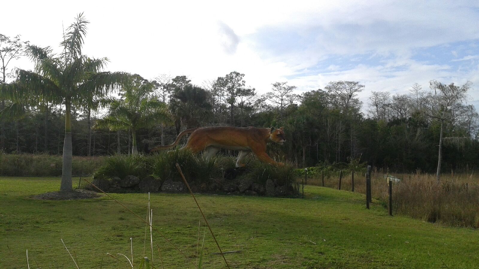 I traveled about 0 miles today.
Check out my current location on the map. As you can see on my tracker, we made it to the southern terminus of the Florida Trail. We found a bus stop, ride three different buses, and then caught a ride with Miss Janet to the campground - where we were warmly welcomed by the most voracious mosquitos I've seen. Mosquitos don't die off in winter - they migrate to the everglades! Our bug suits work pretty well, but it's going to be a challenge. Most folks here are soaked in deet and the smell is obvious. After our ride with miss Janet, Sledge, and Red Beardfield, we met other hikers and supporters here at the kickoff. The couple that wrote the FT Guide, a few that have hiked the whole trail, and some that we'll start hiking with tomorrow. Tomorrow will be our first off into the wild with no potable water, toilets, or cars. A big change from our day today of just riding around! There's a good chance I'll have no coverage the next couple days so don't worry that we've been eaten by a bear, python, panther, or piranha of there's no post.
01/07/2016
Sunny day
 As I was starting to write before my phone whacked out, getting an early start on a day with no clouds meant a nice view of the sun coming up over the Atlantic. Sure, we were walking on the shoulder of the road at the time, but I managed to keep cars out of the pic. After this, misty fog covered us for a couple hours, finally burning off into our hottest afternoon so far.
We've cut back our miles due to shin and ankle pains, with the hope they will get a little more rest. But, after today, our plan has changed significantly and we'll have only a few more miles of roadways before hitting the swamp. Here's the deal. ..
At our lower pace, we'd never make it to, and out of, the swamp on time for Josh to get back to school. We really wanted a continuous line from Key West to Lake Okeechobee, but that is no longer practical. So, hiking the swamp is more important. We had to figure out how to get from Key Largo to the Florida Trail start.
After some research, and help from some great hikers on Facebook, we should be able to join the kick off gang tomorrow. We're buying 5 days of food first thing. Then, walking 3.5 miles to a bus stop, catching bus 301, then 38, then 137 which gets us to highway 41. Then, Miss Janet, a well known AT Trail angel will give us a lift to the trailhead. It will take most of the day, but it should work.
 01/06/2016
Meeting People
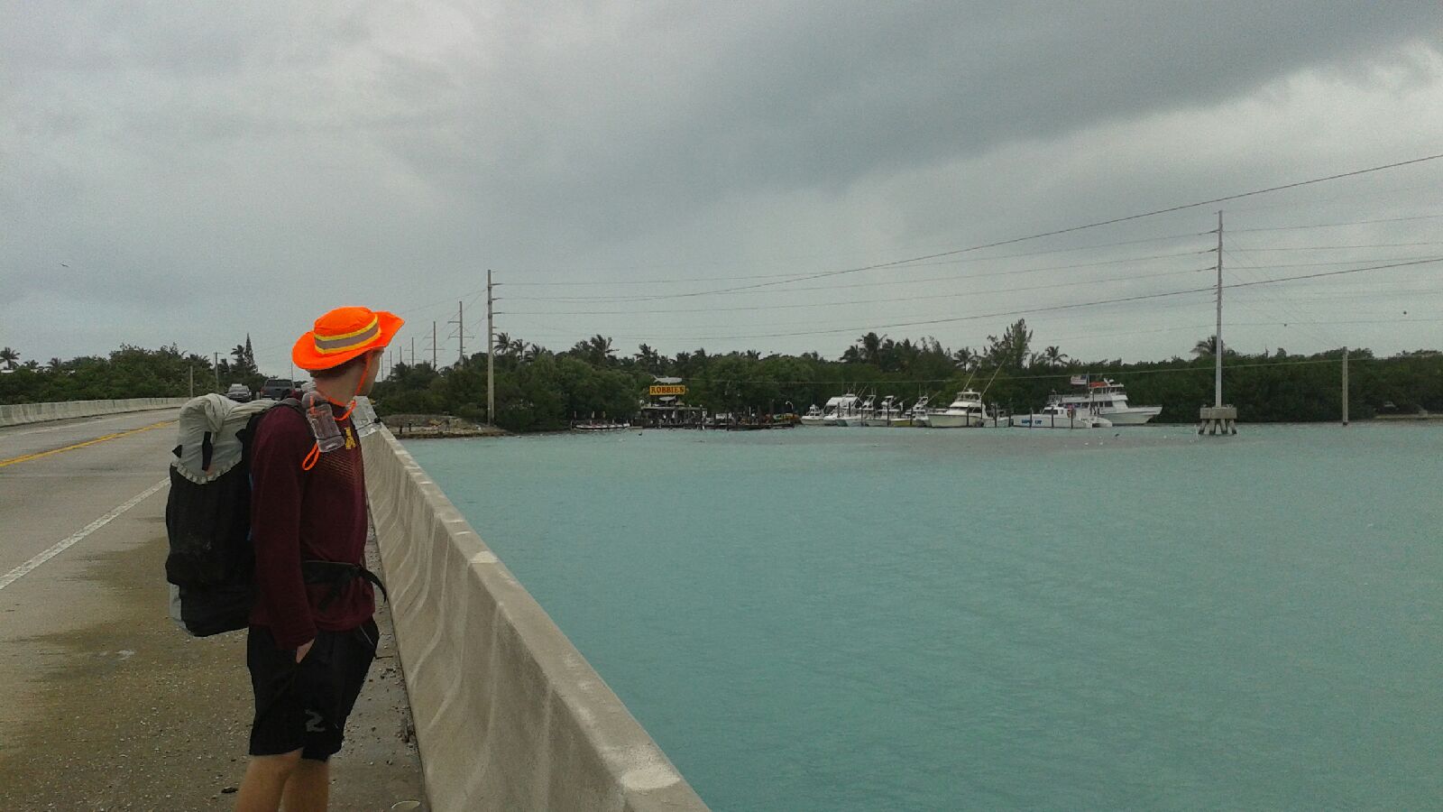 I traveled about 21 miles today.
I could tell you all about the horrendous rain and wind we had all morning across ocean bridges, but I won't. Instead, you can see Josh gazing back longingly towards Robbie's where we had just enjoyed great fish tacos for lunch. Even better than the food was our great chat with our waiter who was quick to share his life stories and plans with us, as well as ask about our trip. Just a great guy Last night at the state park, a young guy that teaches yoga walked by our site and we talked a bit. He had biked through here lady year. When I mentioned we hadn't eaten yet, he insisted we finish his leftover pizza. Tonight, our host drove us to an awesome restaurant so we didn't have to walk the mile. There, Lindsey was so friendly and full of live that we couldn't help but have a wonderful time. The meatballs and pizza helped! After our meal, Lindsey had a cab take us back where we're camping. We've met some wonderful folks here in Florida, these are just a few of them to mention. Our bright orange hats have made is a bit recognizable and known along the Keys. We've had 3 people say that they saw us down the road a day ago and ask about our hike. A handful of others have honked or mentioned or hats as they biked our walked past.
Leave Comment
Posted: 01/06/2016
Posted: 01/06/2016
01/05/2016
Wind, Rain, and a Bonus
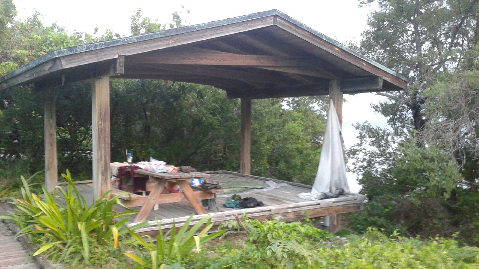 I traveled about 20 miles today.
After a night of less than restful rest, we had a great morning of windy, cool walking through Marathon. The first couple miles took forever since we stopped for groceries, and replacement water bottles for me. I had left mine on the picnic table last night and some helpful person the them out as garbage. The trail was away from the road all morning and had benches every mile or so. We saw many bike riders but no other hikers. The afternoon was a different hike. Mist turned to drizzle then to real rain, all driven by a robust headwind. It wasn't much fun on a 3- mile bridge crossing when even all the fishermen were leaving. At least we were not on the road shoulder toss time. We had no spot for tonight since we changed our plan to reach Islamorada. All the state parks are full but we planned to check at Long Key state park. The park ranger got us a ' primitive ' tent spot for just $14. As you can see, this is a VERY cool site. We are on a covered platform only 10 feet from the Atlantic ocean! No tents needed, and we're just hoping the breeze continues to keep any bugs away. Tomorrow calls for rain all day so we'll enjoy what we have now.
01/04/2016
Bridges
 I traveled about 23 miles today.
After a wonderful night of rest, we began our day of waking with a light rain and high hopes for long miles. The rain stopped quickly and was replaced by a strong, steady wind and light overcast all day - prefect weather for walking! But, our miles were cut back due to the pounding our feet and legs are getting from the pavement and concrete. It was a great day with amazing views, splitting the Atlantic and Gulf from bridges over channels. Our biggest challenge of three day was the famous Seven Mile Bridge - along the skinny shoulder with over 1000 cars pet hour flying past. Our early schedule was too ambitious so I'm now figuring a couple of shorter days to allow a bit of recovery. The biggest overall challenge with this trail is figuring spots to spend the night without breaking the bank. The campground tonight charged $60 for a flat spot to pitch a tent. Ouch! Besides the views, my highlight of today was a sandwich at 5 Brothers 2 where we got to listen to a bunch of elderly Cuban friends chat with the owner. Couldn't understand a word, but enjoyed the experience.
01/03/2016
Night into Night
 I traveled about 26 miles today.
Our overnight plane ride got us to Ft. Lauderdale with no trouble and no sleep. Once we found the Avis counter, we got our car with no trouble. Driving down the Keys was an interesting experience. I couldn't help but try to spy out potential camping spots - a very rare item with water and shrubs much more prevalent than firm land. We swapped our car for a crazy pink taxi at the Key West airport and enjoyed a short, expensive ride to the 'southernmost' point of the US. It's pretty amazing how many'southernmost' places there are, from inns to furniture stores. Our hike finally began at the same time as the warm rain. We hiked from key to key until the sun dropped, and then kept going. Our legs were totally exhausted and sore, and I got two bonus blisters. Summerland Key was our destination for the night. I found a couch surfing host who has welcomed us into his home. This is my first couch surfing experience and I'd recommend checking out out. We've been up since yesterday morning so it's time to sign off and hope this night heals the pains for tomorrow's adventure.
01/02/2016
Waiting to Hike
 We're packed and ready.
Tomorrow morning, if all goes well, we'll be hiking north from Key West around 11am aiming for Summerland Key. It will be a very, very, very long day.
But, for now, we're just waiting. Phones charged. Trail contacts stored. Important documents printed. Backpacks wrapped up for the plane ride.
The plane is scheduled to leave at 1:15am and arrive in Ft. Lauderdale at 5:40am - not much sleep tonight, not a great way to start a long hike, but the best fit for our schedule. Then, a 3.5 hour rental car ride to Key West airport followed by a taxi ride to the SouthernMost Point and we start hiking.
Feel free to check in on us any time you want at FL Hike page and leave any encouraging comment that you'd like.
Hike On!
12/27/2015
Snow walk
 My 5- mile walk today brought me to this boat landing. In a week we'll be seeing plenty of liquid water instead of all this solid water.
I'm still figuring out some places to spend the night in the FL Keys, but I'm sure it will all work out.
Leave Comment
Posted: 12/27/2015
Posted: 12/27/2015
12/11/2015
Florida Hike Prep

 My Florida Trail hike prep is coming along nicely. My son and I will hike from Key West to Lake Okeechobee where he will stop to return to school. I'll decide at that point how much farther to go. At this point, I'm looking forward to hiking to Pensacola but a lot depends on the trail.
Here are some key items that might be helpful to others considering this hike.
- $26 - I ordered and received my Florida Trail Guide. It contains non-navigation section maps that just give an idea where things are generally located along the trail. The pages that list water sources and camping spots are the real reason I purchased this book. Knowing how far to the next water helps me carry enough, but not too much. I've used the camping information to make my own 2-sheet list of camp spots and mileages that I will carry. That also is a starting point for my hiking schedule, but it is out-of-date even before I start hiking.
The book weighs a lot, so I expect to only take a few key pieces along. - $35 - I purchased the Florida Trail app for my phone. It lists a lot of the important information in the guide, but weighs nothing. I expect to use it mostly to pinpoint my current location and see how far away water and camping spots are. The AT app was terrific, so I'm hoping this is just as good. One thing about it, the elevation profile is silly since the highest point on the FT is under 300 feet. :-)
- $45 - I submitted my Florida Trail Association membership request and received their member packet. You have to be a member to hike through the trail and cross some private areas. We need to remember to take our FTA membership cards with us on the trail.
- I submitted liability waivers to the Seminole Indians so we can walk across their land. I took pictures of the originals so I have a copy with us while on the trail.
- I'm hiking. I've been putting in about 5 miles each morning on the long, flat trails around home. This should be perfect training for FL since the trail there will have no mountains to climb.
- I'm hoping to visit Boy Scout groups on my hike. I've found troops in towns along the trail and sent emails letting them know my plans. I've received a couple of positive replies already so I'm excited to meet, and maybe hike with, other scouters.
- All my gear is ready to go. There's nothing new I need to buy, but I expect I'll need new shoes after the first 300 miles since the long Keys roadwalk and Big Cypress swamp will probably be tough on them.
- Food will be purchased in Florida as needed. The first week will be walking through population so we'll carry little and spend more to eat along the way. On our way out of Miami, we'll supply ourselves for 5 days at a Publix or Walmart fairly close to our route.
Researching the trail, both online and in the guide, I've run into some peculiarities of the Florida Trail. It is probably the most bureaucratic trail in the country.
Besides the FTA membership and Seminole waiver I mentioned, a hiker also has to do the following:
- Get a permit and pay to hike the FT across Elgin AFB. But, I can't do that now - I must wait until 30 days before I expect to arrive there.
- Get permits to use campsites in some state areas. They cost no money, but are required to camp.
- Get super secret instruction and permission to cross canals at a couple of locks. Not now, I must wait until I'm just about there.
- Pay fees to camp in some state parks and forests.
- Acquire other permits, pay fees, get permission, ... for two pages of requirements that the FTA sends to its new members. And, at the bottom of the list, it states "list may not include every permit and fee".
- Oh, hikers also must have blaze orange clothing. The trail crosses some hunting areas where it is mandatory to wear blaze orange, not an entire outfit, but a large swatch - just in case your hiking pace resembles a deer or alligator.
Well, if you couldn't tell, the red tape strikes me as a bit much for this trail. But, the FTA is working to make it simpler and, in the grand scheme of things, it's not a big deal. Just don't expect to wake up one morning and set off to hike the whole trail like some folks do on the AT.
I promised my wife I would stop mentioning all the scary things I might encounter on the trail in Florida, so you'll just have to See for yourself if you're interested in what's waiting out there.
Hike On
PS: If you, or people you know, are in Florida and want a hiker visit, just give me a holler. I've got Stickers I can give them.
Leave Comment
Posted: 12/11/2015
Posted: 12/11/2015
10/21/2015
3 Days 3 Hikes
Fall is absolutely the best time to hike. Cool air, no bugs, no humidity, few people, wonderful colors, earthy smells, and dry trails - at least this weekend it was like that.
Mrs. Dude and I got out this weekend to tag three separate trails on three different days. We lucked into some perfect conditions and walked 18 miles of trail that was completely new to both of us.
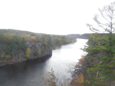

On our first day, we visited Interstate Park on the Minnesota side of the St. Croix River - there's also an Interstate Park on the Wisconsin side. Parking at the southern access point, the trail along the river heads north 1.25 miles to the town of Taylors Falls. It's a nice trail, but runs between the busy road and the river, so it's noisy.
On this beautiful fall day, about 1,000 other people had our same idea. The trail was crowded which means a few oblivious folks blocking the trail to take a photo, others scrambling through vegetation, and dogs - lots of dogs. Small, yippy dogs that had to be carried because some of the rocks were too high for them to jump up. I'll never figure that out.
The vast majority of people were courteous and friendly and it was a very nice hike. The river trail winds through many rock cliffs, cuts, and formations, and there are some informational signs explaining the geology. At the north end of the trail, a visitor center has a lot more information that I found very interesting, especially the basalt rocks ground perfectly round from the river.
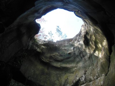

The St. Croix river was the low spot that gave way eons ago, allowing the glacial Lake Duluth to drain, leaving behind what is now Lake Superior. The raging water, filled with glacial silt, swirled in eddies and dug through the basalt bedrock around the Taylors Falls area, creating potholes. These aren't potholes as you'd find in a road. Some are big enough to walk through. This picture is looking up from inside Bake Oven Pothole.
Upon reaching the northern end, rather than heading back down the same trail (with our 1,000 friends), we made our way to the old railroad trail that parallels the river trail but on the other side of the road. This trail is higher up on the hill, and it was a very good decision!
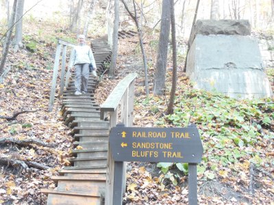

Walking south back to our car, the rail trail had very few people - we saw maybe a dozen. Much of the trail was through maple forest that had not yet lost its leafs. Whenever the wind blew, we were treated to a shower of rattling, golden foliage dropping to carpet the ground.
Where an old train tressle had been, we could see the footings and a staircase of 104 steps brought us to the bottom of a gully with the trail climbing back up the other side. But, at this point, there is a spur called the Sandstone Bluffs trail which adds 3/4 mile. Taking the spur was another very good decision.
Walking up the gully, filled with maple leafs on the ground and in the trees, felt like a walk through a golden cathedral. Viewing the sandstone bluffs, we got to see where new rock had been built upon the basalt bedrock and then carved away by the powerful, persistent work of water. Being higher on the hillside, there were also nice views across the river to Wisconsin.
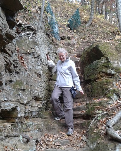

We really enjoyed the trail carved from rock, laid on the old rail bed, or built from wood - a lot of work goes into making and maintaining a trail like this that gets lots of traffic. I was very happy to see (or not see) no grafitti or scratchings in the soft sandstone.
The entire 3 mile hike was very nice.
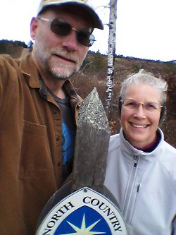

The next day, we headed up Highway 53 in Wisconsin on our way to Duluth. Cruising along, I noticed a sign stating the North Country trail crossed the road ahead. Well, naturally, we stopped. A small kiosk with maps in a simple parking area invited us to go exploring. I had helped make a portion of this trail hundreds of miles away in western Minnesota a few years ago. Now, the trail stretches 4,600 miles from North Dakota through New York.
I've heard much of the NCT is difficult to navigate because it gets such little use. This section has been very well maintained, blazed, and signed. The NCT uses blue blazes on trees, or when crossing prairie, on posts. We got to experience both forest and prairie, hiking west from the trailhead towards Leo Creek campsite.
There is a trail registry at Leo Creek campsite. A trail registry is just a protected, blank book for hikers to sign in and leave their mark. There were less than a dozen hiker notes in this particular registry for the entire year. I guess that supports the claim that not many get out here on this trail.
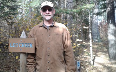

You might also notice the white blaze on the tree to the far right in this photo. White blazes indicate side trails on the NCT, such as to a campsite. It's important to know what colors are used on a trail, since white blazes mark the main path on the Appalachian Trail and blue means a side trail.
Being a long trail traversing the midwest, much of the NCT is relatively flat. This stretch had very little elevation, but gave up some nice views across bogs from low hills.
I was surprised at the lack of animals and birds, just a few red squirrels, today. That may have been due to the cool temperature and blustery wind. We were layered up and it was a comfortable day.
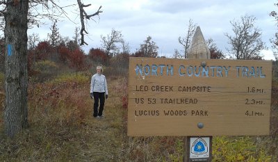

Having no destination, we just hiked. At about 2.5 miles, we decided to turn around. A dirt road crossing seemed as good a place as any to all the end point of our hike.
On this 50-mile section of trail, the map showed many camp sites and water was plentiful. I think I'll probably do a much longer hike on this trail soon, maybe North Dakota through Wisconsin would be a good distance.
In Duluth, we tackled our third and longest hike. The Superior Hiking trail follows the north shore of Lake Superior from Canada to the Wisconsin border south of Duluth. I hiked the northern 250 miles of it in 2012 because the southern 70 miles were not open yet. This was a chance to see what some of the trail is like.
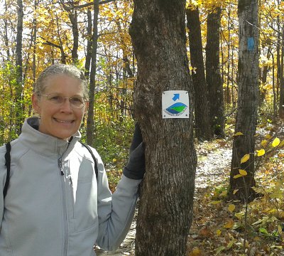

We parked the car at the Martin Road trailhead north of Duluth. Heading into the mostly bare birch, maple, and oak forest, I couldn't help but wish we had been here last weekend instead. The bare trees did give a more open feeling and let in more sunlight on this cool morning.
The SHT uses blue blazes, like the NCT, but there are also plastic tags with the SHT logo and a blue directional arrow. These are helpful in parks where many trail crisscross. On the city streets, signage is sometimes challenging to find - it may be a faded blue splash on an old telephone pole, or a tag screwed to a stop sign, or a plastic sticker stuck on the back of a road sign.
Most of the SHT is out in the wild, but this 10 mile section tries to hide itself in thin strips of woods and parks as it works its way down to the shore of Lake Superior. After a nice woods walk, the official trail does a roadwalk through a large cemetary, then a mixture of short road and trail stretches. I found it to be a lot of fun.
It was probably fun for me because I let Mrs. Dude lead the way for much of the day. The trail was very well marked and only one road intersection was missing signage - we resorted to looking at the map on a cellphone after continueing on in the most obvious (but incorrect) direction for 1/4 mile.
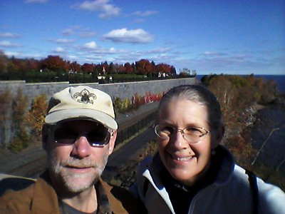

As I kept telling Mrs. Dude, today's trail is all downhill. We hiked from a high ridge down to the shore. The Lake Walk along Lake Superior takes hikers through the Rose Gardens, by a couple of micr-breweries and restaurants, and on to a hectic area called Canal Park. Being this was probably the last nice weekend, the place was a zoo! At least 1,000 people on the boardwalk, sidewalks, and grass.
It was a bad decision to ask our ride to pick us up here for the ride back to our car since the streets were gridlocked. Fortunately, we got ahold of him and met him on his way in, avoiding much of the hassle. It would have been better to stop at Fitger's Brewhouse - oh well.
Combining our three hikes, we covered about 18 miles and got to see a wide range of wonderful fall scenes and terrain left from the last glaciers.
Hike On
Mrs. Dude and I got out this weekend to tag three separate trails on three different days. We lucked into some perfect conditions and walked 18 miles of trail that was completely new to both of us.


On our first day, we visited Interstate Park on the Minnesota side of the St. Croix River - there's also an Interstate Park on the Wisconsin side. Parking at the southern access point, the trail along the river heads north 1.25 miles to the town of Taylors Falls. It's a nice trail, but runs between the busy road and the river, so it's noisy.
On this beautiful fall day, about 1,000 other people had our same idea. The trail was crowded which means a few oblivious folks blocking the trail to take a photo, others scrambling through vegetation, and dogs - lots of dogs. Small, yippy dogs that had to be carried because some of the rocks were too high for them to jump up. I'll never figure that out.
The vast majority of people were courteous and friendly and it was a very nice hike. The river trail winds through many rock cliffs, cuts, and formations, and there are some informational signs explaining the geology. At the north end of the trail, a visitor center has a lot more information that I found very interesting, especially the basalt rocks ground perfectly round from the river.


The St. Croix river was the low spot that gave way eons ago, allowing the glacial Lake Duluth to drain, leaving behind what is now Lake Superior. The raging water, filled with glacial silt, swirled in eddies and dug through the basalt bedrock around the Taylors Falls area, creating potholes. These aren't potholes as you'd find in a road. Some are big enough to walk through. This picture is looking up from inside Bake Oven Pothole.
Upon reaching the northern end, rather than heading back down the same trail (with our 1,000 friends), we made our way to the old railroad trail that parallels the river trail but on the other side of the road. This trail is higher up on the hill, and it was a very good decision!


Walking south back to our car, the rail trail had very few people - we saw maybe a dozen. Much of the trail was through maple forest that had not yet lost its leafs. Whenever the wind blew, we were treated to a shower of rattling, golden foliage dropping to carpet the ground.
Where an old train tressle had been, we could see the footings and a staircase of 104 steps brought us to the bottom of a gully with the trail climbing back up the other side. But, at this point, there is a spur called the Sandstone Bluffs trail which adds 3/4 mile. Taking the spur was another very good decision.
Walking up the gully, filled with maple leafs on the ground and in the trees, felt like a walk through a golden cathedral. Viewing the sandstone bluffs, we got to see where new rock had been built upon the basalt bedrock and then carved away by the powerful, persistent work of water. Being higher on the hillside, there were also nice views across the river to Wisconsin.


We really enjoyed the trail carved from rock, laid on the old rail bed, or built from wood - a lot of work goes into making and maintaining a trail like this that gets lots of traffic. I was very happy to see (or not see) no grafitti or scratchings in the soft sandstone.
The entire 3 mile hike was very nice.


The next day, we headed up Highway 53 in Wisconsin on our way to Duluth. Cruising along, I noticed a sign stating the North Country trail crossed the road ahead. Well, naturally, we stopped. A small kiosk with maps in a simple parking area invited us to go exploring. I had helped make a portion of this trail hundreds of miles away in western Minnesota a few years ago. Now, the trail stretches 4,600 miles from North Dakota through New York.
I've heard much of the NCT is difficult to navigate because it gets such little use. This section has been very well maintained, blazed, and signed. The NCT uses blue blazes on trees, or when crossing prairie, on posts. We got to experience both forest and prairie, hiking west from the trailhead towards Leo Creek campsite.
There is a trail registry at Leo Creek campsite. A trail registry is just a protected, blank book for hikers to sign in and leave their mark. There were less than a dozen hiker notes in this particular registry for the entire year. I guess that supports the claim that not many get out here on this trail.


You might also notice the white blaze on the tree to the far right in this photo. White blazes indicate side trails on the NCT, such as to a campsite. It's important to know what colors are used on a trail, since white blazes mark the main path on the Appalachian Trail and blue means a side trail.
Being a long trail traversing the midwest, much of the NCT is relatively flat. This stretch had very little elevation, but gave up some nice views across bogs from low hills.
I was surprised at the lack of animals and birds, just a few red squirrels, today. That may have been due to the cool temperature and blustery wind. We were layered up and it was a comfortable day.


Having no destination, we just hiked. At about 2.5 miles, we decided to turn around. A dirt road crossing seemed as good a place as any to all the end point of our hike.
On this 50-mile section of trail, the map showed many camp sites and water was plentiful. I think I'll probably do a much longer hike on this trail soon, maybe North Dakota through Wisconsin would be a good distance.
In Duluth, we tackled our third and longest hike. The Superior Hiking trail follows the north shore of Lake Superior from Canada to the Wisconsin border south of Duluth. I hiked the northern 250 miles of it in 2012 because the southern 70 miles were not open yet. This was a chance to see what some of the trail is like.


We parked the car at the Martin Road trailhead north of Duluth. Heading into the mostly bare birch, maple, and oak forest, I couldn't help but wish we had been here last weekend instead. The bare trees did give a more open feeling and let in more sunlight on this cool morning.
The SHT uses blue blazes, like the NCT, but there are also plastic tags with the SHT logo and a blue directional arrow. These are helpful in parks where many trail crisscross. On the city streets, signage is sometimes challenging to find - it may be a faded blue splash on an old telephone pole, or a tag screwed to a stop sign, or a plastic sticker stuck on the back of a road sign.
Most of the SHT is out in the wild, but this 10 mile section tries to hide itself in thin strips of woods and parks as it works its way down to the shore of Lake Superior. After a nice woods walk, the official trail does a roadwalk through a large cemetary, then a mixture of short road and trail stretches. I found it to be a lot of fun.
It was probably fun for me because I let Mrs. Dude lead the way for much of the day. The trail was very well marked and only one road intersection was missing signage - we resorted to looking at the map on a cellphone after continueing on in the most obvious (but incorrect) direction for 1/4 mile.


As I kept telling Mrs. Dude, today's trail is all downhill. We hiked from a high ridge down to the shore. The Lake Walk along Lake Superior takes hikers through the Rose Gardens, by a couple of micr-breweries and restaurants, and on to a hectic area called Canal Park. Being this was probably the last nice weekend, the place was a zoo! At least 1,000 people on the boardwalk, sidewalks, and grass.
It was a bad decision to ask our ride to pick us up here for the ride back to our car since the streets were gridlocked. Fortunately, we got ahold of him and met him on his way in, avoiding much of the hassle. It would have been better to stop at Fitger's Brewhouse - oh well.
Combining our three hikes, we covered about 18 miles and got to see a wide range of wonderful fall scenes and terrain left from the last glaciers.
Hike On
Older Posts Newer Posts
Find more Hiking Resources at www.HikingDude.com


Follow Me
Recent Comments