
Portugal Fishermens Trail 2024 Journal
Go to main Fishermen's Trail Hiking Info page.
Click photos below to view a larger version.
- Hike northbound or southbound? - If you are using a solar charger, hiking northbound would help. Otherwise, southbound has increasingly better scenery as you progress.
- Are there any fishermen? - Yes, but not many. We did see 5, but there were many buoy markers for fish traps off the coast.
- Are there nude beaches? - Yes, they were marked on our map app with a different symbol but it didn't seem to matter much.
- Is the trail crowded? - No, it did not seem that way to me. Since the terrain is so flat and open, other hikers far away are visible and we saw a few people every day. The vast majority of hikers we met were from Germany. We leapfrogged with a group of 5 very friendly Italians for a few days, and it was always fun to run into them at random spots.
- Is it expensive? - No, compared to the other European countries we visited. If you play by the rules and do not stealth camp, every night costs to stay in a campground, hostel, or hotel. Restaurant meals are very easy to find each day, but are more expensive than cooking your own. Wine was the only alcohol that wasn't very expensive. Even Cokes were pricey.
- What are the biggest challenges? - Sand in the shoes! Other than that, it was a wonderful hike.
- The wind blew constantly, sometimes forcefully.
- There was virtually no wildlife.
- Walk on the packed sand of the beaches whenever possible.
- Expect progress to be slow in the loose, dry sand. Powering through uses a lot of effort, so a slower pace works better.
- No water filter is needed. We filled with potable water along the way and never had a problem finding some.
- Even though there are no mountains, we used our hiking poles pretty much every day in the loose sand, and for climbs down and up to sea level.
- Dinner is typically eaten later, like after 7pm. We found that it was very easy to get a table at 7pm or earlier if the restaurant was even open. As we ate, many times all the restaurants around would fill up by 7:30.
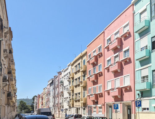
Lisbon is hot! At least compared to our last few weeks hiking the Kungsleden and West Highland Way trails in northern Europe. Arriving on a morning flight from Geneva, we figured out the metro (especially the ticketing system) and got ourselves from the airport to a store for cooking gas and then on to the bus station to catch our 2-hour ride to our starting point on the Fisherman's Trail in the village of Porto Covo.
The bus station in Lisbon is sketchy as most bus stations seem to be, but much of our walk along the streets was very nice. Our bus ride was in a very nice, air conditioned bus so it was a great way to get a feel for the Portuguese landscapes as the miles flew past. It appears to be very much like Arizona or California - dry, hot, and scrubby vegetation.
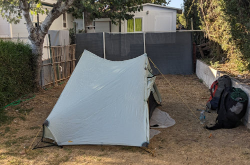
From the bus stop in Porto Covo, we had a very short walk to a campground right in town, more like a semi-permanent trailer park rather than tents and overnight campers. The nice young hostess (the only one that speaks English) took us to the small tent area which was packed with tents and people that looked like they were living there. Since it was crowded and pretty filthy, she showed us a small spot in a little back alley behind some camper trailers, at least it's quiet and out of the way.
We decided to try the campground restaurant for dinner without high expectations after seeing the camping spots. To our surprise, once we could explain what we wanted, our cod dinner was huge and very tasty, with potatoes, bread, a bowl of olives, and wine.
Prices (at least for camping and meals) are much more reasonable than what we've seen the past few weeks in the North. Unlike everyone speaking English in the north, there appear to be a lot of Portuguese that speak little or no English, especially older ones that run small shops, and campgrounds.
We are very happy with our decision to change our third European hike from the alps to the coast. Our first day on the Fishermen's Trail was wonderful with blue sky, stiff breeze, and dry air all day! It was practically perfect weather and the dampness of the past week just vanished. I'm sure glad I bought a new hat for the sun while in Lisbon, even though it's not really my style.
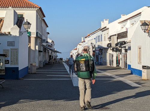
Since had time to do very little research about this trail, we started in Porto Covo rather than the actual starting point about 10km farther north. Kelly had read that the first part was uninspiring and Porto Covo was easier to get a bus to, so it was a simple choice. Walking along the few streets of the village early in the morning was a great way to start our hike. Bright white buildings with crisp, blue trim and red clay roofs would become the norm for the next 10 days.
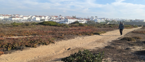
After hiking out of Porto Covo, we spent most of our 6.5 hour hike high on a plateau overlooking the ocean with only a couple drops down to the sea to walk on the beach. There were also a couple miles in sparse forest away from the shore.
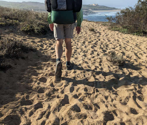
The trail itself had very little elevation but was tough much of the day. Deep, dry sand, like powdered sugar, made many miles very slow going, especially on the incline. Still, it was sooooo much better than mud in the rain! We traveled 12 miles to the next town South of Porto Covo, called Vila Nova de Milfontes.
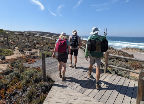
We met this couple from Scotland and we would wind up meeting up with them a few times over the next days. We met other hikers from Germany and Australia but we're the only ones camping so far. Everyone else had their treks arranged through companies to reserve lodging so they are hiking with light daypacks. We didn't meet anyone at our campground tonight, but it's mostly car campers.
We started after 8am and stopped at the A Ilha cafe right beside an ancient fort on the cliff overlooking the ocean for a nice toasted ham and cheese sandwich around 10am. We took a short snack break later, but other than that just walked through the beautiful day until we reached our destination.
Since the sun is bright and it's pretty warm, we're hoping to start a bit earlier tomorrow. But, that brings up other challenges.
After setting up our tent and taking showers in a campground much nicer than last night, we wandered around the town looking for groceries and then dinner. Like other hot places, it seems most shops shut down in the afternoon here. We did find some snacks for tomorrow, but we had to wait until 7pm for a restaurant to open. So, late dinners make early departures come quickly. We'll see how it goes.
Also, Kelly started feeling similar symptoms to my cold this afternoon. That might mean a miserable few days for her. We'll see.
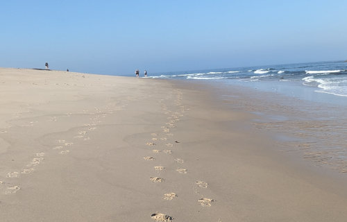
The hard sand on the beach is much easier walking than the loose, dry sand up on the cliffs.
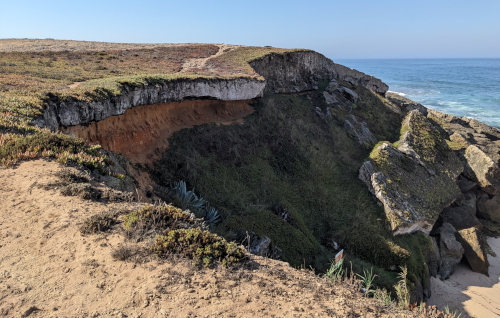
The trail often follows right along the cliff edges.
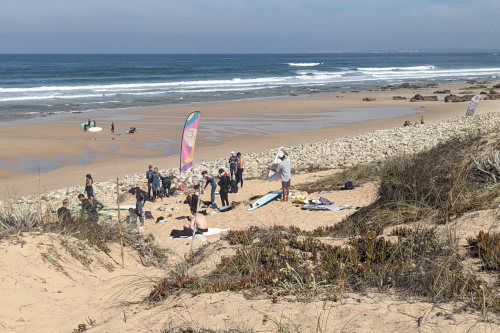
It seemed that surfing classes were held every day on nearly every beach we walked past.
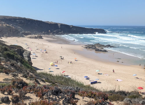
Also, most beaches were quite busy, even those that seemed to be far away from any towns. Nude sunbathing is pretty common, too.
Other than dogs, roosters, and garbage trucks, we got a pretty good night's sleep. The joys of camping in town. We had hoped to get going early, but it just didn't happen and we were on the go before 8:30 after a nice breakfast of mango and granola that we purchased at a mercado yesterday. A mercado is similar to a convenience store, but there is a huge range in size and product selection between stores.
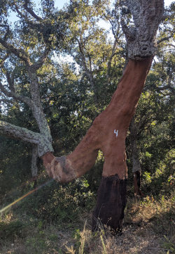
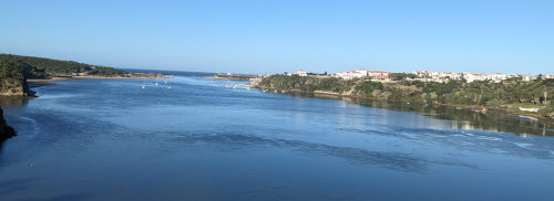
We had a short road walk to get us out of town and across the Mira river. Some hikers pay to take a boat across the river closer to the mouth to avoid the roadwalk inland. Since our hostel was already quite a way east, the boat would not have saved any time, and we would have missed walking through the only cork tree forest of the trip. Portugal manufactures a lot of cork and the process of growing and harvesting cork is pretty interesting - they strip the bark off the lower 6 feet or so of the trunk every nine years and it grows back. So, it was fun to see some trees up close.
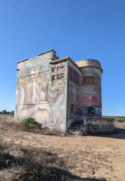
We also would have missed walking past this boarded up old bulding covered in art/graffiti.
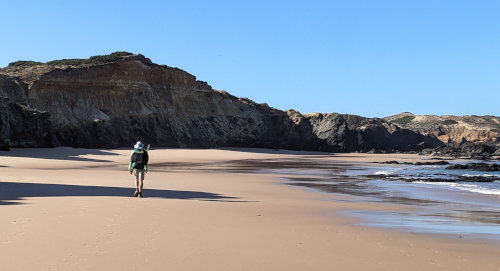
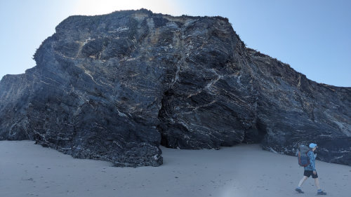
The rest of the morning was spent on trail running along the coast. There was much less deep sand on the trail than yesterday and we got to walk barefoot on the beach for awhile.
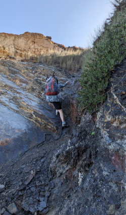
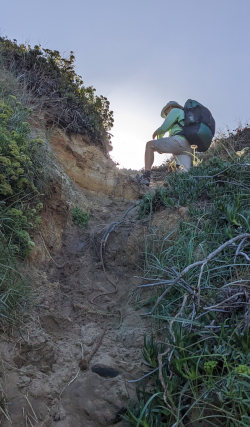
Our beach walking included a couple of rope-assisted climbs back up to the plateau on the cliffs above which gave us a little challenge. These were at the end of extra beach sections that we did rather than following the official path up earlier, so we could walk on the beach more. If you follow the official path, there are no ropes.
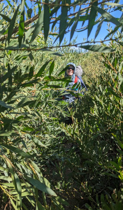
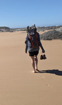
One stretch of trail was a Hobbit tunnel cut through a very thick manzanita and cane jungle. Very strange to be practically crawling to squeeze through the low, narrow passages. Even stranger was to catch up to two bicyclists struggling their way through and then still needing to walk their bikes in the deep sand once they got out.
Walking on beach sand was so much nicer!
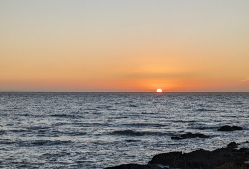
We reached the town of Almograve in the early afternoon and could not check into the hostel where we're staying until 6pm, so we spent a few hours on the local beach having lunch at a beach cafe/bar. We saw our Scottish friends again on the trail and then at lunch so they joined us and it was nice to chat a bit. After checking in and taking showers at the hostel, we returned to the beach bar for a light dinner and to watch the sunset at about 8pm.
We're staying in a hostel because you can't just wild camp in Portugal like you can in Scotland and Sweden. There are no campgrounds around here, so we're in a private room. The plan is to camp when possible and use hostels, airBnB, or hotel when necessary.
There have been maybe a dozen or so people on the trail each day. Not nearly as many as the previous two trails.
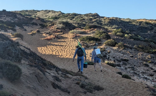
After a great breakfast included in the hostel price, and a brief roadwalk above the ocean, the sandy trail began again. I saw two fishermen walking ahead of me to their fishing spot, so I guess this really is the Fisherman's Trail.
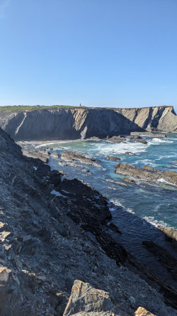
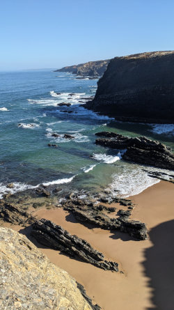
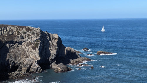
Today's walk offered many nice views of the sea from the cliffs.
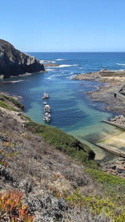
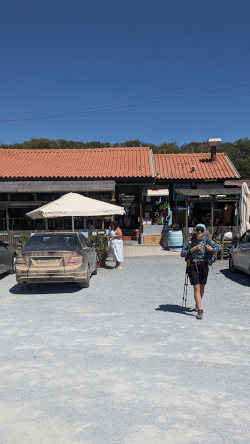
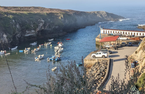
We took a break near an old lighthouse and stopped for lunch in a restaurant by a tiny fishing port. We had clams and mushrooms.
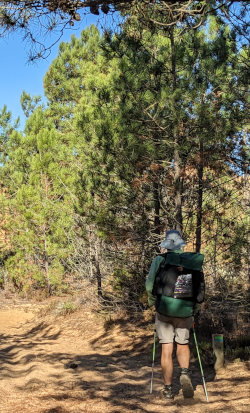
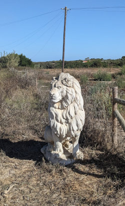
On a less interesting section later in the day which was a few miles along some dirt country roads, we were overtaken by a man. He had on a Wisconsin baseball hat so Kelly mentioned it. Turns out he is Portuguese but has a friend who went to school in WI years ago and gave him the hat. We walked and chatted quite awhile. He told us about some of the plants and the general area, so that made the walk pass faster.
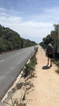
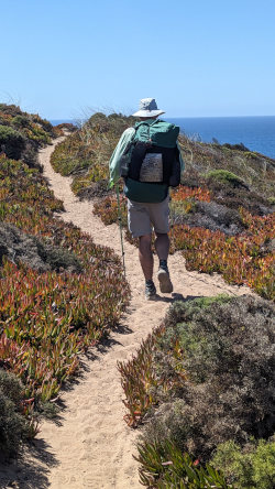
Whether it is along a busy road, or the edge of the ocean, you can count on the Fishermen's Trail to have plenty of sand. And sun!
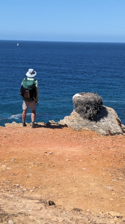
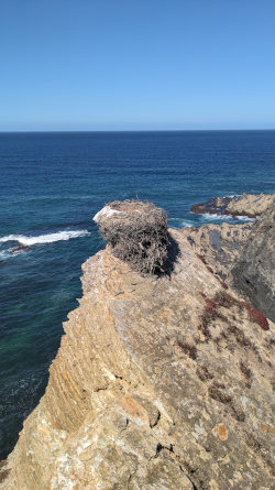
Storks nest on the cliffs in Portugal and migrate to Africa. The vacated nests were pretty impressive, perched on the tops of cliff faces or rock spires.
We arrived in Zambujiera in the afternoon and walked another half mile inland on a road to our campground which was very nice, and crowded. We spent some time in the outdoor swimming pool, showered, washed clothes, and then considered our dinner options. The campground restaurant didn't look that good, so we walked the half mile back into town.
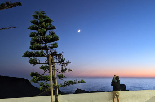
We found Cantino dos Sabores restaurant with no customers yet. We decided to take a look. The man running the restaurant, Daniel, sat us outside and explained that they had many different cuts of pork tonight. I got the impression that a pig had probably just been butchered today. But, Kelly asked if he had fish and he offered to make a typical Portuguese meal called Bacalhau a Bras which is cod and eggs. It was great! We had a Pastel de Nata for dessert. Daniel said it is the best Portuguese dessert.

Our day ended with the hike in the dark back to our campground.
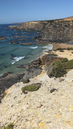
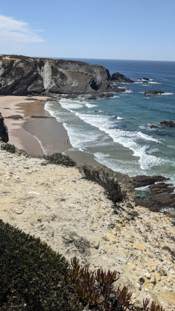
Just a couple more pics of the cliffs and beaches along the trail today.
Can't really expect each day to be a thriller. Today was mostly just a day of hiking and camping. But, no rain!
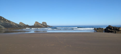
We got packed up and hiking at about what seems to have become our normal start time of 8:00am. A short roadwalk back into town and we had some breakfast bars and fruit while watching the ocean at the nice, small beach below the town before starting our hike. That was a nice way to begin.
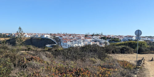
Last glance back at Zambujiera as we continued our march south.
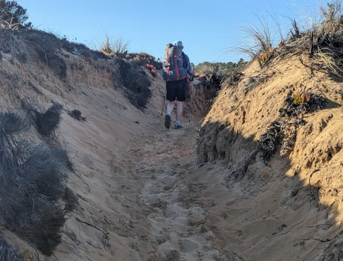
Much of the trail today was deep sand, overgrown Hobbit tunnels through thick brush, or dry country road walking. There was just a lot that was just a different kind of fun today.
For a few very long sections, we battled our way through brush, hunching over and twisting around. A couple times, I had to actually crawl to get through. Sorry, no pics of this. :-)
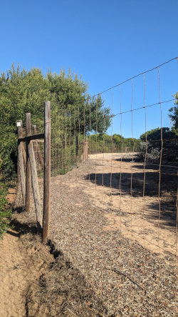
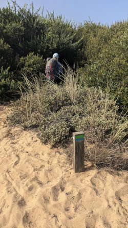
At one point, just south of Praia do Carvalhal, we encountered a six foot high wire fence and the trail followed alongside it. On the other side of the fence, all vegetation had been grazed away by cattle or something. On our side, the manzanita grew right up to the fence. We had to slowly squeeze along, forcing through the brush. A few times, when there was an opening, we turned away from the fence toward the ocean, hoping to find a parallel way, but each time we ran into thick brush and had to turn back.
So, if you hike this trail just follow the fence on this part - or consider just skipping ahead to Odeceixe since there were few views for the amount of effort.
We took a lunch break on a bench overlooking a small port. An English couple stopped and we chatted with them about a half hour. They're hiking the opposite direction.
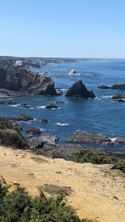
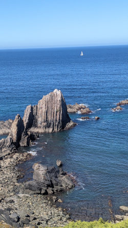
We had some views down to the ocean, a few with beaches and others with crashing waves on rock faces. But, the trail stayed up on the cliff all day.
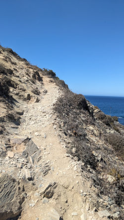
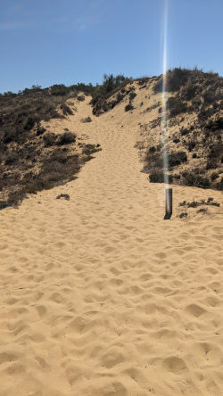
More of the trail was rocky, perched on the lip of the cliffs. But, never a shortage of deep sand to wade through. The sand is actually interesting. It definitely slows down the pace a lot and requires more effort, but it's a unique hiking experience. I have learned that it is a tiny bit easier to place my entire foot down flat and to step into a recent print made by a previous hiker. So, I guess I have a new 'sand hiking gait' - still slow, but a little more efficient. Today, while hiking, I was wondering if anyone invented a 'sand shoe' like a 'snow shoe'.
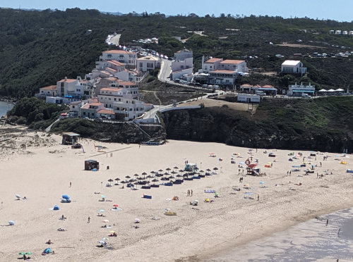
The last cliff along the ocean brought us to a river, across which we could see the Odeceixe beach and touristy area. Unfortunately, we won't get there until tomorrow because the trail turns inland for 2.5 miles along a road to a bridge to cross the river. But, tonight, we're staying on this side of the river at a campground another mile farther along the road.
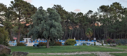
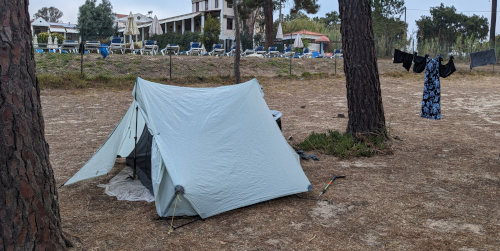
But, the walk was worth it, even though it was busy, narrow, and fast traffic for a mile. Campgrounds in Portugal continue to be very complex - showers, pools, restaurants, and little stores - but all drive-in use. We are the rare hikers. Since we are far from town, we just showered, bought something to drink and sat by the pool (Kelly swam), then had a basic pizza for dinner at the campground restaurant. It was a nice, relaxing afternoon and evening.
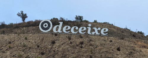
Along our sketchy roadwalk to Odeceixe and back towards the ocean to start the day, we stopped at a tiny mercado and bought fruit and a fig nut treat for breakfast.
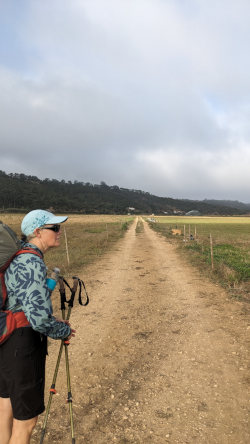
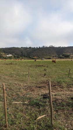
Getting off the road, we had a couple miles of flat walking through cow pastures towards the mouth of the river. We met the rancher tending to fence along the way.
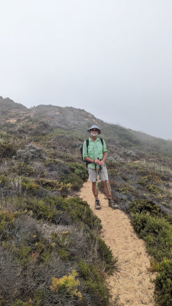
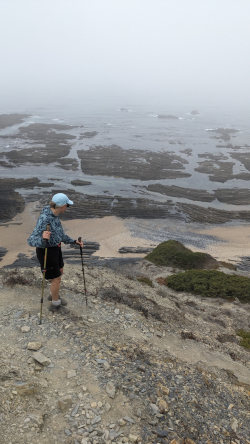
Once we were on the trail by the ocean, we were on the typical cliffs looking down at the water. But, today there was very little of the sea to see because of thick fog blanketing the shore. It was nice and cool with a great sound track of breaking waves, but few views.
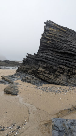
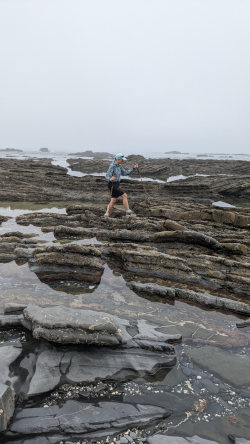
We took a snack break on a bench on a cliff which probably had a great view. Later, we took a detour to scramble/hike down a steep rock slope to the beach where we explored a little. That was our one time today at sea level with the rest being up in the clouds, I mean on the cliffs.
After a few miles along the cliffs on the usual deep sand trail, we turned inland and had about eight miles of gravel road walking. With the fog keeping the sun away it was a pleasant walk.
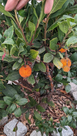
We saw lots of various small fruit trees like oranges, limes, apples, pears, and a few new ones that I couldn't recognize. We tried one small fruit and it had a gritty texture but tasted great. Later, I researched that it is a Strawberry Tree which is the national tree of Italy, and the fruit is fermented and distilled into Medronho. I found Medronho at a restaurant later and tried a shot - it's pretty much like Cachaca from Brazil made of sugar cane.
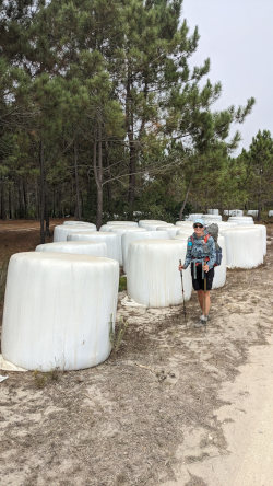
As you can see, we also discovered a hidden patch of the world famous Giant Portuguese Marshmallows! We were lucky to hike by while they were ripe and had not yet been burned by the sun.
We stopped in a supermercado in Rogil which was very nice and got sardines, crackers, plums, and Coke for lunch. We got extra for the next couple lunches since there doesn't seem to be mercados for the next few miles. We sat on a bench on the main street enjoying our meal before walking the last few miles to our campground for the night out on old backcountry roads.
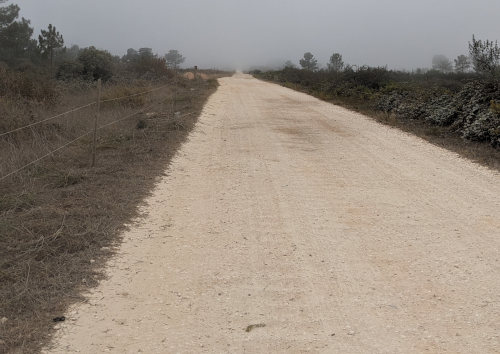
In the open field section of trail after Rogil, there are no blue and green Fisherman's Trail markers. Instead the markers are white, red, and yellow but they follow the same path. The markers were pretty much the only thing to notice for a couple miles.
Along this part, we caught up to a solo Austrian hiker out on her first long walk. We enjoyed chatting with her until we reached our campground which is 2 miles before the next town, so we couldn't do any exploring. We tried the restaurant but it looked pretty dismal so we're finally cooking one of our own camp meals that I've been carrying since Sweden.
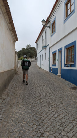
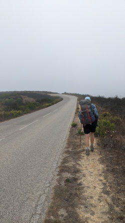
It took half of our hike today just to reach the coast. The trail headed farther inland from our campground, toward the town of Aljezure, where we wound along narrow streets through a quiet neighborhood set on a steep hill. The only activity was grazing cows and one lazy dog.
After this village, we had 3 miles along a paved road, often with no shoulder, and very fast traffic heading to the coastal beaches. It was a little stressful, but fortunately we could usually hear the cars approaching. There wasn't much to see along the way.
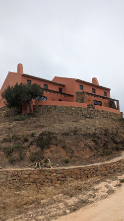
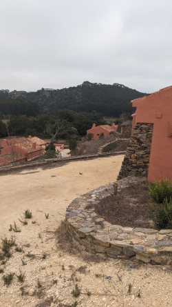
The path did take us through one strange area - what appeared to be brand new houses creating a new neighborhood on the top of a steep hill. But, there was no activity, no vehicles, and no sign of life. Weeds were growing in the gravel road. It seemed that the houses were built and then not used. Maybe the grand opening is happening soon.
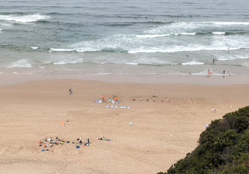
About 2.5 hours after starting, the Praia da Amoreira beach welcomed us to the ocean shore. We stopped and sat on a bench overlooking the beach near a closed cafe for a light brunch while we watched nearly 100 people taking surfing classes.
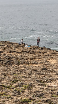
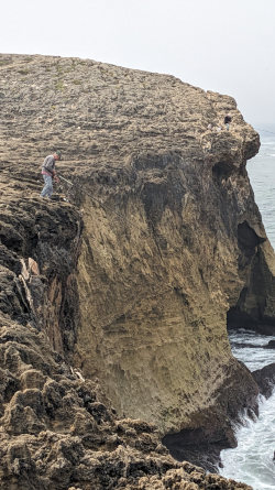
Just a few minutes later, as we walked over a small hill to reach the cliffs of the actual ocean, we found a few fishermen! They were trying their luck in the surf far below their precarious perch on the very edge of the rock face. I was hoping to watch them reel a fish up such a long way, but after 15 minutes with no action, we had to continue hiking.
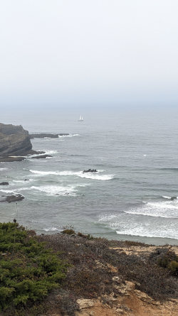
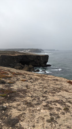
The fog let up today so we could see the water but we were up high for the few short miles along the coast. Much of the trail was the typical deep sand.
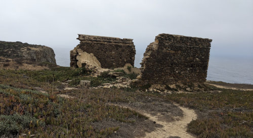
We did get to walk through the foundations of the Ribat of Arrifana which was pretty cool.
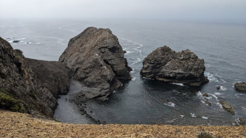
After the Ribat, and our last half mile along the cliffs, we turned inland through a very warm, sparce forest, but still hiking through deep sand, and then across barren fields to the small village of Arrifana where we're staying in a hostel private room.
There seems to be very little grocery opportunities here, or for the next couple days, so we bought some food yesterday for our lunch tomorrow. We enjoyed a tasty dinner at the one restaurant around - cuttlefish stew, and clams in creamy rice. (It turned out that we were wrong - there is food available somewhere along the trail pretty much every day.)
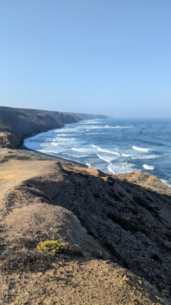
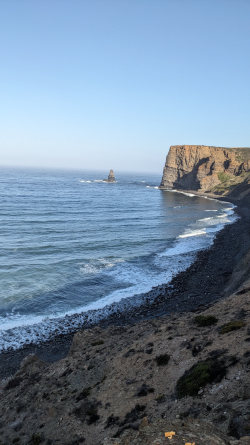
On this bright, sunny morning, we had a 2-mile walk on a dusty, dirt road to reach the ocean at Praia do Canal, a tiny beach with, of course, surfing lessons! There was quite a bit of traffic heading to the beach. About a mile out of town, I hooked my prescription glasses with clip-on sunglasses onto the pocket of my shirt while we applied sunscreen. I left them hanging there since we were walking by a row of shady trees. About a quarter mile farther, when I reached for them, they were gone. A quick, frantic search did not find them, so I hiked back the way we had come. I found them, but one car had found them first. Now, I have flat glasses with one lens, but the sunglasses still work. It's ok, because I needed to get an eye checkup anyway.
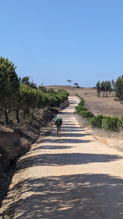
At the ocean, we watched surfers for a while and then climbed a very long hill back up to the plateau where we would remain away from the ocean for most of today's miles. These roads were more secluded with no traffic, but a few fellow hikers in the distance ahead and behind us.
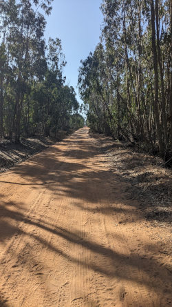
We hiked along a very nice dirt road that was comfortable to walk on and it was in a planted forest of trees that we weren't sure what they were but they had long leaves and several thin trunks that came together at the bottom.
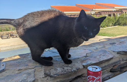
Then we walked through arid farmland for quite a while until we came upon a very nice looking lodging/bar/restaurant that seemed to be in the middle of nowhere. It was after 11am, so we stopped for a snack and Coke. It was a very pretty bed and breakfast place and we had tapas, some meat and cheese and bread and olives. The place shows up as Restaurante 44 at Barranco da Fonte and was a pleasant oasis in a long, hot stretch. A handful of other hikers stopped here also, so it was nice to chat with them. The vast majority of hikers have been from Germany.
While trying to enjoy my snack, the local cat visited us. It kept attempting to step from the stone wall onto our table to get to the food. I finally gave it a firm shove that nearly sent it tumbling into the swimming pool on the other side of the wall, but his claws scraped and held on. He got the hint that I wasn't sharing after that.
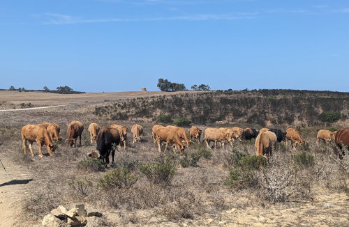
Our dusty roadwalk continued along dirt roads again, where we hiked right through a herd of cattle coming up the road with many bells clanging as they walked, being herded by their dogs but no people. The dogs kept a wary eye on us as they passed. In the distance, we could see wind turbines on many ridges. Portugal makes most of its electricity from renewable sources - wind, solar, and hydro.
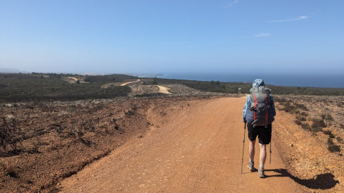
The coast finally came back into view as the road trail wound back to the ocean after 8 miles of walking across the brushy range. The entire day was sunny and warm with a wonderful blue sky and a nice cool breeze blowing off the ocean. Even though it was nearly all road, it was a pleasant day of walking.
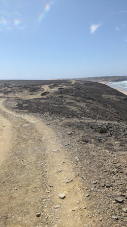
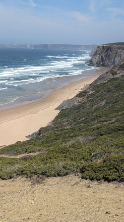
We had more sand dunes to trudge over with the ocean off to our right, but we were not close to the cliffs. The land seemed to be more dried out and barren today, maybe fire in the recent past?
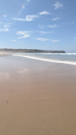
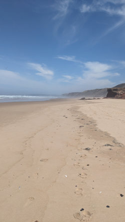
About one and a half miles before our destination of Carrapateira, the trail drops down to a huge long Bordeira Beach that's very beautiful. This is a great spot to stop and enjoy the beach for a couple hours before reaching your destination as a nice reward from missing the ocean all day. The trail from the beach inland to town follows along on a hill to the south of the beach but we stayed on the beach and walked to the parking lot - it was easier and nicer.
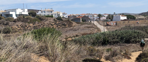
The town of Carrapateira has a small, quaint, clean center with nice food choices and a quiet atmosphere. Our night is spent in another very nice hostel after a dinner of pesto pasta and pizza.
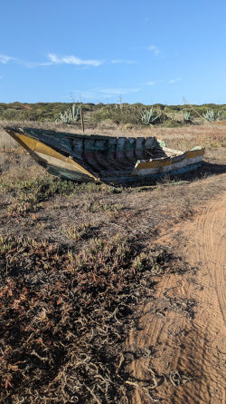
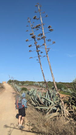
We slept in and then had plums, cocoa, and bread for breakfast at the hostel, so we didn't get out of town until almost 9:00. The usual dirt roadwalk to the coast was pleasant with very little traffic and some interesting oddities along the way - such as this stranded boat and very tall agave plant.
The wind was very strong all day and the sun bright. It was a great day for walking.
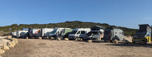
When we finally reached the ocean, you'll never guess what we saw - that's right, surfing school! Plus, there were over a dozen adventure vans of surfers living the good life.
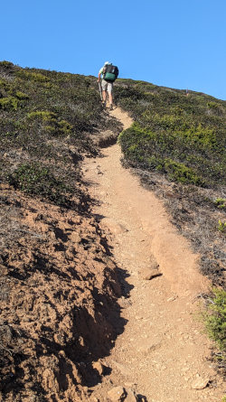
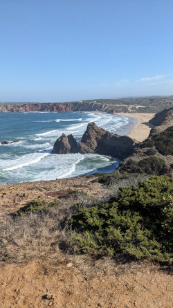
This was definitely a day of ups and downs. The official Fisherman's Trail route had us drop down to three separate beaches today. That also means three climbs back up to the plateau! Each climb was about 300 to 400 feet and some were steeper than others. Those ups and downs provided short times on the shore as well as nice views on such a beautiful day.
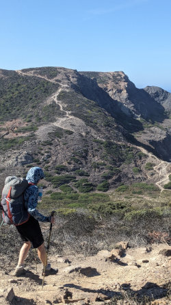
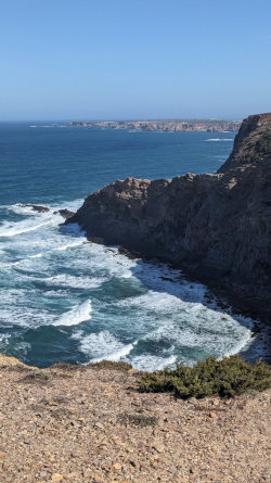
Since the hike today was only about 10 miles, we decided to divert off the official trail which went inland for 4 or 5 miles across more dry farmland to our destination of Vila do Bispo. Instead, we stayed on the coast another couple miles before heading inland to Vila do Bispo. This meant adding about 3 more miles of hiking which included a little more up and down, but we got to spend a lot more time walking above the ocean, and on over a mile of beautiful beach.
To follow our path, at a four-way intersection about 6.5 miles south on trail from Carrapateira, stay on the yellow/red marked trail heading southwest rather than the green/blue Fishermen's Trail heading southeast so you tend west to the coast instead of south to Vila do Bispo.
When you drop down to the first beach, which is Praia de Barriga, just walk out onto the beach and enjoy following the shore to the left/south for about 2 miles to Beach Castelejo where you can follow the road, then trail, Southwest to Vila do Bispo.
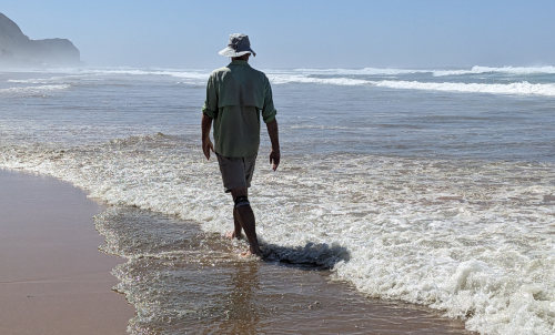
This reroute gets you on the beach for a long, pleasant walk with only one additional climb.
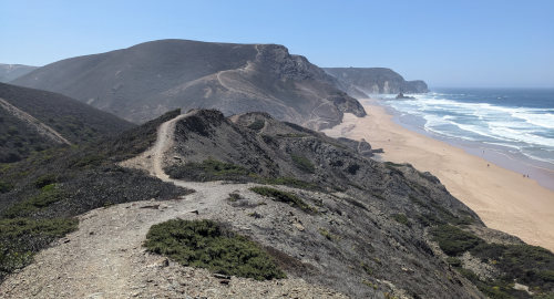
This scenery is a bit better than miles of dry scrub brush.
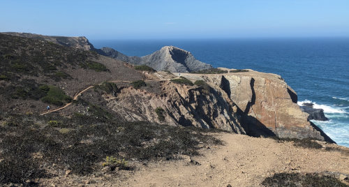
We met a few more German hikers - surprise! Most of the hikers we've seen are day hiking, either out and back from their vehicle, or having their luggage transported for them to their next hotel. We've seen only a very few other hikers that are also camping along the way. The trail was not very busy today, but we did see a trail friend from Austria named Katie so we're looking forward to maybe running into her again.
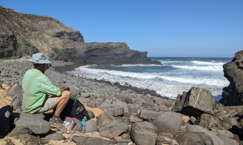
We stopped on one beach for a sardine and crackers picnic and on another for a snack while we watched waves crash onto the rocks.
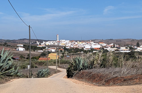
The hike ended with the typical roadwalk into town where we are staying in someone's apartment that has been changed to a lodging similar to AirBnB.
Vila do Bispo is the first town on this trek that has had a 'real' grocery store, AND it has two - an ALDI and a Lidl. We explored the Lidl since it was close to our lodging and picked up breakfast and lunch food for tomorrow.
With a little effort looking for a place that would take more than just cash, we enjoyed a dinner of sea bass and grilled shrimp in a tiny restaurant that was full.
Excitement for today: my floppy sun hat got whipped off my head by the strong wind and almost down a steep hillside, but we retrieved it before it got away.
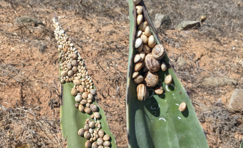
Yesterday and today, we've noticed snails clinging to plant leaves, dead stalks, fenceposts, telephone poles, anything rising up from the ground. Thousands of snails!
Through some research later, I found out that during very hot and dry periods, the snails do this to get above the hot ground into the cooler breeze. They seal their shells to the surface so no water evaporates and they enter a state similar to hibernating until cooler, moist air arrives.
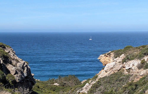
Friday, the 13th, what could go wrong? Well, nothing actually. Today was a very pleasant uneventful day in which we reached the 'Edge of the World'.

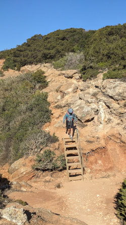
After what is becoming our typical breakfast of fruit, yogurt, and granola, we walked out of Vila do Bispo on our last southbound hike in Portugal. The first 5 miles were west and then south on dirt roads with the usual surf school vans flying past, across virtually flat land angling gradually toward the coast. Once we got there, the familiar expansive views from the cliffs and dips into gullies resumed.
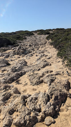
The sand of the trail gives way to bedrock in many places along this section. The mix of sand between rocks makes for a very interesting time walking.
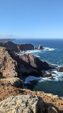
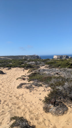
We could see forever in all directions since the plateau here is so flat. Water towers that we had passed days ago were still visible on the horizon and the edge of land where Portugal dropped to the sea was ahead of us.
You can see the lighthouse far in the distance in the photos above. (click for larger images)
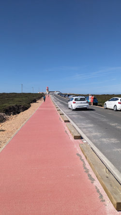
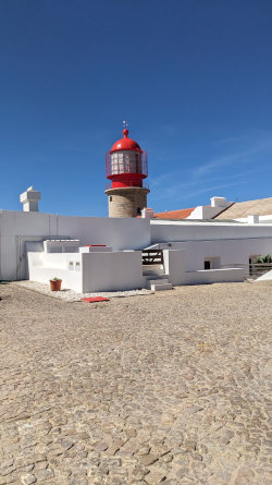
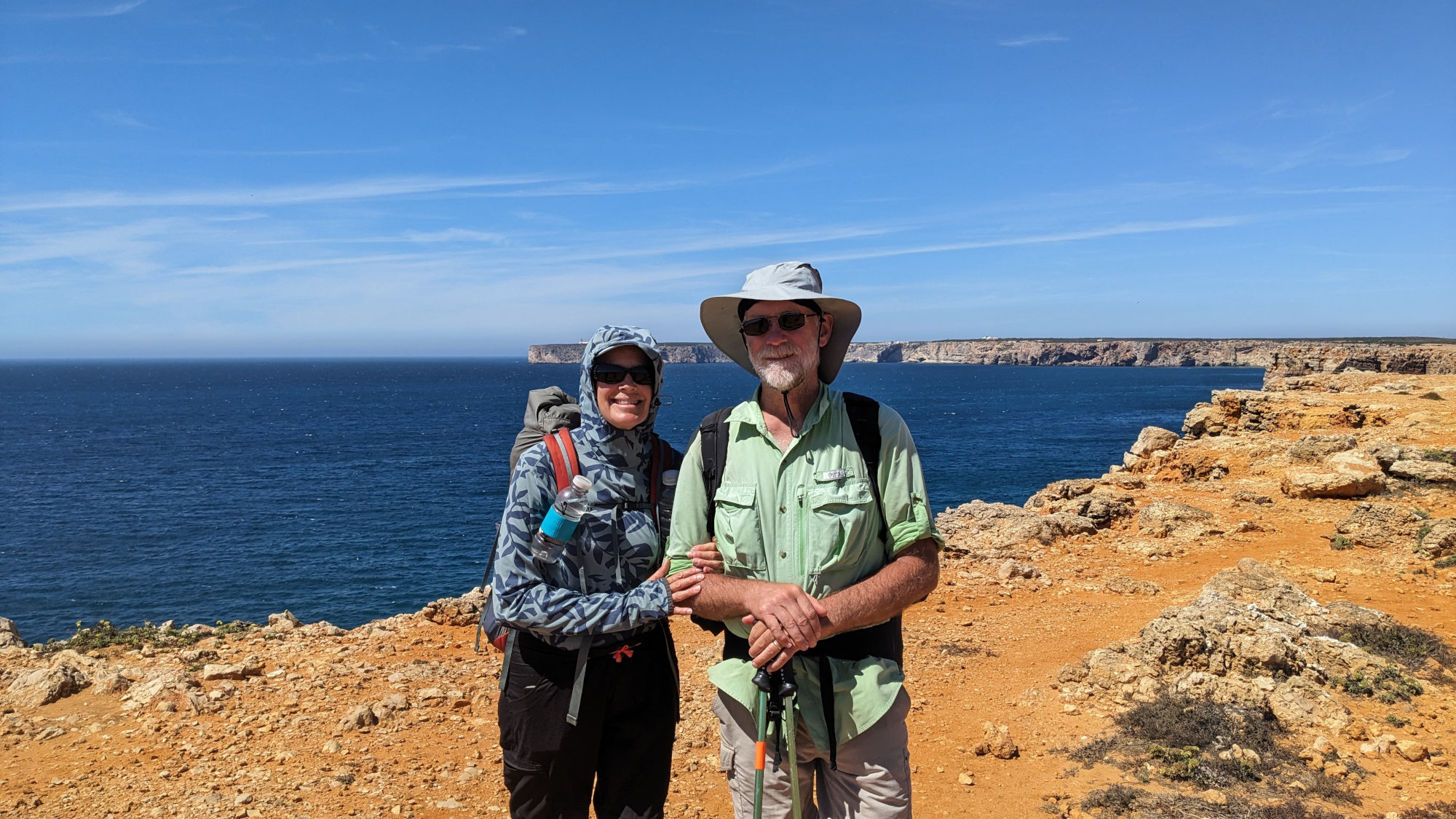
We followed the western cliffs south and then a final half mile of paved road lined with parked cars to the Cabo de Sao Vicente lighthouse where we could go south no more. This is known as the 'Edge of the World' because it is the most southwest spot in Portugal, the Iberian Peninsula and Europe. It's the last bit of land sailors would see when sailing off on adventures.
Today, it's more of a tourist trap with tour buses and gaggles of people stopping for selfies and then moving on. We found a sheltered spot out of the continual wind, and away from the crowd, for our sardine lunch.
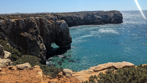
Leaving the lighthouse, the trail takes a big turn to now head east along Portugal's south shore for a couple days. The first view of the sea in this direction looks different, the water below us is a lighter color and is begging us to jump in. But as we're still over a hundred feet above that's not happening for awhile.
The last miles of our hike into the touristy town of Sagres consisted of a wonderfully wide and smooth walkway along the road and some rougher trail along the cliffs.
Tip: If you are tempted to just walk the fast, easy road into Sagres from the lighthouse, you you will miss the first very beautiful views down into the 'new' ocean. The small extra distance and rougher trail are worth it.
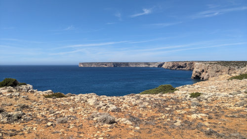
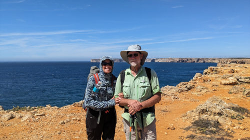
Now a couple miles behind us, you can see just how starkly flat the land is as it seems to float on the ocean. We met a day hiker here to take our picture.
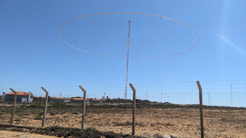
We spent most of the rest of our hike enjoying the ocean views, but we did walk right past these strange structures. They are part of an obviously closed and dilapidated military installation. I'd guess radar or communications apparatus of some sort.
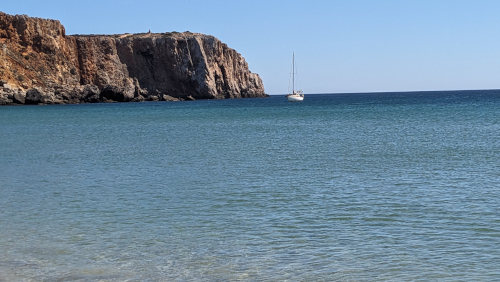
Arriving in Sagres around 1:30, we found our lodging for the night in an airBnB home, and then headed to the beach which was just a 10-minute walk. It was beautiful, but the water was as cold as any mountain lake I've ever been in! Maybe as we head east it will warm, but I doubt it.
After our beach rest, we did our usual showers, groceries, and then dinner so we're ready for our penultimate day of hiking tomorrow.
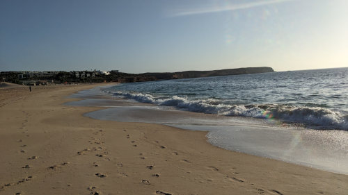
Yet another beautiful day hiking along the coast of Portugal. Most of the day offered great views south over the Atlantic but we worked for them. All of today's trail was right on the coast, except for two 1.5 mile sections, and each of those were unique enough to be interesting.
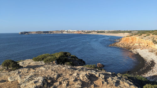
Immediately upon leaving Sagres, we had a nice, long beach walk for a mile. Looking back towards Sagres, we could see how far we'd already walked.
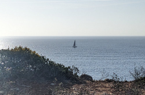
Just your daily sailboat photo. For all I know, it's the same one we've seen nearly every day along our long walk.
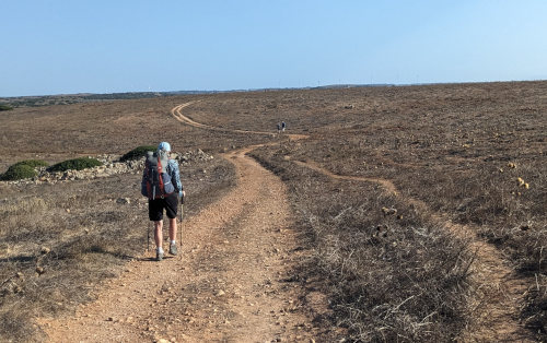
A quick walk past the empty, fancy beach chairs and umbrellas of a ritzy resort, and we had a short uphill to the dry plateau. The next 1.5 miles went quickly and easily as we strolled along an old road with wind turbines dotting the horizon.
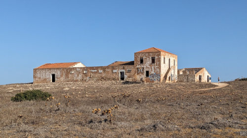
Halfway through this portion, we came upon yet another deserted structure. It was once a huge farm/ranch compound, but now is only a canvas for local 'artists'. After wondering about the history here, we hiked on.
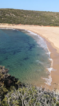
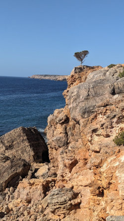
Back on the coast, our hike oscillated from beach to cliff throughout the day, giving views both low and high.
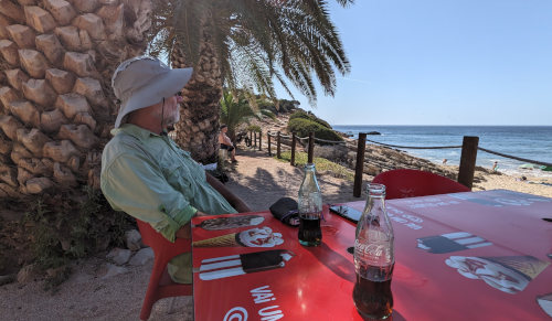
Near the middle of today's walk, we stopped for $2.50 cokes at yet another beach bar - Restaurant do Sebastião on Praia da Ingrina. It was a very nice rest break, enjoying the breeze in the shade of palm trees and watching a couple families swimming.
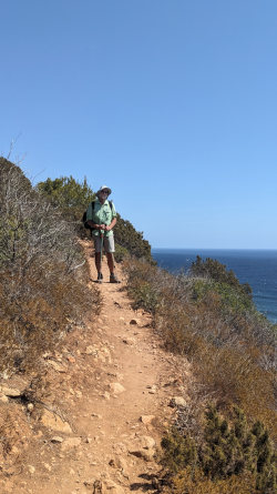
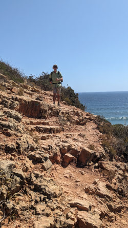
The plateau here on the south shore compared to the west coast is quite a bit lower, making the 10 climbs down to beaches or into gullies and back up in the second 6 miles of our day a bit easier. The climbs were still on very steep and rugged trail, but at least they were never more than 200 feet of elevation. A dozen of them throughout the day were enough to tire us out, though.
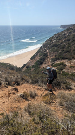
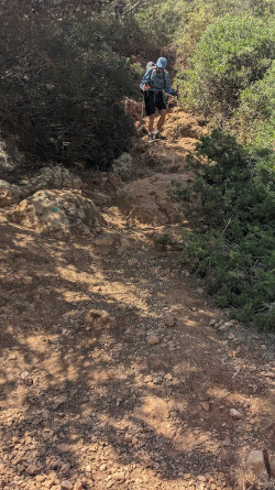
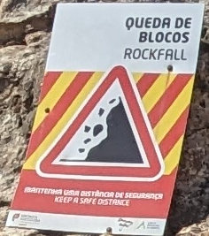
The trail itself is much more rugged here that in earlier days. There is more erosion of cliff faces, causing ravines to extend farther and deeper into the plateau. This means more up and down trail. Scrambling up rock hillsides with lots of loose gravel and scree made slipping an easy and common activity.
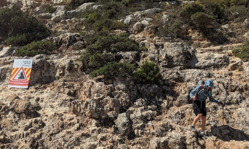
Like I said, some parts were steeper and slower than others.
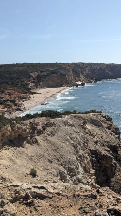
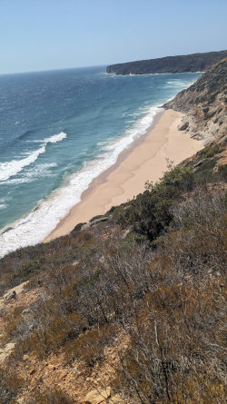
The continual breeze helped keep us cool as we hiked from beach to beach.
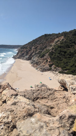
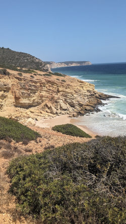
These views filled our day except for one other 1.5 mile section that took us inland from Praia das Furnas to Praia da Figueria, just two tiny inlets with beaches. We walked a road inland and then worked our way through a neighborhood and back to the coast.
I actually missed a marker somewhere on the road and we wound up walking down the wrong street. By the time I noticed on my map app, we were halfway back to the shore, so we just continued down a different path that looked to be headed the correct direction.
It turned out to guide us through a little nature preserve and popped us out right on the Fishermen's Trail where we wanted to be. We lost no time or effort, so it was all good.
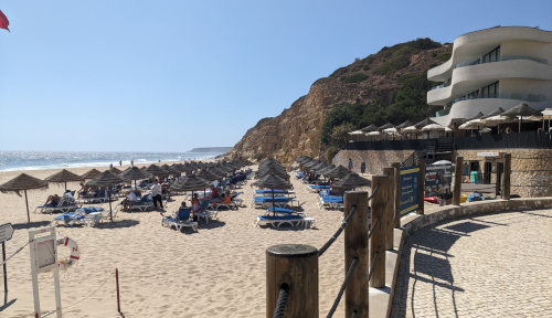
We arrived in Salema around 2:30 and had 90 minutes to wait for a shuttle to take us a mile north of town to our campground. We would normally walk, but the mile of road to the campground appears to be very narrow and winding and the shuttle is free, and the trail heads east from here. Our plan is to delay our start tomorrow morning and take the first shuttle from the campground back down to the town at 10am.
We got yet another coke and enjoyed some shade by the beach. Salema is definitely the most touristy/expensive town so far. Cokes have become our big splurge. :-)
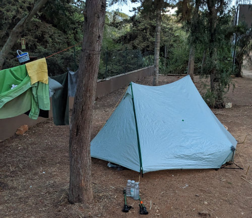
The Salema Eco-Camp is a huge, sprawling campground filling a draw, hillside, canyon, ravine above the town. Like most of the other campgrounds we've visited in Portugal, this is full of car campers and RVs. We are the only hike-in campers. We found a flat space of dirt for our tent but I wasn't sure if the narrow strip was a road or tenting area. So, I walked back to the main office to make sure and was told we can tent any place.
Showers, some hand-washed clothes, and a simple dinner at the camp restaurant finished off our day. Tomorrow is our last, long walk. The mile of road to the campground is very narrow and windy so our plan is to delay our start tomorrow and take the first shuttle down to the town at 10am.
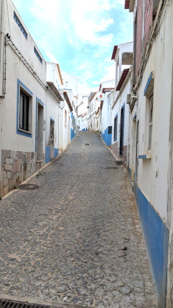
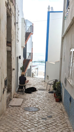
No one drove over out tent last night, so I guess our location was good enough. The campground was quite a bit quieter than I expected based on the general noise level in the evening. So, we live to hike our last day on the Fishermen's Trail!
After a nice breakfast at the campground restaurant, we loitered until our shuttle driver was ready to take us and 5 others down to the beach in Salema at 10am. We were the only ones with backpacks, the rest were just enjoying the town for the day. Our hike along the narrow streets soon brought us out of town and back onto our familiar path along the cliffs.
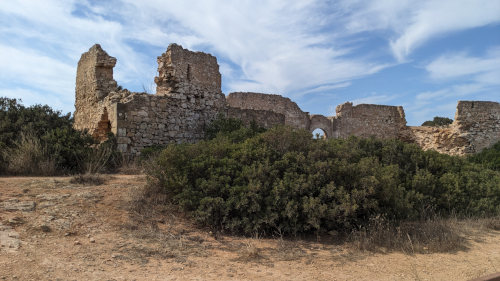
Down to our first beach crossing and back up the other side and we were warmed up. We soon came upon the ruins of Forte de Almádena. Yet another stark foundation from past centuries. This one I looked up and it was built in 1632 and abandoned in 1849.
The old fort was soon followed by a quick dodge around a private house built right on the cliff edge. This is the only building we encountered on the entire trail that was so close to the ocean, except for beachfront bars and such.
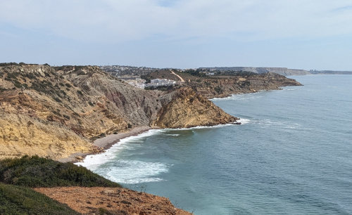
Looking east ahead of us along the coast, we can finally see a couple tall buildings in Lagos, our final destination still many miles away!
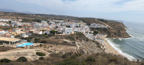
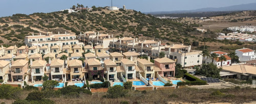
We walked into and through Burgau, a very expensive looking village where every house had its own swimming pool
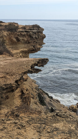
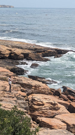
The ocean views didn't stop all day, and we were treated to lots of cliff structures. All the way until the boardwalks of Lagos, the coast was unobstructed except when passing through the towns of Burgau and Luz. I even got to watch another fisherman as we walked past, but still no fish caught.
In Luz, we stopped for a snack on a bench under a shade shelter downtown overlooking the ocean. We met a nice couple from Holland sitting there also, and enjoyed chatting with them before hiking on.

Reaching the suburbs of Lagos, we could see the final point of land that we'd need to walk around. It had one last lighthouse sitting high on the cliffs much like the others we've past over the past 10 days. Here, we were stopped by a young lady asking about our backpacks. So, she got a quick explanation about the Fishermen's Trail and got a Hiking Dude sticker to check out the blog.
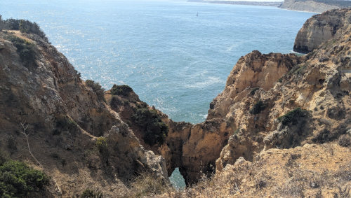
Just the daily sailboat photo.
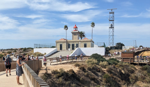
That final point of land is called Ponta da Piedade and attracts hundreds and hundreds of visitors to its maze of boardwalks and views off the honeycombed cliffs over the sea caves below. Tour boats were cruising around below us as we disappeared into the throngs of people. Can you find the backpacker in the 75+ people above? (click the image for a larger view)
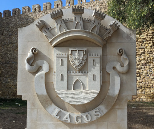
From the lighthouse, we had our first northbound hike - 2.5 miles north following the boardwalks, then streets into Lagos.
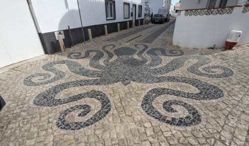
The last mile or so always seems to take so long. The streets of Lagos were a welcome, and fun, end to our hike. The artwork of the hand-set stone roadways was amazing. It seemed each street had a different design.
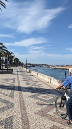
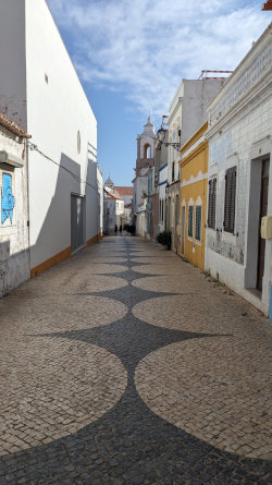
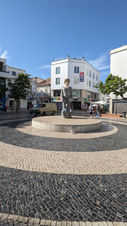
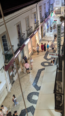
Tonight, we had grilled sardines and grilled golden bream at a restaurant recommended by our host. Our walk through the big city of Lagos was fun. The tight old streets are packed with people. Our airbnb lodging is right in the old town and is very comfortable just above a small ice cream shop.
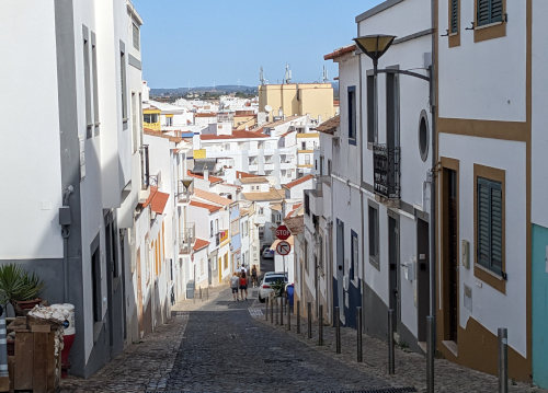
The next day was our first 'zero' day of this hike. We spent the day exploring 'Old Lagos Town' and playing on the massively long beach. We even finally went swimming - the water was warm enough to enjoy and we had a great time. Old town is surrounded by a rock battlement from centuries past which includes yet another fort, of course.
Back to Fishermen's Trail Info page.
Find more Hiking Resources at www.HikingDude.com


Follow Me
Recent Comments