
Fishermens Trail
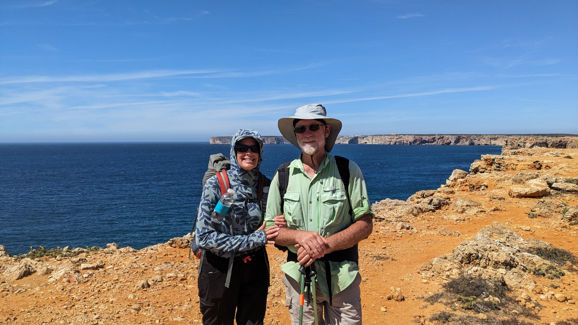
My Fishermen's Trail 2024 Hike
This was the last of three hikes we did in Europe during August-September, 2024. Prior to this, we hiked the Kungsleden Trail in Sweden and the West Highland Way in Scotland.
We hiked along the Portuguese coast from Porto Covo in the north to Lagos in the south. We hiked this trail for 11 days from September 5 to September 15 to finish off our 5 week trip.
My Gear
Some of my original lightweight equipment that I've been using for 14 years is showing its age, so I finally invested in some serious new gear for this European adventure. My wife heard about ZenBivy quilts and convinced me we both needed one. Also, after literally hundreds of nights of us, the zipper on my BearPaw Wilderness Designs tarp tent has become a pain to keep closed so we purchased a TarpTent Stratospire Ultra shelter made of a new 'nearly Dyneema' material they call 'Challenge Sailcloth Ultra TNT'. I'm very pleased with the tent and quilts after these first 4 weeks of use.
| Item | Oz | $$ | Notes |
| EB Stowaway pack | 12.7 | $0 | 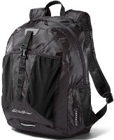 This is a small, frameless 20L pack that can be compressed down into its own little packet when not used. We both had identical packs. We needed these for airplane travel and had to carry them in our backpacks for the entire trek. They were used a lot for our city exploring between trail hikes. This is a small, frameless 20L pack that can be compressed down into its own little packet when not used. We both had identical packs. We needed these for airplane travel and had to carry them in our backpacks for the entire trek. They were used a lot for our city exploring between trail hikes. |
| G4 backpack | 16 | $0 | 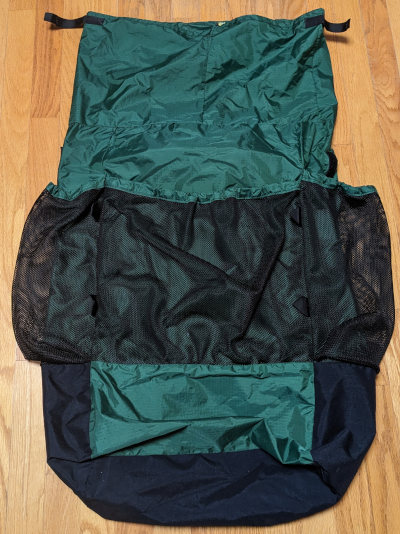 made myself from pattern. made myself from pattern.Comfortable, light, and plenty of room. |
| Sleeping | |||
| shelter | 40 | $550 | 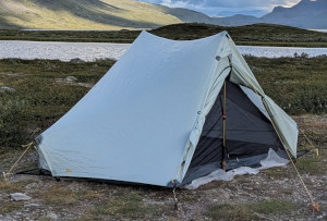 TarpTent Stratospire Ultra. It worked wonderfully. The material is completely rainproof, does not stretch like silnylon, and is almost as light as Dyneema. |
| quilt | 35 | $330 | 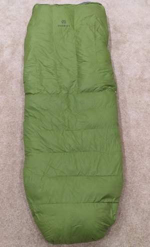 ZenBivy 10-degree Light Quilt, Large, 800 fill down. Our new ZenBivies worked just great, very warm, packed small. |
| sleeping pad | 10 | $0 | I just used an old blue cell foam pad. It gives structure to my frameless pack, weighs little, and is cheap and indestructible. |
| Cooking | |||
| fuel | 7 | $10 | Bought a 100g canister in Lisbon since we couldn't carry on the plane, but we used it only once. |
| cook kit | 8 | $0 |  Snow Peak, pot w/lid, windscreen, and 2 lighters. Snow Peak, pot w/lid, windscreen, and 2 lighters. |
| food cozy | .8 | 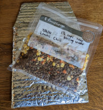 insulates food package while the hot water is heating it up. Cheap, saves fuel and works super. insulates food package while the hot water is heating it up. Cheap, saves fuel and works super. | |
| food | ~2 lbs. | $0 | 2 dinners, snacks and bars, daily lunch foods. |
| Water | |||
| water filter | 5 | $0 | I carried my Sawyer Squeeze, bags, and backflusher, but did not use it. Potable water was available every day. |
| water bottle | .6 | $0 | two .6L disposable bottles - cheap, easy, light. |
| Clothes | |||
| new Wide-brimmed hat | 3.0 | $23 | wore it every day |
| Pehrson Lodge baseball hat | 3.5 | $0 | didn't wear it |
| Fishing shirt | 9 | $0 | well-used, long-sleeve, light, synthetic. It refuses to wear out. |
| 2 Paka t-shirts | 12 | $50 | made with alpaca hair to reduce smells. Seems to help. |
| shirt | 12 | $0 | nice enough button short-sleeve shirt to wear in towns. |
| Kuhl zip-off pants | 17 | tough and comfortable. | |
| zip-off pants | 18 | no-name extra pair for city wear and back-up | |
| Darntough socks | 5.5 | Brought 2 pair. I'm on my 4th free replacement set now. Soft, strong, and comfortable, but I wear through them every year or so. | |
| underwear | 3.6 | 3 pair | |
| shoes | 28 | $25 | My regular Ozark Trail trail shoes from Walmart. I still haven't found anything more comfortable. |
| bandanna | 2.0 | $1 | 2 of them, too many uses to list here. |
| rain jacket | 18 | $30 | Frogg Toggs jacket and pants. Did not use. |
| rain poncho | 4 | $28 | off-brand poncho. Did not use. |
| Electronics | |||
| cellphone | 6 | for daily blogs and pics. Google Pixel 5. This is my watch, alarm, phone, camera, gps. | |
| tracker | 4.2 | pings to satellite with my location. Batteries last about three weeks when on for 12 hours/day. | |
| headlamp | .5 | $0 | 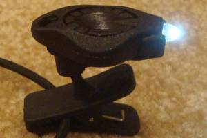 Awesome photon light. One set of batteries lasts about 10 days. Awesome photon light. One set of batteries lasts about 10 days. |
| batteries | 4.0 | $15 | Extra 3 AAA lithiums for tracker, and 4 CR2016 coin batteries for headlamp - purchased online for pennies. |
| Other | |||
| trek poles | 14 | $0 | Still using Walmart pair that refuse to die |
| 1st aid kit | 3 | basic personal items - bandaids, pain relief, tape, liquid skin, CPR mask, gauze pads, allergy meds, ... | |
| compass | 1.1 | ||
| knife | 1.1 | tiny, single blade. | |
| misc. | 5 | 2 garbage bags, whistle, clippers, thermometer, and other small items | |
| stickers | 2 | Taking some Hiking Dude stickers to hand out to folks I meet. | |
| Total | ~21 lbs total weight +2.5lb of water | ||
My Food
I carried a couple dehydrated meals that were left over from Scotland through this entire trail and they are still uneaten at home. Every campground, hostel, and airBnB we stayed at had easy restaurants and groceries available, so we just bought and ate food each day. It was more expensive, but just so convenient.
My Expenses
Still figuring it out.
Fishermens Trail Statistics
| Location | Along the southwest coast of Portugal |
| Distance | about 140 miles - 226km. |
| Total Elevation | There is very little elevation, only 50 to 100 feet each time you descend to the beaches from the high plateau and back up which is done a few times a day. So, certainly under 10,000 feet total. |
| Terminus | North: Sines South: Lagos |
| Highest Point | 525 feet just north of Palmas Lodge on our day 7. |
| Lowest Point | 0 feet at every beach along the trail. |
| Map | The 'official' map of the route is HERE. |
| Terrain | The trail follows Portugal's coastline on the fairly flat plateau that is 100 feet or so above the ocean. There are many beaches along the way and the trail often drops down to the water level for short beach sections. There are many recreational vehicle tracks throughout the area, making it easy to follow the wrong one if a hiker is not paying attention to trail markers. Green/blue stripes are used to blaze this trail and it often is on the same route as a red/yellow blazed historic trail. In this hot, arid area with a constant breeze off the ocean, there is little vegetation other than occasional sparse forests and thick brush in some gullies running down to the ocean. Exposure to the sun and wind is constant. |
| History |
This route was established by the Rota Vicentina Association around 2012 to encourage tourism in southwest Portugal. Existing social trails and rural gravel roads were used as the route and trail markers were constructed or painted along the way. |
| Challenges | The sand, so much sand. One troublesome roadwalk on a fast, busy road near Odeceixe. A few fairly steep and narrow climbs down to beaches and back up, made slippery with sand and loose debris. |
| Time Window | Late Summer through late Spring (September-June), avoiding July and August when it may be uncomfortably hot. We found that the first two weeks of September were wonderful. |
| Time to Hike | It is about 140 miles and can take 6 to 16 days depending on your hiking speed and logistics. We hiked for 11 very comfortable days that ended at villages where we had been able to arrange last-minute camping or lodging. It is possible to arrange lodging in other towns and shuttles to the trail if plans are made in advance. There is currently no Fastest Known Time for the entire trail, so you could be the first! |
| Thru-hiker Tally | No list is kept yet, and few people hike the entire trail. Most hike shorter sections along the west coast, but it looks like 15,000 to 20,000 people hike on the trail annually. |
Trail Links
| Info | Rota Vicentina Association |
Find more Hiking Resources at www.HikingDude.com


Follow Me
Recent Comments