
Kungsleden Kings Trail 2024 Journal
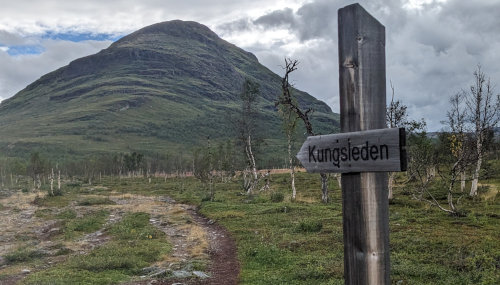
(Click for Larger View)
Go to main Kungsleden Hiking Info page.
Click photos below to view larger versions.
Our big hiking adventure plan for 2024 was to hike three trails in Europe - Kungsleden in Sweden, West Highland Way in Scotland, and the Tour du Mont Blanc in France, Italy, and Switzerland. We planned to hike the Kungsleden first for a number of reasons - the far north would be warmer in August, the crowds of hikers on the TMB would thin out later in September, and our food supplies would work better. Since we would be in the wilderness on the Kungsleden, we took enough dried meals for the entire hike. The other two trails would have much more civilization in which to buy food, so we wouldn't need to carry much.
Our plans completely changed halfway through and we hiked the Fishermen's Trail in Portugal instead of the TMB.
The section of the Kungsleden that we hiked was wonderful, but the weather wasn't so great. Following is my hike report. To see a track of our route, you can visit my Trail Map page. I'd be happy to take any questions you have about this long hike - hopefully this info will help you prepare for your trek which will be much different from ours.
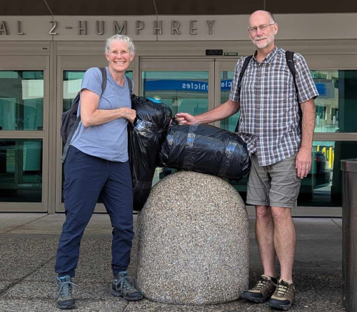
Our flight left Minnesota at 7:45pm on IcelandAir to Reykjavik, to catch a connection to Stockholm, then a final leg north to Kiruna. My plan was to sleep the first leg, then stay awake from the on until night in our new location.
I slept fitfully for most of the 6 hour first flight to Iceland. In Iceland, we went through passport control in the most understaffed, poorly signed, chaotic airport experience since Tanzania, and then barely caught our connection. 'Barely' is an understatement - we were the final two to reach the gate, get a personal recalled bus out to the plane sitting on the tarmac, and had the flight attendant say 'Boarding Complete' as soon as we stepped aboard. We were those people that everyone glares at for being late - even though we did actually run to our gate.
Our next connection at Stockholm was polar opposite. What a beautiful relaxing facility! Plenty of time, clean, lots of signage and displays, and few people. From there, the short flight to Kiruna above the Arctic Circle was pleasant. Our Airbnb host met us at the airport in Kiruna and we enjoyed a quick tour through town to his home. We got a canister of gas for our camp stove so we're all set to hike tomorrow.
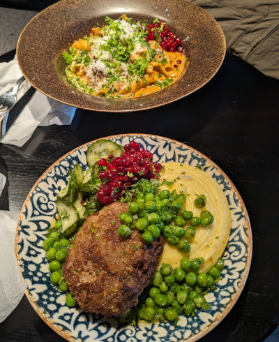
The highlight for me was a mile walk in Kiruna to a restaurant called 'Spill'. We had a mini meatloaf made of elk and a bowl of pasta with smoked reindeer in a creamy sauce. Such good, strong flavors! Showers back at the Airbnb and we could no longer keep our eyes open after about 18 hours of travel. Our hike starts tomorrow!
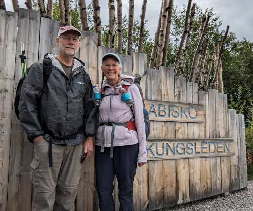
Our Airbnb host gave us a ride to the Kiruna bus station and we took the 90 minute bus to Abisko on the skinniest of paved roads. We noticed that the terrain looked very much like the Iron Range of Northern Minnesota. We figured the Scandinavians that immigrated to the U.S.A. felt quite at home when settling in Minnesota centuries ago.
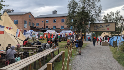
The Kungsleden trailhead was a beehive of activity when we hopped off the bus. Besides ourselves, there were maybe a dozen or so others heading out on a hike. There was also a large collection of tents, booths, tables, and support personnel for the 20th annual Fjallraven Classic that was finishing today. This is a social hiking event that follows the same route we are taking, only in the opposite direction. And, about 1,700 people were participating in it!
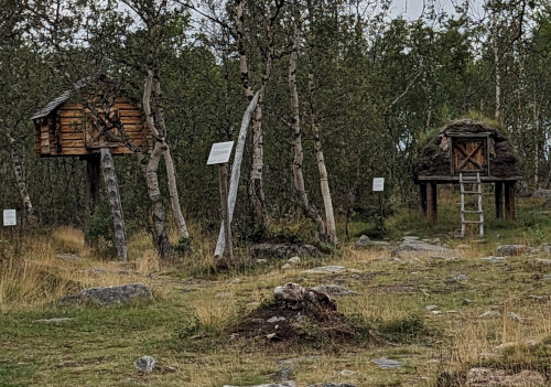
Before setting off down the trail, we took a detour to explore a demonstration 'Sami' village that was just across the road - interesting sod houses and food storage of the indigenous people.
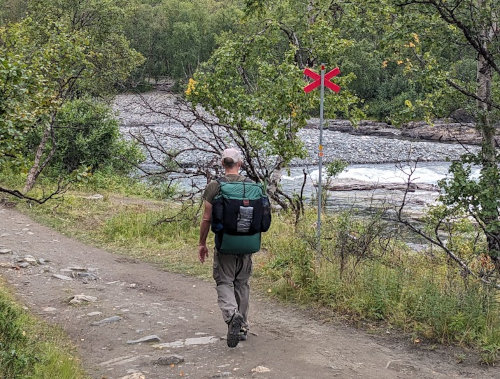
Finally, we started hiking south on the Kungsleden at 10:30am on a very wide, very well used pathway. The weather was dreary with enough drizzle episodes to cause us to wear our rain gear occasionally.
We got plenty of practice with the Swedish version of saying 'Hi' as we passed others on the trail. It's 'Hej' which sounds just like 'Hi', but sometimes they say it twice - 'Hej Hej!' The Fjallraven event had about 500 people starting each of three days to spread out the traffic a bit. So, we saw almost 500 people in the first 9 miles of hiking, some of them looking quite ready to be finished. At times, I felt like a salmon swimming upstream against the current with so much traffic going the other way.
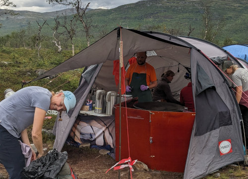
We were planning to hike 10 miles this first day so that we would clear the border of Abisko National Park which had no camping. Once out on public land, you can set up your tent pretty much anywhere. Just outside the national park boundary, where we were planning to camp, there was a huge establishment of large tents and equipment. This was a group of event support staff for the many north-bound hikers. They had just finished serving swedish pancakes to the hoard, but they had a ton left and preferred to not carry it all out. So, we got to have pancakes (more like crepes) with blueberries and whipped cream for a very unexpected snack. Since it was still early, and this area was pretty crowded and worn down from all the camping the past few nights, we decided to hike farther.
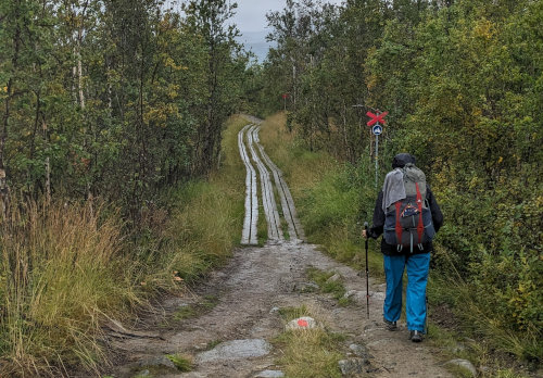
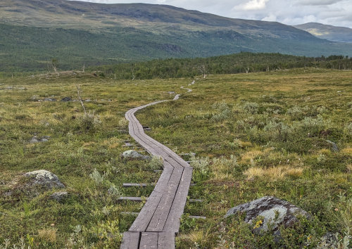
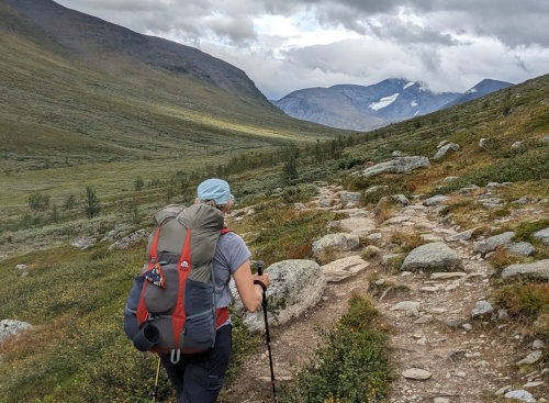
In this first day of hiking, we walked along wide, packed dirt paths, over many long sections of boardwalk, and some rough, rocky areas. All of the trail was very well-worn and very easy to follow.
The Kungsleden summer hiking trail blazes are red paint on rocks or trees. There is also a winter trail marked with red Xs high on metal poles so snowmobilers can see them above the winter snow. The two trails often crossed each other and sometimes were the same.
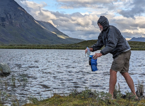
After another 3 miles or so, we found ourselves out on the barren tundra with no one around and beautiful views in all directions. We set up our new tent, filtered water from a small pond, hung wet clothes to dry, and made shepherd's pie for dinner. At 9:00, we were all cleaned up and settled into our tent and it was still light out. Since we are in the land of the midnight sun above the Arctic Circle, it never gets completely dark at night this time of year. We'll be losing many minutes of daylight each day as the summer winds down.
This would be the only time we used our Sawyer Squeeze water filter. Everyone we met was drinking water directly from the small streams running off the mountains, so we took the chance and did the same. On the West Highland Way and Fishermen's Trail, we had access to potable water often every day so there was no need to filter.
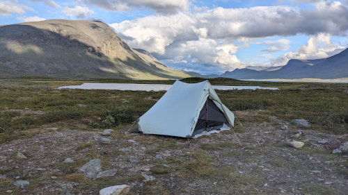
Here are a few interesting / surprising things I noticed...
There was very little animal activity. I only saw a few birds and no animals, except reindeer, for our entire hike.
There were miles of permanent boardwalk installed. I thought this might just be in the national park, but there were sections of it all along the entire trail.
A vast majority of the Kjallraven hikers were Asian. After the first day, all other hikers we met were white, except for one group of about 20 Asians hiking hut-to-hut on the same route as us. Some going the same direction as us that we got to talk with were from South Carolina, Germany, Sweden, and Poland. Everyone we met could speak English.
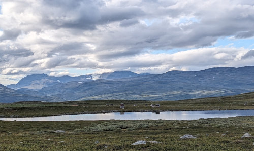
Along the trail, we passed a few uninhabited small villages like this one. They are used occasionally as needed by the reindeer herders.
Last night was our first night in our new TarpTent Stratospire Ultra. It was extremely windy all night long and I slept poorly, but the tent worked wonderfully. It is fairly light at 40 ounces (1.1kg) and uses two hiking poles. There is plenty of room for two hikers and we each have our own zipper and vestibule on opposite sides so there is a lot of room for keeping gear dry outside. TarpTent has a new fabric they call 'Ultra TNT' which is completely waterproof, does not sag when wet like silnylon, and is less expensive than Dyneema - but weighs a bit more per yard than Dyneema. (By the end of our 5-week adventure, I was still very pleased with this tent!)
We woke to heavy rain so we stayed in the tent, completely dry and warm, until it stopped around 10am. Since we have very long hours of light, we are not in any hurry to start early. When I started to take down the tent, I noticed there was a pinprick hole near the ground of the rainfly. The wind was so strong for so long, and I had the tent set down to the ground, that the fabirc rubbed against some rough rock for hours and wore through. Fortunately, TarpTent includes a patch kit with the tent. (and you can email them to request another one for free whenever you need). Fortunately, I brought the sheet of patches with me! So, a very simple patch and the hole was fixed.
Our hike from 10:30 to noon was an easy walk over the tundra along a very long string of lakes fed from glaciers in the surrounding mountains. The skies stayed calm though grey and threatening, but then the rain returned in the afternoon for about 3 hours making the day slower and dreary.
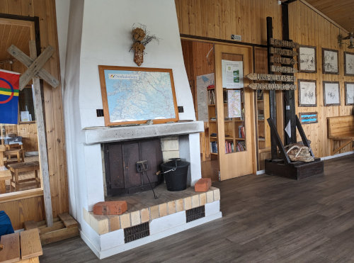
We stopped at our first STF (Swedish Tourist Association) mountain hut at Alesjaure to warm up and dry off a bit, and wound up staying for well over an hour. These mountain huts are like remote hostels, staffed by volunteers during the summer. Hikers can reserve beds and meals, or just stop in to warm up or purchase items. Some of them let you stop for free, others charge to use the day-use cooking/warming area. They are varying in age and amenities, but are quite expensive due to the logistics for such remote locations, especially compared to a free tent. We found the staff to be friendly, and many people we met on trail were hiking hut-to-hut.
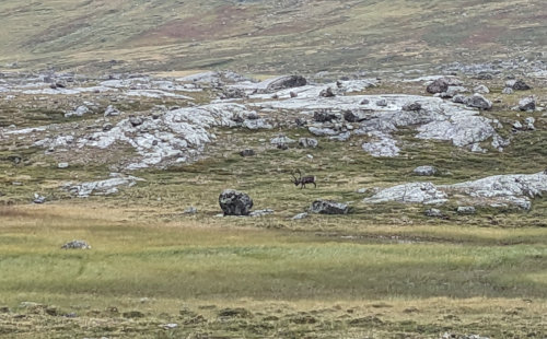
We saw many of the same people hiking that we met yesterday on trail. We also saw quite a few ptarmigan birds along the trail. They seem about as smart as grouse (not very). We even spied a few reindeer in the distance and hope to see more tomorrow.
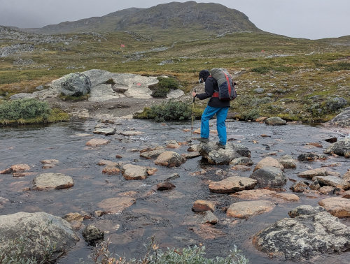
The trail had many more boardwalks today. The rest is often rocky from so much use, but easy to follow. There are also many streams with raised wooden bridges and an occasional metal suspension bridge over rivers. This was one of the very few open water crossings on our stretch of the trail. Farther south, the trail crosses lakes across which you must row a boat, or hire a motorboat - our hike does not go that far.
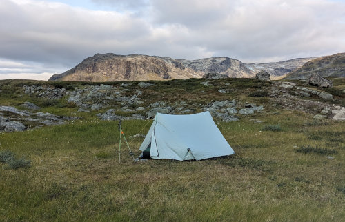
Around 4:30, drizzling rain resumed and the sky looked ominous ahead, so we found a spot and stopped for the night, making today's hike fairly short. It is again chilly and very windy, but the sky has cleared and will hopefully usher in a sunny day tomorrow. Our camp spot is great and there is no one else across the open tundra.
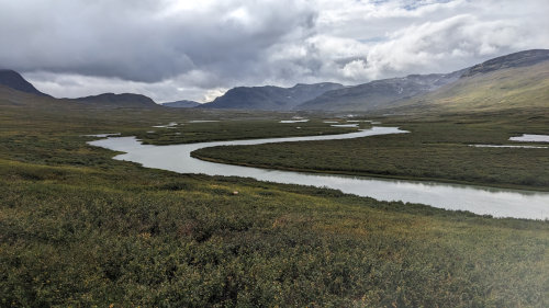
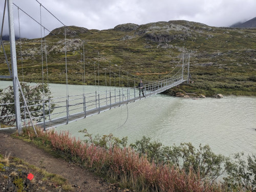
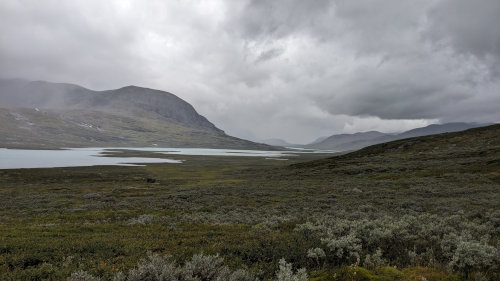
You might notice the river water doesn't look clear and refreshing. Many of the lakes and rivers were milky and silty from the 'glacial flour' suspended in the water. We had no problem finding streams that were clear every day.
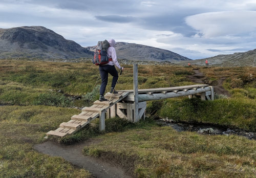
Our days have become walking across open tundra, crossing streams and rivers on sturdy bridges, and visiting mountain huts for lunch. :-) The water crossing structures are obviously Scandinavian - simple, sturdy, and practical. Whether they are wood or metal, small or large, the efforts to install them are appreciated!
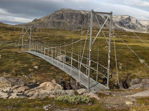
Our morning was a nice walk gradually uphill as we continued to follow the long, broad valley south and higher into the mountains. It was chilly, but great for hiking, and only some occasional spits of rain. After a few miles, the terrain steepened a bit up to the Tjaktjastugan mountain hut. For some reason the facility was built on the west side of a river gorge while the trail is on the east side. So, a big suspension bridge is crossed on a detour off the trail to reach the buildings, but we did it so we could see what this station was liked compared to the one we visited yesterday. As we approached on land, a helicoptor approached from the sky and we got watch it land and take off again.
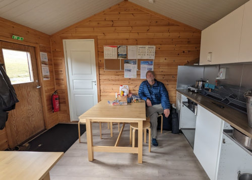
We found the hut caretaker and he required us to pay to sit in the warming hut for hikers which is separate from the main building where overnight guests stay. It was worth the few dollars because we had some damp clothes to dry and enjoyed our 2 hours of resting in a very warm, comfortable room. We used their gas stove to make cocoa while we chatted with a hiker from Denmark who had been camping there a couple days. A father and son Swedish team that was hiking hut-to-hut stopped in for their lunch also. And, we said 'Hej' to two young ladies sitting on a bench outside the hut, being protected from the strong wind as they had lunch.
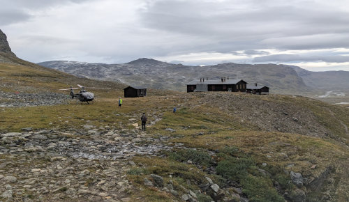
The couple got in a very vocal confrontation and ultimately decided they were completely done hiking with each other. They told the caretaker that they wanted to be helicoptored off the trail. There was no injury, no rescue needed, they just wanted to leave - they could have hiked out. So, the caretaker contacted the helicoptor and found out it would cost over 10,000 euros to evacuate the people. The caretaker collected the fee from the couple IN CASH - who carries that kind of cash??? and they waited for the helicoptor. All this was happening just as we were walking up the hill to the hut.
Just as we arrived, we saw only one woman board and depart on the helicoptor. It turns out that the man who paid for the evacuation had disappeared. We did not see anyone hiking past us, but the caretaker could not find him anywhere. We never did find out if he hiked out, eventually got a ride, or was found in the bottom of the river. Just a very strange drama to have in the middle of the wilds of Sweden. :-)
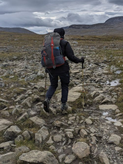
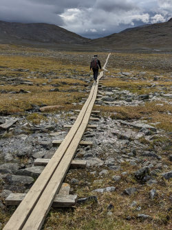
Anyway, back to our hike... the pathway after Tjaltjastugan continued a gradual climb up to the highest point on the entire Kungsleden. The Kungsleden trail is over 400km, but our route is only about 100km. This section of trail was the rockiest yet. It slowed us down, but there were once again long stretches of boardwalk to make the walk easy. We continued on towards the Tjaktja Pass high point as the dark clouds continued on towards us. They never did more than a light rain, but we wore our rain gear all afternoon since it was fairly cool and quite windy.
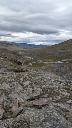
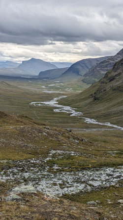
The many boardwalks gave way to a couple miles of very rocky trail, especially over the pass. At the top, the view ahead of us to the south was spectacular! Looking back north, it was all rocky, but to the south the valley looked comparatively lush and green. From this point, the glacier-fed streams flowed away from us in both directions.
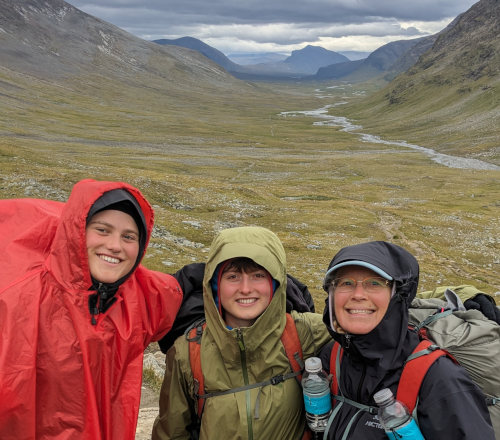
Just as we began our descent into the valley again, the two young ladies from the mountain hut appeared on the trail behind us. With an open view over the tundra in all directions, I could not understand how they had suddenly appeared. Kelly noticed one of them had the exact same Granite Gear Virga 2 backpack as her, so we stopped and chatted with them. Turns out they are sisters from Belgium hiking the entire 400km trail together. We talked and walked awhile until we took a short break and they continued ahead. With the wide open spaces, we could see them for hours.
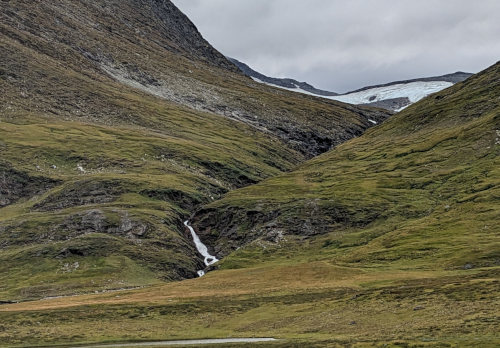
The last 3 hours of today's hike was a gentle descent along the river to the Salka Fjallstuga (Salka mountain station). We had occasional views of glaciers partially hidden back behind the closer hills. We did see a dozen reindeer in the morning on the hillside quite far away.
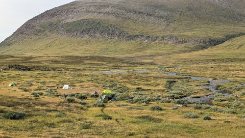
With rain threatening, we decided to stop at Salka and take advantage of a huge area of free camp sites and pit toilets. It was a good choice, rather than hiking farther, because after we stopped it rained off and on but we were dry and warm in our tent.
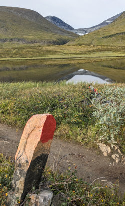
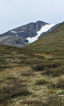
Continuing our hike south from Salkastugan, we enjoyed a beautiful morning and afternoon of sun and the usual wind in our face. Since we started this trail, the wind has been blowing from the south constantly, and often quite strongly - maybe that's why there have been no insects to bother us. We were treated to more views of glaciers up the side valleys as we followed the mostly packed dirt path with a few areas of rocky trail.
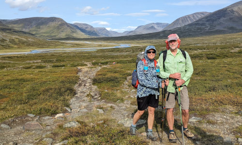
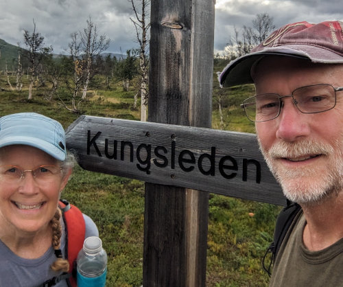
We ran into another hiker taking a rest and we took his photo in exchange for ours with this great view to the north. The low spot far in the distance is Tjakta Pass that we crossed yesterday.
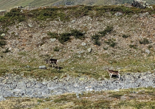
Two hours into our hike, at about 11am, we finally had a close encounter with reindeer. We saw a herd of a dozen or so up on a hillside, but when we crested a low ridge, there was a mother and calf on the hill making their way down toward the trail. So, we found a place to sit and watch as they trotted right across the trail behind us and on down toward the river. Definitely a highlight.
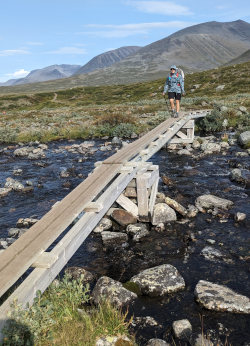
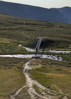
A few more bridges and our first somewhat steep downhill brought us to the Singistugan at about 1pm. Here we would be leaving the main Kungsleden to head east into another valley past Kebnekaise mountain and to the village of Nikkaluokta. The Singi mountain hut seemed quite a bit more rustic than the others and we had no need to stop since the weather remained dry, so we used the outdoor toilets and turned left to hike up over the last pass of our trek. There is a shortcut trail that can be taken to trim off a few kilometers and reduce the amount of elevation change, but we didn't know how well maintained and marked it was so we stuck to the main route.
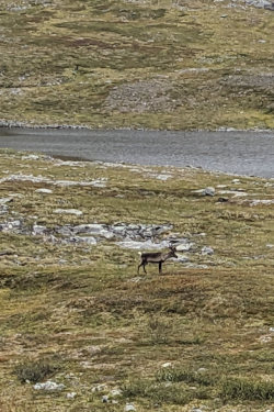
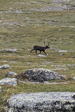
Nearing the top of the pass after a 500 meter climb, we spied a few various reindeer out grazing on the hillsides. They were fun to watch while we took a short break.
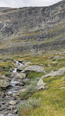
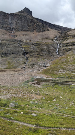
We were also treated to more waterfalls.
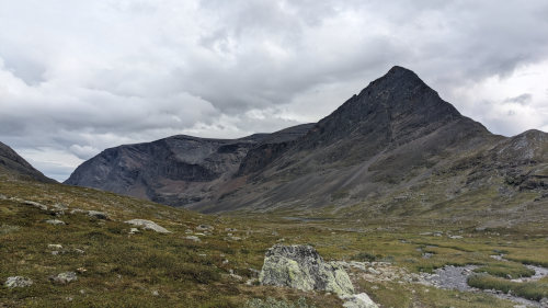
Of course, once we crested the pass, that wind that had been blowing from the south now came from the east maintaining its head-on blast. It kept the temperature chilly, but was comfortable as long as we kept hiking - so we did. This new valley had much steeper sides up to looming, dark rock mountains. The clouds began to build and we could no longer see far to the horizon to anticipate rain.
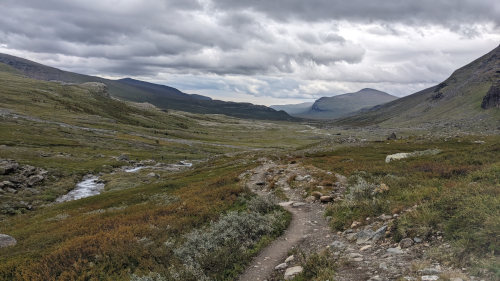
The gradual descent eventually broke out onto another broad sloping valley much like we had become used to. We saw a few more reindeer along the way and passed many potential camp spots, but the weather remained hikable so we just kept hiking until we reached the Kebnekaise mountain station area and stopped just outside their 'no camping' boundary. We were able to hike all day with no rain, but it started raining just as we began to set up our tent. We climbed in and again cooked our meal in our tent vestibule. This photo below is from our tent location with the last bit of blue sky before the rain rolled in from the mountains.
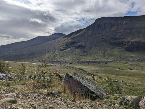
Our hope was to hike to the summit of Kebnekaise since it is Sweden's highest mountain. Unfortunately, the weather this evening is expected to stay tomorrow so we'll be skipping that part of the adventure. It doesn't sound like a fun day to hike for 10 hours or more in thick clouds, and possibly rain or snow, for no view. So, it looks like we'll be hiking out a day early.
It was still raining when we woke up, so we stayed in the tent until it finally let up around noon. Since we aren't climbing Kebnekaise in this cruddy weather, we have two days to hike the last 12 miles to Nikkaluokta. We're have no interest to hike in more rain when there's no hurry, the rain is forecast to stop this afternoon, and we have light until very late.
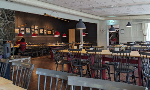
When we finally packed up and walked 1/4 mile to the Kebnekaise Mountain Station, we found it is actually a huge resort with 200 rooms, restaurant, and shop! Nothing like the other huts along the way. We enjoyed a great lunch buffet with reindeer, chicken curry, rice, corn, quinoa, and juice. We really took advantage of the stop and their wifi for over 2 hours.
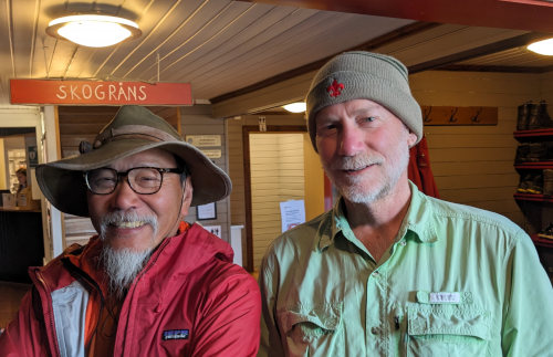
We met a Danish couple and two French hikers while relaxing after lunch in a common room waiting for the rain to give up. Another hiker noticed the scouting emblem on my hat and asked about it. Turns out he was a scout in Hong Kong but has lived most of his life in Australia. He was in a group we had passed yesterday that are hiking hut to hut and arrived here today for the night.
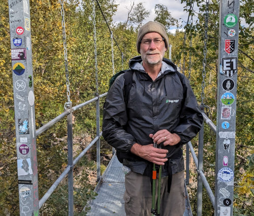
A bit before 3:30, we finally had some blue sky and hiked from Kebnekaise down the last of the trail out of the mountains. Right away, we crossed yet another suspension bridge, this one covered in stickers. So, I added one - can you find it?
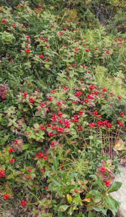
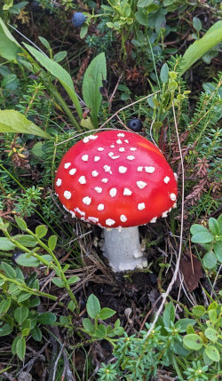
The hike itself was easy with much less inspirational views since we were now down in forest much of the time. We hiked along a long lake that many hikers pay to take a boat from end to end. I had hopes of seeing some wildlife, but still no luck. We did see some beautiful berries, mushrooms, and general forest landscapes.
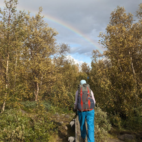
Occasional sprinkles and cool temperature had us keep our raingear on all day. We did enjoy a few episodes of actual bright sunlight and even a rainbow a couple times.
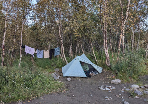
Because there was no rain this evening, we finally had the opportunity to choose a camping site that looked good to us and have time to set up the tent and relax. We found a flat sandy spot right beside a river. We are camped two miles away from our bus stop in the morning where we will board a bus to Kiruna.
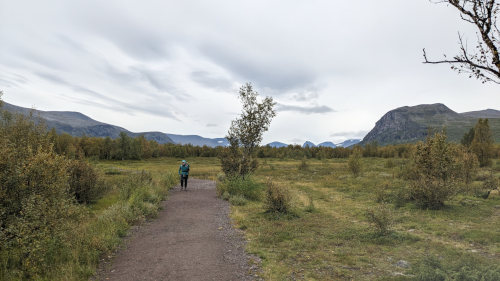
As a complete opposite to yesterday, we woke early this morning to a cloudy but dry morning. There was no reason to tarry, so we were hiking by 7am on a wide, flat path through scrubby birch forest to the end of the trail.
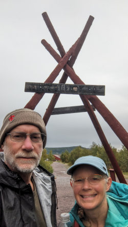
We reached Nikkaloukta at 8am with 4 hours to wait for our bus ride back to Kiruna. Fortunately, the trail ends right at a restaurant that opens at 8am so we snacked on their buffet for 3 hours. Fruit, rolls, bread, granola, cheese, salami, berry jams, hard boiled eggs, juice, coffee, yogurt.
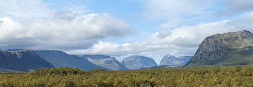
The last hour, we walked up a small hill for a view back up into the mountains. Of course, there's no rain now, and even some blue sky, so it was a beautiful sight.
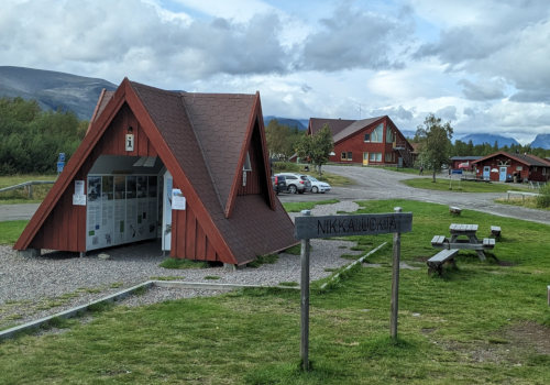
This is downtown Nikkaluokta! The tourist infor kiosk and bus station, with the restaurant/hotel and cabins for rent in the background. Our bus ride was 90 uneventful minutes on a very comfortable bus with wifi. In Kiruna, we walked to the 'Yellowhouse' hostel where we stayed 2 nights since we finished the hike a day early. It's old, inexpensive, and just a comfortable place to rest. From here, we fly to Stockholm, then to Edinburgh, Scotland, then a train to Milgavnie to hike the West Highland Way.
Back to Kungsleden Info page.
Find more Hiking Resources at www.HikingDude.com


Follow Me
Recent Comments