
Appalachian Trail

My Appalachian Trail Hike | ||||
| I hope to hike the Appalachian Trail soon. I'd like to hike with someone, but it is so well-traveled that I should have no problem meeting folks to hike with for days or weeks. | ||||
Appalachian Trail Statistics | ||||
| States | Georgia, North Carolina, Tennessee, Virginia, West Virginia, Maryland, Pennsylvania, New Jersey, New York, Connecticut, Massachusetts, Vermont, New Hampshire, Maine | |||
| Distance | 2180 miles - trail reroutes happen so this is an estimate of the trail length. When I complete the trail, I'll let you know how many steps it took me since I'll wear a pedometer the distance. | |||
| Total Elevation | From hiking up and down over hills, mountains, gullies, and ravines, it is estimated that about 550,000 feet of elevation is covered. | |||
| Terminus | South: Springer Mountain, GA North: Mt. Katahdin, ME | |||
| Highest Point | Clingman's Dome, 6643ft | |||
| Lowest Point | Hudson River, 124ft | |||
| Map | 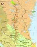

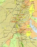
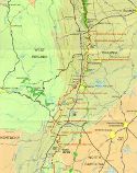
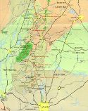
< - - North to South - - > Click for Large Maps | |||
| Terrain | The majority of the trail is densely wooded forest, giving it the nickname of the green tunnel. Sub-alpine and occasional alpine areas are traversed on the northern portion of the trail, the most notable being the Presidential Range. The trail is well-marked with white blazes and highly trafficked its entire length with an estimate of 4 million people visiting some part of the AT each year. There are over 250 permanent shelters available for hikers. | |||
| History | conceived by Benton MacKaye in 1921. First trail section opened in 1923. Earl Shaffer completed first documented thru-hike in 1948. Designated as a National Scenic Trail in 1968. Permanent route completed in 1971, but minor reroutes continue to occur for many reasons. | |||
| Challenges |
Lyme disease from ticks is a fairly common problem along the trail. Poison ivy is common along the trail, particularly in the south. Venomous snakes, heat, humidity, and insects can also cause trouble. The AT is a very social trail and many encounters with other people should be expected. This can be frustrating if you are looking for solitude, and there is the slim chance of meeting a bad character. The AT has many steep grades, referred to as PUDs (Pointless Ups and Downs), which wear on body and mind. | |||
| Time Window | February to October northbound. Mt. Katahdin weather will stop you if you arrive too late. Most thru-hikers go late March through mid September, northbound. | |||
| Time to Hike | Typically takes 5 to 7 months. Speed record set in 2011 is 46 days. | |||
| Permits |
There are no fees or permits required to hike the Appalachian Trail. Great Smoky Mountains National Park, Shenandoah National Park, Baxter State Park (Maine) require permits to camp. There are some campsites in the Green Mountain National Forest and White Mountain National Forest which have fees, but you can open camp for free. | |||
| Thru-hiker Tally | Over 10,000. The Appalachian Trail Conservancy gives the name 2000 Miler to anyone who completes the entire trail. | |||
Trail Links | ||||
| Google Earth | View Trail with google earth | |||
| Full Maps | ATC Interactive Map | |||
| Agencies | Appalachian Trail Conservancy
Land Managers and Partners of the Appalachian Trail
| |||
Hike On: My Hikes
Find more Hiking Resources at www.HikingDude.com


Follow Me
Recent Comments