
Hiking Dude Blog
2025 - Aug Jul
2024 2023 2022 2021 2020 2019 2018 2017 2016 2015 2014 2013 2012 2011
09/24/2020
(Click any photo to see original size)
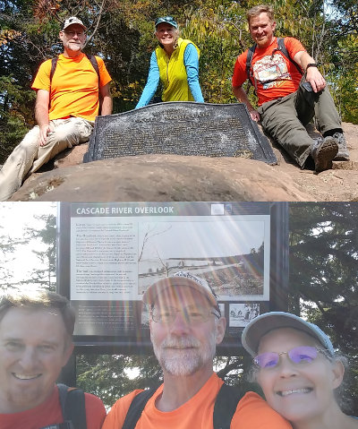
On this adventure, I took my wife and my brother-in-law on a 36-mile loop hike to touch both the highest and lowest points in Minnesota. This is a hike I've been wanting to do for a few years, just to see what it is like since I've not heard of anyone else doing it.
You can see a track of our walk HERE
We drove to Duluth Saturday evening and stayed overnight with the BiL, otherwise the day would be half over before we started hiking if we drove all the way from the Twin Cities.
On Sunday morning, we left at 7am and drove up the North Shore past Cascade River state park, onto County Road 7, and then wiggled our way up to the intersection of forest road 157 and 158, also known as Cascade River Road and Bally Creek Road. This is about the halfway point of our planned hiking adventure.
Just a hundred feet or so north, the CL Ramstad snowmobile trail intersects FS158 and that is where we parked.
Just as we were leaving our car to head north up the dirt road at 9:36am, we heard a shotgun blast very close. We quickly changed into our orange and yellow shirts. Less than a hundred yards up the road, we walked past a pick-up truck with three hunters and a dog. As I'd find out throughout the day, driving a pick-up along forest roads is a preferred method for some 'hunters' around here. But, it probably has some success since we saw four or five grouse along the road.
The first 6 mile leg of our route was simple - follow FS158 to the northern end. The road Ts and at the intersection is the trailhead for Eagle Mountain. The road walk was easy, and it was nice for a morning walk through the forest, but there's not much to take pictures of.
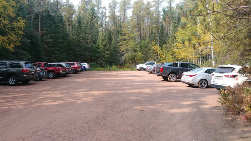
We weren't the only ones that thought a Sunday hike to the highest point in Minnesota was a good idea. Over 20 cars in the parking lot, and 52 people on trail, but it didn't feel too crowded.
I self-registered and got our permit at the trailhead kiosk. The locked box where I deposited the permit was so full, I had to crush it into the slot on top and hope it stayed. The permit is mandatory but free since we're doing a day hike in the Boundary Waters Canoe Area Wilderness.
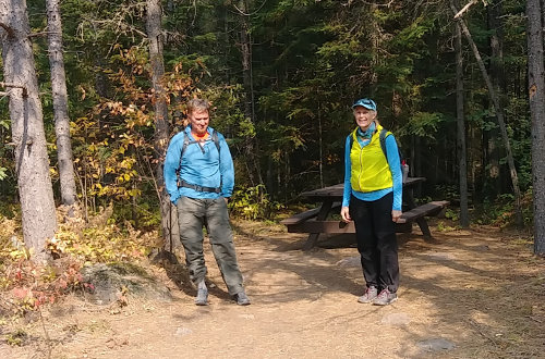
There's one nice picnic table at the trailhead so we stopped for a snack and used the pit toilet. If you visit here, be sure to bring your own toilet paper - there were 6 empty rolls and 2 usable when we started our hike - they were all empty by the time we finished.
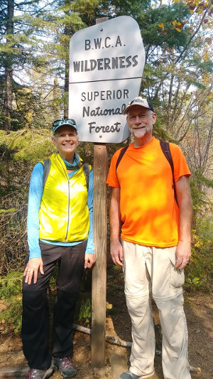
The trail starts at about 1750 feet elevation. About .9 miles in, you enter the BWCA at Whale Creek - the sign is kind of obvious.
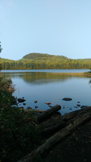
At 2.1 miles, a wonderful view of Whale Lake opens to the north with a hill (excuse me, mountain) across the lake that is just 100 feet shorter than Eagle Mountain.
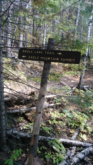
At 2.4 miles, the Brule Lake trail splits off the Eagle Mountain trail to continue west for another 5 miles or so. It stays flat, but here is where we start our climb up Eagle Mountain, rising from 1900 feet up to 2301 feet in a little over 3/4 mile. That's only 400 feet with a few steep spots, but mostly a nice, consistent ascent.
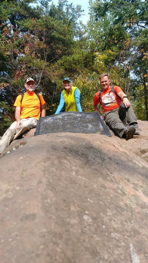
OK, so what's at the top?
Well, I was very surprised to see such a memorial here! There is a geodetic marker embedded in the summit rock as I expected, but there is also a very large metal plaque installed by the MN Historic Society - Read It. There is also a large old first aid case acting as a geocache, full of Clif bars, bandaids, and a couple trail registries. I did not sign in, but did leave a couple stickers for anyone to take.
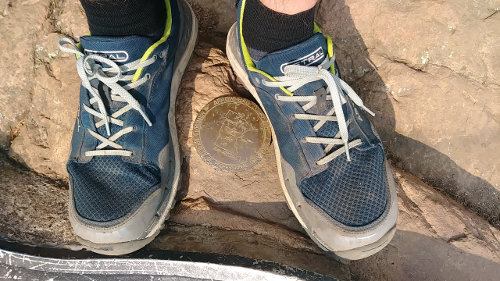
The most interesting thing about the summit was the geodetic marker. It was cemented in place in 2002 and gives an elevation as 2298.15 according to the stamped brass marker. That's 3 feet short of the 2301 feet advertised height - what's the deal??? (actually, the marker is so defaced that I had to find an older image to read.)
I looked at the past few days in the trail registry and it looked to be an average of about 20 new sign-ins each day. This is a POPULAR trail!
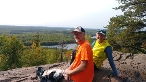
One thing missing at the summit is a view. It is covered in forest, but a wonderful view is just a few feet down from the summit where a rock plateau makes for a wonderful rest spot to scan the forest below all the way to the vanishing horizon with 4 or 5 lakes in the woods below.
We visited a week or so too early for great fall colors at this spot, but the sea of green below us will be brilliant yellows around the end of September.
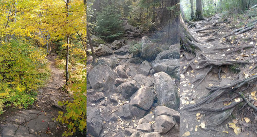
After a short rest, we headed back down the trail at 1:15pm to make room for others at the top. The trail itself was a mix of easy flat tread, roots, and rocks. So much traffic tends to wear trail tread down, increasing erosion and making it a rougher hike. I'd recommend using hiking poles if you're used to them.
We had a nice lunch at the trailhead picnic table, very surprised that it was not being used. That was followed by a brisk 6 mile hike back to our car. Since we were back by 4:30, we decided to 'glamp' and drove into Grand Marais for dinner at Voyageurs Brewery instead of cooking our own.
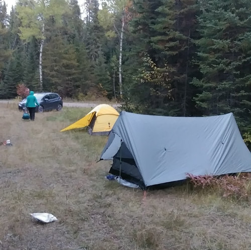
Just before sunset, we returned and set up camp for the night. We just pitched our tents on the snowmobile trail since we were on the Superior forest. It was a warm, dry, breezy evening with no bugs and the stars were brilliant.
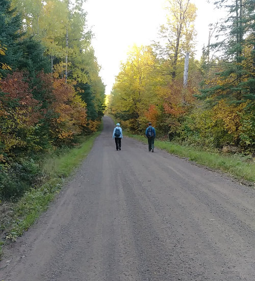
Our second day started with another brisk 6-mile hike along dirt forest roads. Since today was Monday, there were only a couple log trucks and no hunters out. Most of this section was across the higher Minnesota forest, with a few rises and falls over hills as we slowly dropped only a hundred feet towards Lake Superior at the very end.
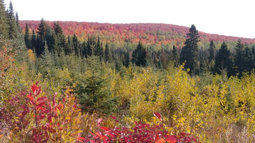
The hills closer to Lake Superior had more color, so we were treated to many red, orange, and yellow trees along the way.
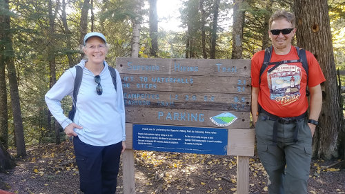
Since we started hiking around 7:30am, we reached the Superior Hiking Trail at about 9:30 and headed down the last 3.3 miles to the lake. Well, it was actually down, and then up, and then down, and then up, ... as we hiked into and out of every side gully that drains into the Cascade River. Here's what I mean...
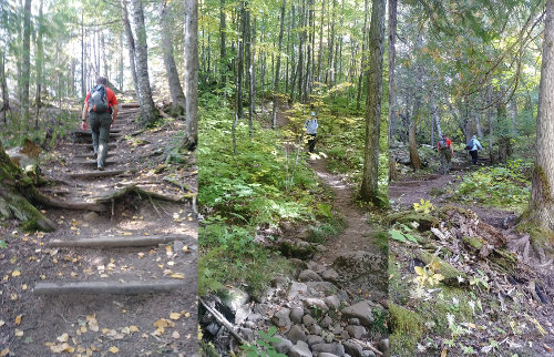
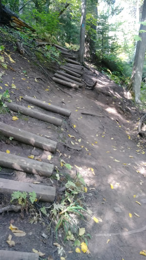
Since the SHT runs up both sides of the Cascade River, this 7 mile loop is very popular. It is a great example of the SHT being loved to death by thousands of hikers like us visiting it each year. With so many footsteps, the trail tread, erosion structures, and steps eventually wear out, as you can see here. This part of the SHT is in great need of some maintenance. Once the developed trail erodes, people tend to create their own paths and everything breaks down even faster.
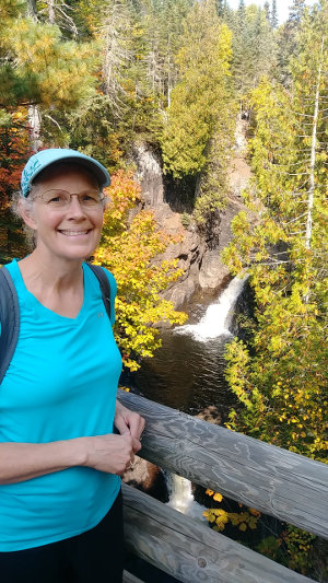
The lowest half mile or so gets the most traffic since it has beautiful waterfalls, constructed bridges, and a nice parking area directly on Highway 61. We encountered about 40 people, and there were people waiting to get a photo at this spot - probably the most photographed spot on the Cascade River. :-)
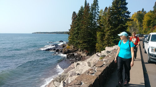
We played Frogger to get across Highway 61 to reach Minnesota's lowest point at 602 feet on the shore of Lake Superior at 11:45am. So, we made it from the high point to the low point in about 22.5 hours. We enjoyed lunch, lake, sun, and breeze for a half hour and then started our climb back up to our car.
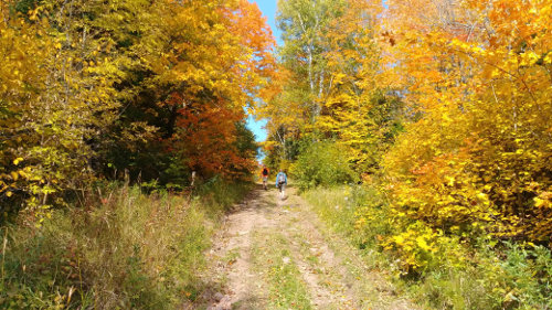
Instead of hiking up the SHT, I decided to take an alternate route using the cross country ski trails in the park. What a great idea! Insted of PUD after PUD, the ski trails made a constant, gradual ascent. Going this way, we were treated to an easy walk through quiet forest with many grouse, fall colors, and no tourists.
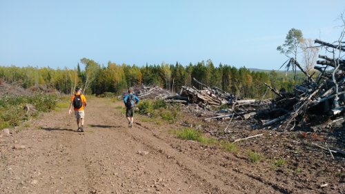
Our ski trail connected to an old forest road which brought us back to the dirt road we had walked down, but this new route cut off about a mile of road. To get more off-road miles, we followed two sections of the CL Ramstad snowmobile trail back. We hadn't taken them at first because I was concerned they might be swampy and overgrown. As it turns out, the trail was a wonderful walk even though it cut through a logging operation for a half mile.
We reached our car at around 3:45pm for a total Shore to Summit loop time of 30 hours.
Hike On!
Posted: 09/24/2020
09/20/2020
I finished hiking for today. You can check out my current location on the map and I'll post about my day when I am in coverage.
Posted: 09/20/2020
08/12/2020
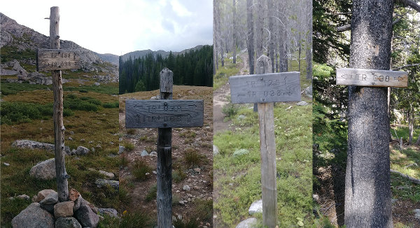
Last week, I solo hiked about 65 miles around the Cloud Peak Wilderness in Wyoming on the Solitude Trail. It was a great, grueling adventure that I said I'd never need to do again, but am already looking forward to trying as soon as someone says they want to go with me. :-)
I just finished the writing and you can read about it on my 2020 Cloud Peak Solitude Trail hike page.
Hike On!
08/07/2020

I finished hiking for today. You can check out my current location on the map and I'll post about my day when I am in coverage.
Posted: 08/07/2020
08/02/2020
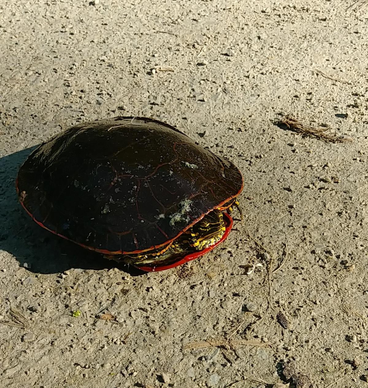 When you're all packed and just waiting to start a trek, but you don't leave until tomorrow...
Time moves sooooo slow just like this turtle on the trail.
This is when you have to refrain from adding just this one little item or that extra food. It's not needed and just makes more weight. As long as I don't forget my toothbrush, I'll be fine.
When you're all packed and just waiting to start a trek, but you don't leave until tomorrow...
Time moves sooooo slow just like this turtle on the trail.
This is when you have to refrain from adding just this one little item or that extra food. It's not needed and just makes more weight. As long as I don't forget my toothbrush, I'll be fine.Posted: 08/02/2020
07/27/2020
I just completed my SECOND thru-hike of the year! I'm so proud! :-)
I admit that when I posted about my virtual SHT thru-hike back in March I figured life would be normalized by now. Oops! With the pandemic persisting, the National Scenic Trail organizations continue to recommend local hiking.
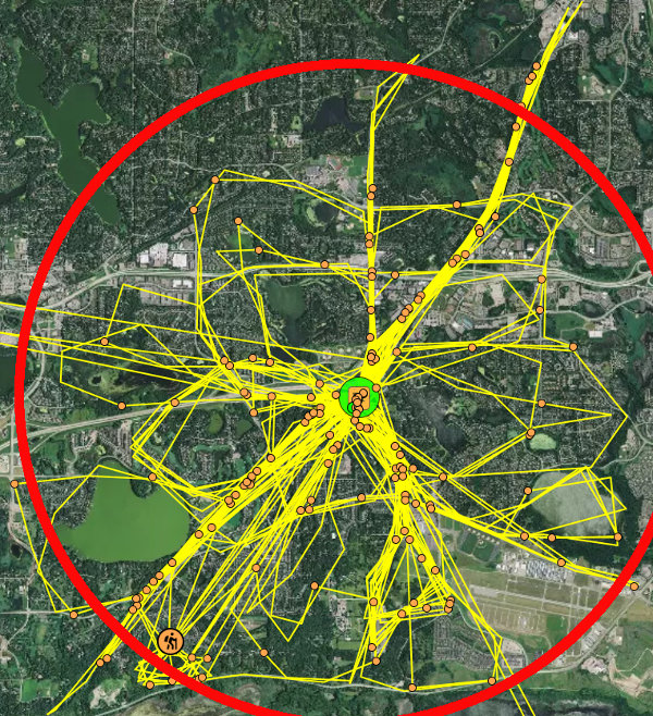
So, I continue to put in my 5 to 7 miles most mornings and that has finally added up to 800 miles - the length of the Arizona Trail. You can see in the image above that I've covered and re-covered most of my local area. The red circle is about 6 miles in diameter. I hiked for 90 to 100 minutes 5 times a week for 27 weeks.
I know it's not as interesting as a long trail, but better than nothing. Now, I'm working on either the Pacific Northwest Trail, ice Age Trail, or Florida Trail - I haven't decided yet but they are all similar lengths. And, I have about 350 miles or so to complete them.
By the way, I've also picked up over 350 pounds of trash over my 800 miles as a 2020 GroundsKeeper through Granite Gear. Might as well accomplish something while walking.
You can do a Virtual Thru Hike too!
You can virtually hike your trail of choice while staying safe and doing some good where you live. Here's how:
- Get up early while it's still cool and the trails are less crowded. Around 7:30am, our trails just fill up, so I go at 6:30.
- Use gmap.pedometer.com to figure out an 8-mile route around your community.
- Hike this route in 2.5 hours.
- Get home by 9am for a shower.
- Repeat 5 times a week, making new routes.
- Take a bag along and pick up litter.
- Easy Peasy
Posted: 07/27/2020
07/22/2020
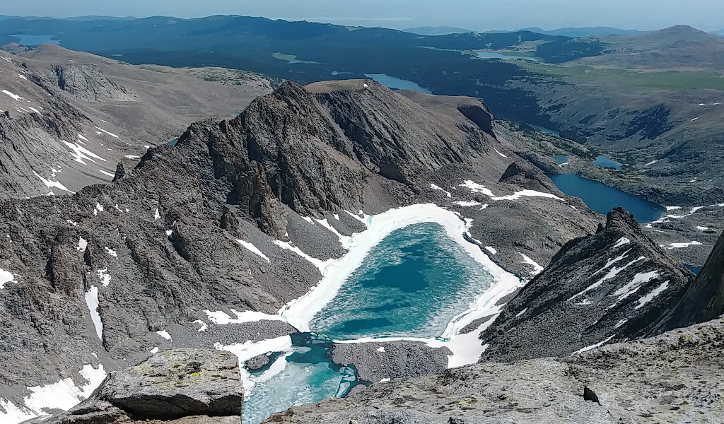
Finally preparing for a real hike this year!
Like the vast majority of hikers, I've been doing the #stayathome #staysafe #stayhealthy #socialdistancing #recreateresponsibly and all the other hashtags encouraging us to minimize our impact on the spreading of covid-19. I've been walking about 6 miles each morning since March and have started doing an hour or so of hill hiking with a pack on for the past couple weeks. On August 3, I'll be heading out for a week of backpacking.
Since my first trek in the Cloud Peak Wilderness near Buffalo, WY 15 years ago, I've wanted to hike the complete Solitude Loop Trail but each year I've led a group instead. This year, there's no group going so I finally get to give it a try to hike the 60-mile loop solo.
A backpacking friend is driving with me and will do his own solo trip for a few days while I scurry all the way around the mountain. Then, we'll drive home together. So, the only pandemic impact we should have is any stops we make on the drive.
We are packing our own food and the drive will be about 13 hours. So, our only stops will be for gas and bathroom. Using credit cards, there's no risk of exposure getting gas. That means 3 or 4 minutes in a gas station bathroom every few hours is our only opportunity to contract or pass the virus. I feel that is a miniscule and socially responsible risk.
My trek plan is to start at Hunter trailhead on the east side of the wilderness area. We'll arrive Monday evening and I'll hike in a few miles north to find a campsite before it gets dark. If all goes well, I'll make it the 8 miles to Elk Lake where I meet the actual Solitude Trail 038 but I don't expect to make it that far.
The next morning, starting around dawn, I'll hike counter-clockwise to the west, covering the section of trail that I've never been on. This way, I'll have the more familiar sections later so I'll have a good idea of how long they'll take. I plan to walk 20 miles, or until I get tired. If that doesn't happen, and the weather is clear, it's a full moon so I might just hike into the night for a little excitement. I hope to reach Duncan Lake at the northwest corner of the loop to camp.
On the second full day of hiking, I head south over Geneva Pass and then a long, downhill section. At the Paintrock Creek ford, I head east and up into the higher part of the loop past Lake Solitude and to the base of Cloud Peak. If I reach this spot late in the day, I'll camp here. If I arrive early, I have to make a decision. I could stop for the day, do a summit climb of Cloud Peak on day 3 and then hike out on day 4. Or, I could push on east over Florence Pass and camp at Medicine Park then complete the loop on day 3 and have a short hike out on day 4.
And, as you experienced folks know, as soon as I set foot on the trail, the plan changes. So, we'll just see what adventure the trail provides.
If you'd like to follow along, my tracker will be plinking my location here on my blog throughout the days of hiking. I'll write each day, but I doubt there will be any coverage to post until I get off trail.
As part of my commitment as a 2020 Granite Gear GroundsKeeper, I'll be picking up any trash I find and packing it out. Hopefully, I'll find more the last day and not the first. I'll let you know how it goes. So far this year, I've gathered over 350 pounds of trash on my local hikes around town.
Hike On!
Posted: 07/22/2020
05/14/2020
When I thru-hiked the Ice Age Trail across Wisconsin, I met Melanie hiking the trail in the opposite direction. At the time, her trail name was Valderi but it has since become Snowshoe. I'm very envious of Snowshoe because she has made a career of writing about her travels - can't beat that!
Anyway, since I'm no expert on the subject, I've asked Snowshoe to share her views on women solo hiking. Here's her thoughts...
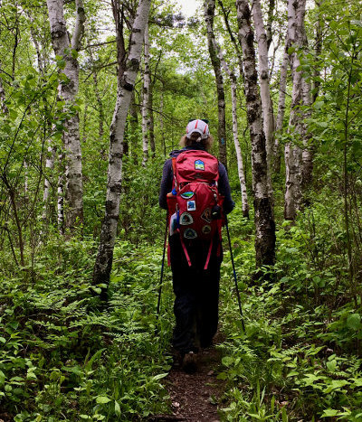
One of the most common questions asked of veteran female hikers is this: Aren't you afraid to be alone on the trail? Most of the time, the real question behind this question revolves around the fear of being attacked, molested or killed by a male - not having an accident or being harmed by another woman.
My answer, and that of other experienced female hikers, is a resounding No! Sure, there are risks to heading into the outdoors alone - risks that apply to both men and women. And yes, you need to take some precautions. A few of the main ones: Always let someone know where you are going. Carry a medical kit and a phone with charger. (A GPS device that can communicate by satellite is also a wise option.) Have adequate food and water, know the weather forecast and dress appropriately.
But commonsense precautions aside, here are four reasons why solo hiking is safer than you may believe.
1. Few People Are Attacked or Killed While Hiking
Yes, every once in a while some crazy person kills a hiker and it's splashed all over the news. But that's a very rare occurrence compared to the risks we encounter in everyday life. Let's look at some numbers:
- According to the CDC, in 2017 the top causes of death for females of all ages, races and origins were heart disease, cancer, chronic lower respiratory diseases, stroke, Alzheimer's disease, unintentional injuries, diabetes, influenza and pneumonia, kidney disease and septicemia.
- In 2019, nearly 40,000 people died in car crashes in the U.S., according to the National Safety Council.
- After a male hiker on the Appalachian Trail (AT) was killed by a machete-wielding man in the spring of 2019, some panic ensued among hikers. So the Appalachian Trail Conservancy (ATC) crunched some numbers and reported this: During the last 45 years, about a dozen people were killed on the AT by other people. But since 2 to 3 million people hike on the AT every year, that computes to a 1 in 20 million chance of being murdered on the AT.
The lesson? Rather than worry about some creeper in the woods, you're better off making sure you always wear a seatbelt when you're in the car, and that you eat well and regularly exercise your mind and brain.
2. Sexual Assaults Aren't Typically Committed by Strangers
If you're going to be sexually assaulted, chances are it will be by someone you know, not a stranger on the trail. According to RAINN – the Rape, Abuse & Incest National Network – eight out of 10 rapes are committed by people known to their victims.
3. Trail Associations Have Your Back
Trail associations are passionate about their paths. If they learn of a problem on their trail - say, a sketchy individual lurking in the woods or harassing hikers - they will be on it, stat. Remember, too, that you can always call a trail association or governing body before you set out to ask if there are any current safety concerns. It doesn't hurt to get the names and numbers of some local trail angels, too. Then, should you become uneasy for any reason and want to get off the trail earlier than planned, you'll have someone nearby to call.
4. It's Easy to Hike in Solitude or Crowds
Depending on your perspective, you may feel safer hiking among crowds or striking out where virtually no one will be around. You're in luck, as it's easy to do both. If you want to hike solo, yet have the comfort of many people in the vicinity should something happen, select a popular trail and plan to hike it during peak season. That could be the southern terminus of the AT in March or April, the Florida Trail in January or the John Muir Trail in late summer.
Conversely, if you'd like to wander alone in the woods, there are thousands upon thousands of miles of little-known trail out there to explore. Ever heard of the Kekekabic, Jones Hole or Charon's Garden Trails? Identify some of these paths less followed and head on out.
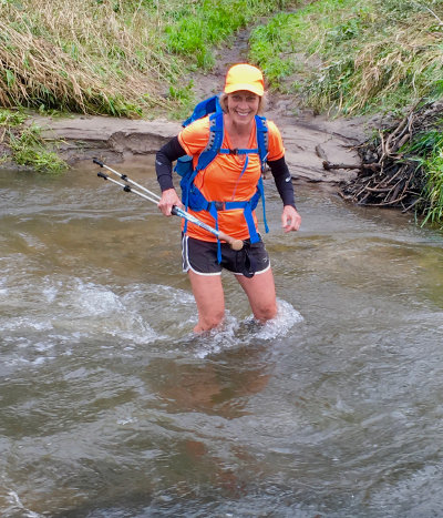
Over the last decade, I've hiked nearly 10,000 miles, mostly alone. Yes, there was one time when a man made me feel uncomfortable by asking questions I found unusual. I quickly hiked on and nothing happened. But far more significant is that during this same time, dozens of male hikers helped me on the trail – doing everything from carrying my pack over a rushing stream and helping me climb over large obstacles to sharing snacks and lending me a phone charger when mine died.
The message is clear: Shelve those fears and hike on!
Melanie Radzicki McManus writes and blogs at The Thousand-Miler. She has trekked around the globe and is currently attempting to hike all 11 U.S. National Scenic Trails. As of May 2020, she has four down and a fifth partially completed.
04/29/2020

The past month has been pretty boring for hiking with rona in the works. Oh, I've been doing plenty of it - about 6 miles every day, mostly in the morning before the local trails get packed with people not working and battling cabin fever. On these hikes, I've managed to pick up over 200 pounds of trash, garbage, and litter doing my part as a 2020 GroundsKeeper.
The challenge is finding new places to walk without being a covidiot and going far from home. Fortunately, there's lots of trails around here with few people, so I'm happy not acting like a morona.
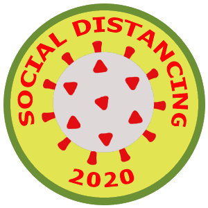
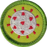
I just create an online Hiking Dude Store page where you can get some cool Social Distancing stickers and patches for your water bottle, backpack, or whatever.
Check it out.
Now that talk about opening things up a bit is circulating, I'm hopeful we'll be out on the long trails in a month or so, post-rona. I hope to see you out there!
Until then, recreate close to home and don't put on that dreaded COVID-15 from sitting around home.
Posted: 04/29/2020
03/26/2020
Missing the outdoors? You can still go on walks and hikes every day. But, for those long days of social isolation, there are a ton of movies and videos to watch and wonder why you ever thought being in the wilderness would be a good idea. :-) Most of these can be found on some streaming service, but maybe not yours.
Are one of these your fav? There are a lot more, so please add any other suggestions you have...
Long Hikes:- free - Walking Home
- free - As It Happens
- free - Only the Essential
- A Walk in the Woods
- Into the Wild
- Mile...Mile and a Half
- Southbounders
- Tell It on the Mountain
- The Way
- The Way Back
- Tracks
- Wild
- free - The Endurance
- 7 Years in Tibet
- A River Runs Through It
- Castaway
- Dances With Wolves
- Desert Runners
- Lost City of Z
- Ride the Divide
- Secret Life of Walter Mitty
Plus, here's 101 free videos of various lengths and quality to pass the time...
- 7 Stages - skiing - 41:44
- Amo - Easter Island - 7:08
- Ascending Afghanistan - Afghan women issues and mountain climb - 43:33
- Age of Ondra - Part 1 - Adam Ondra - 20:57
- AoO-2 - part 2 - 30:22
- AoO-3 - part 3 - 27:53
- Artifishal - saving wild salmon - 1:19:55
- Aziza - ultra-running - 6:30
- Bawli Booch - Downhill Biking India - 4:30
- Beautiful Idiot - mountain biking - 14:41
- Beneath the Ice - ice climbing and climate change - 16:48
- Blood on the Crack - rock climbing - 9:49
- Blood Road - Ho Chi Minh Trail bike ride - 1:34:59
- Blue Heart - protest European river dams - 43:59
- BMX Nigeria - city BMX riding - 12:12
- Break on Through - rock climbing - 29:03
- Brotherhood of Skiing - black skiers - 10:11
- Brothers of Climbing - rock climbing - 7:18
- Camel Finds Water - building a boat - 8:37
- Carving Landscapes - reenactment of woman researcher - 6:13
- Charge - snowski tricks - 4:37
- Chasing a Trace - searching for wolverines - 20:01
- Chasing the Sublime - cold water swimming - 6:40
- Children of the Columbia - skiing and history - 21:23
- Climb Your Dreams - short poem - 2:29
- Circle of the Sun - skiing Norway - 5:03
- Danny Daycare - bicycling Scotland spoof - 4:10
- Defiance - snowboarding - 12:37
- Dream Job - skiing - 14:41
- Dreamride 3 - mountain biking - 6:00
- Eclipse - freeski - 31:24
- Electric Greg - climate change and mountain sports - 19:14
- Eli - ultrarunning - 5:18
- Emil Johansson's Story - mtb rider's illness - 24:52
- Escape - cross-Canada bike ride - 8:01
- Facing Sunrise - hiking - 8:51
- Fast Horse - bareback horse racing - 13:10
- Fell Runners - trail running - 17:17
- Flip - base jumping - 3:13
- For the Love of Mary - 97yrold runner - 6:17
- Free Flow - trail running, free climbing - 4:15
- Frozen Mind - snowboarding - 33:15
- Frozen Road - bike ride in Canada - 24:30
- Good Morning - red bull snow ski - 4:18
- Grizzly Country - protecting habitat - 11:46
- Holocene - climbing and skiing - 12:14
- Hourya - paragliding - 9:24
- How to Run 100 Miles - mountain ultramarathon - 28:14
- Ice & Palms - bikepacking - 32:00
- Imaginary Line - highline between US and Mexico - 10:38
- Kai Jones - 11yr-old snow skiing - 5:18
- Ladakh Project - whitewater kayaking - 14:11
- La Grave - free skiing - 17:00
- Last Honey Hunter - cliff climbing for honey - 35:51
- Legend of Rafael - bicycling - 6:51
- Lhotse - first ski descent - 23:00
- Life of Glide - snowboarding - 15:45
- Life of Pie - two women bikeriders - 11:47
- Liv Along the Way - mountain climbing - 22:21
- Lorax Project - basejumping - 34:38
- Loved By All - Apa Sherpa - 13:50
- My Mom Vala - fishing Greenland - 9:45
- Mother Earth - mountain biking - 5:43
- Motivator - meet my mom - 4:26
- Narics - snowboarding - 18:21
- Nordic Skater - ice skating - 5:26
- Okpilik - interview with woman - 4:57
- Out on a Limb - prosthetic foot for climber - 21:20
- Over Time - skiing - 7:20
- Par For The Course - Mirnavator hike - 3:39
- Perspectives - mountain biking - 5:20
- Redstone Pack - dog sledding - 5:22
- Refuge - steelhead fishing - 6:04
- Ride of the Dead - Mexico mountain biking - 11:53
- River's Call - whitewater kayaking - 7:45
- RJ Ripper - Mountain Biking in India - 19:00
- Rotpunkt - rock climbing - 50:27
- Running Pastor - trail running - 8:14
- Sacred Strides - running for Bears Ears - 12:20
- Safe Haven - indoor rock climbing- 7:49
- Silence - rock climbing - 17:40
- Ski Photographer - skiing - 8:49
- Skier Vs Drone - drone & skiier race - 4:08
- Sky Piercer - skiing - 43:57
- Solstice - skiing - 3:56
- Speak to Me Softly - rock climbing - 6:14
- Standing Man - FTK MTB attempt - 13:05
- Surface - ocean photography - 7:07
- Surviving the Outback - a month in Australia wilds - 59:49
- Thabang - trail running in Africa - 13:15
- The Botanist - building hydroelectric to survive - 20:04
- The Frenchy - 82yrold ski racer - 14:19
- The Moment - mountain biking - 1:17:05
- The Passage - canoe the Inside Passage - 25:19
- This Land - running - 10:32
- Treeline - forest communities - 40:16
- Up To Speed - speed climbing - 22:30
- Valley of the Moon - climbing - 21:38
- Wallmapu - skiing - 5:50
- We Are Abel - life of caribou hunter - 8:35
- Wolf Pack - trail running - 12:23
Hike On!
Posted: 03/26/2020
Older Posts Newer Posts
Find more Hiking Resources at www.HikingDude.com


Follow Me
Recent Comments