
Hiking Dude Blog
2025 - Aug Jul
2024 2023 2022 2021 2020 2019 2018 2017 2016 2015 2014 2013 2012 2011
04/24/2012
Day 38 - the GC
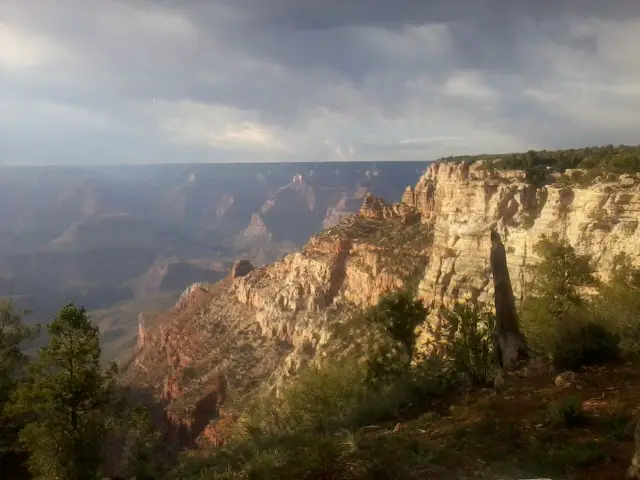 I walked 70000 steps on the trail today.
I traveled about 35 miles today.
Made it to the South Kaibab trailhead by 6:00 this evening. That is the starting down point for the Grand Canyon. Then I took a free shuttle back to Grand Canyon Village to figure out camping or hotel. The silly GC Visitor Center closes at 5pm - how dumb, so no help there. Finally found Mather campground which is just $6/nite for a tent - cool!
I met two guys, each doing their own bicycle tour around the country - one has been going 11 months, the other 13. Makes my 6 weeks seem paltry.
Today's hike wasn't too excitin, but I did see my first antelope and a bunch of elk. Sprinted (well hobbled) into Tusayan and got a chicken sandwich at McD's. Met a couple cool NPS employees at the park entrance and they said, 'Hey, anyone ever tell you that you look like...'
I said, 'Yep, all the time.'
Met a guy from Michigan, a Bulgarian couple living in Chicao, and a couple from Ontario. I'm getting better at starting conversations with strangers, obviously. :-)
Tomorrow hopefully sees me getting a permit to hike the canyon or else I wait here a day.
04/23/2012
First View of Canyon
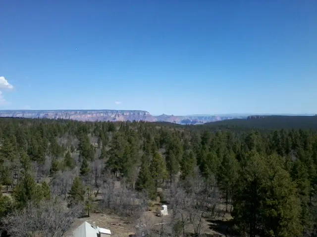 View from the top of the GrandView lookout tower! I climbed to the top but the trapdoor is locked, so it's not QUITE the top.
There's been a swarm of helicoptors heading east, maybe tours or maybe something more serious. I'm heading to Grand Canyon Village now and should get there this evening.
'
Day 37 - Day of Blessings
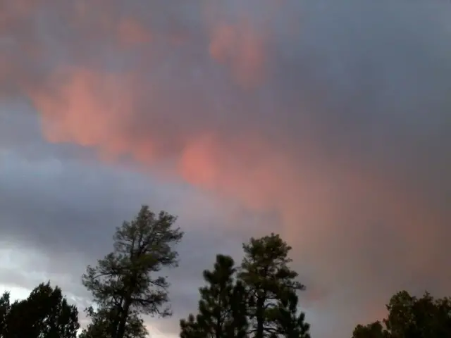 I walked 80000 steps on the trail today.
I traveled about 40 miles today.
I found out my pedometer stops counting at 65000 steps in a day so I have to estimate for today.
I started my day feeling great, but bummed that my phone wasn't working. With some water left from yesterday, I started at 6:30. By a bit after 9, I reached my cached water which was 10 miles away. Some people cache water and then leave the empty jug. Seems wrong to me, so I packed mine out.
There was no water available all day until I reached Russell Tank 40 miles from my start point! I can't believe I did 40 miles. I got a couple blisters and my legs are very worn out, but I should be good to go tomorrow. I went this far because I decided to reach the Grand Canyon in 3 days from Flagstaff last night when I saw how far along I was. Tomorrow will be a 31 mile day to make it happen.
While hiking, I was hoping for a small cloud to move under the sunbso I could get some shade - it was HOT today. Well, the cloud grew into a thunderstorm but I only got a little wet.
At Russel Tank, there's actually a trailhead with a very clean, large toilet. Guess where I'm sleeping tonight? It's warm, flat, dry, and no critters. Practically a free hotel.
The trail data said Russell Tank is muddy so I was concerned about getting water. But, it is just fine. The water jug I packed out came in handy to scoop water.
It was a long day of challenges that turned one by one into blessings. I even got to wash up in the pond.
Day 36 - Unplanned Long Day
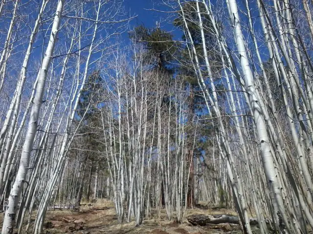 I walked 63784 steps on the trail today.
I traveled about 30 miles today.
Taking the higher trail, I passed through some stands of aspen. Once I got to Alfa Fia tank for water, the trail was a gradual downhill for the rest of the day - so I just kept walking. I made it to mile 620 which is nowhere.
Whoever laid out this section of trail really felt it was important to experience the forest. About 4 miles meandered all over similar to switchbacks, but with virtually no elevation change. Weird!
I've left my stove behind and will eat only cold food for the rest of the hike, except when I hit a restaurant. Just trying to lighten my pack - lots of candy bars, poptarts, and peanut butter and honey on crackers.
Leave Comment
Posted: 04/23/2012
Posted: 04/23/2012
OOPS and WHEW
I was getting water from Alfa Fia tank at mile 603 north of Flagstaff. It's a beautiful pond with great water and possibly the only good water for about 50 miles.
As I reached out with my 1quart zip-loc to scoop up some h2o, PLUNK went my cellphone from my shirt pocket into the pond. It took me less than 3 seconds to get it out, but that was long enough. I dried it but could not power it off. I opened it and set it in the sun.
Still not able to turn it off and other buttons doing crazy things, I put it in a mesh pocket and kept hiking figuring all was lost. At night, the screen was a weird green color and nothing worked. But, this morning, it was black. I decided to wait until this afternoon to try it, plugged in my solar charger from Northern Star Council and gave it a shot. BAZINGA! It works. Whew! Now I can take pics and blog again.
High Point
 I believe I'm at the high point of the AZ Trail here, at about 9400 feet on the side of the San Francisco Peaks. I took the Kachina Trail instead of the new AZ Trail route because it is higher, cooler, shorter, and more scenic. The reroute is for mountain bikers and I think alternate sections just for hikers should be continued.
If I already posted this, I apologize - you'll hear why in the next post.
Leave Comment
Posted: 04/23/2012
Posted: 04/23/2012
04/21/2012
San Francisco Peaks
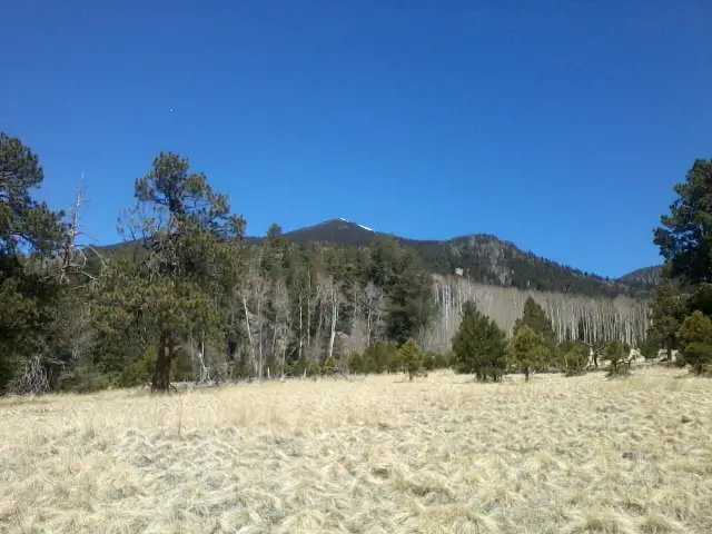 Remember those mountains from yesterday? Well, I'm on the base of them skirting them to the west. They are the San Francisco Peaks north of Flagstaff and include the high point of AZ and the high point of the AZ Trail.
I'm on the Kachina trail which is a more scenic alternate to the recent AZ Trail reroute for mountain bikes. The new trail is longer, lower, hotter, and no aspen. Easy choice for me to skip up the hill a ways and enjoy this trail.
So far, my heel blister is cooperating and I'm covering miles.
Trail Journal
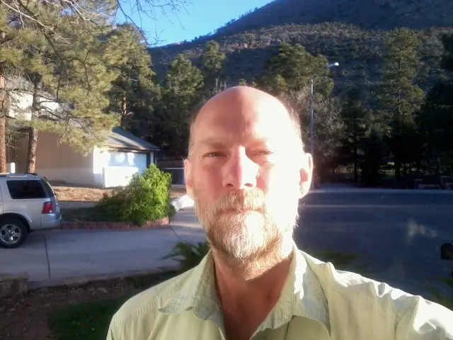 Ready to start hiking again at 6:30am on Saturday. Everything but my left heel feels great - it's still sore but getting better. I have high hopes that my replacement shoes will help out.
I probably won't have cell coverage after this morning so posts may be delayed.
Check out my current location on the map.
My ride is here - bye
Leave Comment
Posted: 04/21/2012
Posted: 04/21/2012
04/20/2012
Trail Journal
 If you click the picture, you can see a larger version. And, if you look real close, you might see some of the 50 elk that thundered across the trail ahead of me on the prairie south of Marshall Lake. That was a very cool thing to see.
Day 34 - A Long Day
 I walked 64735 steps on the trail today.
I traveled about 33 miles today.
Mormon Lake to Flagstaff is too far for 1 day. I set a new record for myself - about 35 miles in 10 hours. The flat terrain and cool temps made it possible but I don't plan on doing days this long again. It's too hard on joints, muscles, and feet for a guy my age. I pushed to reach Flag tonite so I can start hiking again on Sat.
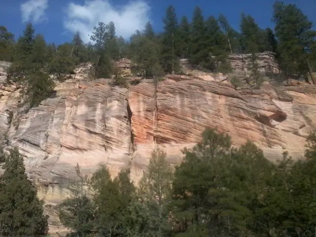
There were some great sights today, including a herd of about 50 elk which I'll post tomorrow. This cliff was just coming through a canyon east of Flag.
I never did see another bike rider so I think the guy I saw has it pretty much won as long as he completes.
I'm now at a nice Scouter's home resting after a shower and a terrific dinner at another Scouter's place. Tomorrow is a zero day to get groceries and rest me aching feet. I've got a replacement pair of shoes which I hope help me along.
Older Posts Newer Posts
Find more Hiking Resources at www.HikingDude.com


Follow Me
Recent Comments