
Hiking Dude Blog
2025 - Aug Jul
2024 2023 2022 2021 2020 2019 2018 2017 2016 2015 2014 2013 2012 2011
09/25/2013
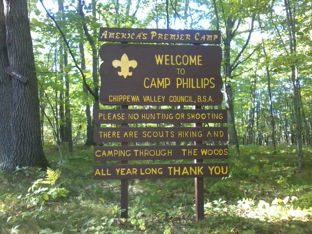
Camp Phillips
 I walked 66000 steps on the trail today.
I traveled about 30 miles today.
We put in a long day, but it went quickly hiking and visting with the new people we met on the trail.
Nearly to Haugen, a man with a dog came down the trail towards us. He recognized us and said he's been following this blog - how cool! Greg chatted while we hiked toward his vehicle. When we got there, he had soda and snacks waiting. What a great treat on a warm afternoon - Thank You, Greg (and your dog Archie)
Once past Haugen, the trail passes through BSA Camp Phillips. I've heard of this camp but never visited. It looks like a well-run and very nice camp with waterfront, pioneering, nature trails, and lots more. It was sure great of the BSA to have the trail pass through.
Soon after the camp, there is a big logging operation underway - chopping down everything, including many blazed trees. This was our first real hardship of the trail. We lost about 45 minutes searching for blazes, backtracking, and a little guessing before we finally made it through. Pat and Kehly - watch out!
Other than that, just a glorious day on a very mellow trail most of the day.
09/26/2013
Hitchhiker
 I walked 58300 steps on the trail today.
I traveled about 26.5 miles today.
There appear to be two camps of people when it comes to 'Ticks'. One group says they are only out in spring and summer with nothing to worry about in the fall. The other group says deer ticks can also be encountered in fall. After today's hike, guess what group I'm in?
Here's the blurry pic of the little hitchhiker Papa Bear tweezed off my back where it had been warm all afternoon under my pack. I've had dozens of wood ticks but this is my first ever deer tick! I don't think he was biting in long enough to cause trouble but I'll keep an eye out for any strange symptoms next week.
Besides this pest, the hike was great today - clear blue sky above colorful trees buffeted by strong breezes. Leaves falling around us all day in the sun made a perfect fall hiking day.
The trail was pretty good. We hit one swamped over area of trail and threw down a few logs. There were a few strangely blazed spots that we figured out. We also did a short roadwalk at the end of the day. When we came out of the woods on County E there was absolutely no indication of where to go. No entry point across the road, nor arrows, blazes, or notes pointing north or south. So, we roadwalked around the section, adding a mile or so. Looking on the IATA website, we should have gone north to find the new trail.
Checking weather, looks like our final day on Saturday will be wet and windy. :-)
09/27/2013
One More Day
 I walked 67500 steps on the trail today.
I traveled about 31 miles today.
The adventure is almost complete. Only 23 more miles to finish tomorrow - from Luck to St. Croix Falls. We covered a lot of ground today since the weather was great and tomorrow promises rain. We'd also like to reach the terminus in time to tour the Ice Age center before closing.
As you can see, the bridge over the Clam River is closed - but easily crossed so no detour is needed. It's just a little deteriorating in spots.
This morning, we passed the northernmost point of the trail - just another little milestone.
We also met another Ice Age volunteer running on the trail today. John stopped and chatted awhile and then ran on. We saw our first bowhunters also.
Leave Comment
Posted: 09/27/2013
Posted: 09/27/2013
09/28/2013
Trail Journal
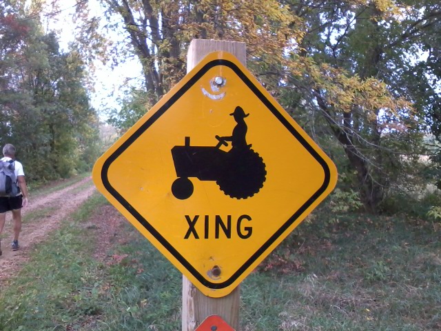 Thanks to an early start, smooth bike trail, and cool, breezy, dry weather, we've covered 10 miles by 9am and reached Centuria. From here, it's a bit over 12 miles to the terminus!
There hasn't been much to see this morning along the Gandy Dancer bike trail, but these tractor crossing signs ard fun.
The rain is supposed to start any time, but I've got my fingers crossed it will miss us.
If you have nothing better to do today, you're welcome to join the big parade at the end around 2pm! :-)
Leave Comment
Posted: 09/28/2013
Posted: 09/28/2013
Few More Blazes
 In the final St. Croix Falls segment which is 7.5 miles. Just a few more yellow blazes to follow to the end.
I can see. MINNESOTA across the river through the trees and beginning raindrops!
Leave Comment
Posted: 09/28/2013
Posted: 09/28/2013
End of the Trail
 I walked 30500 steps on the trail today.
I traveled about 23 miles today.
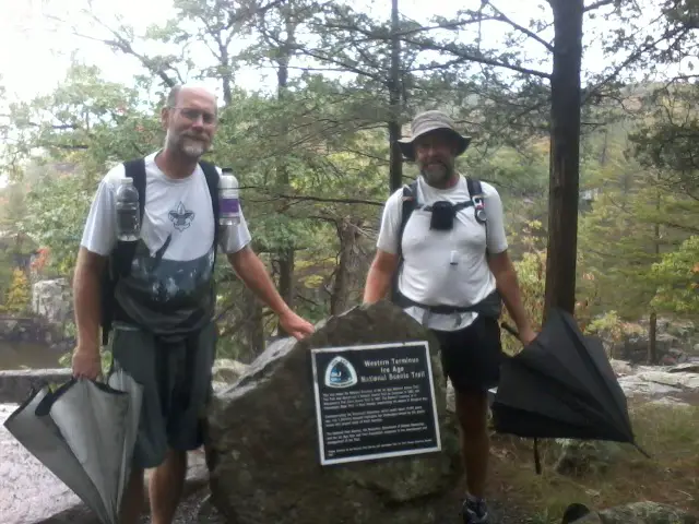
We slogged our way to the western terminus!!! A few pictures and congratulations, and then into the Ice Age center to get out of the cold rain. I guess the directions for the parade got lost - no one showed up except my good friend Duncan. What a great surprise to be greeted by him at the very end!
We ran into some volunteers doing trail work and actually got to be the first hikers on a brand new piece of trail that will be completed next weekend. It will nearly complete the trail through St. Croix Falls.
No need to find a plce to camp tonight. No planning tomorrow's hike. No wondering what excitement the trail will bring. Just profound gratitude to all the folks that make this trail possible and my opportunity to enjoy it - end to end.
10/27/2013
Kehly Finishes
 Another Ice Age Trail hiker finished her trek today. See Kehly's Hike to read her story. Kehly started a bit before me and had some problems starting out. She persevered and completed the trail which is just super!
I got to meet Kehly on the trail in the Kettle Moraine which is a bit of a funny story.
While Papa Bear (PB) and I were on a rest day in West Bend, we checked Kehly's blog and saw she was hiking through the area a couple days behind us. PB has done some Trail Magic out on the Pacific Crest Trail and thought it would be cool to give Kehly some encouragement on her trek.
(Trail Magic happens when someone unknowningly gives aid to a hiker. Something like giving them food, a ride into town, or maybe even a night's rest in a real bed! I received just tons of trail magic on my Ice Age Trail hike from some wonderful people all over Wisconsin!)
We knew the general area where she'd be hiking and, in this area, the trail crosses various roads every 3 to 6 miles. We hopped in the car and headed out to the trailhead that we knew she could not possibly be past yet.
I got out and hiked up the trail to the next trailhead while PB drove around to that same trailhead. The hope was that I would run into Kehly on the trail.
No luck! After about 4 miles, I came to the trailhead with PB waiting in the car. I continued onto the next 3 mile stretch while he drove around to the next trailhead.
No luck! You get the picture? :-) So, I hiked on while PB drove on.
But, this time, just as I walked over a hill and around a corner, I saw someone hiking up the incline towards me, forging ahead with her head down and a determined stride.
When I called out 'Howdy!', she literally jumped a bit. :-) I guess it was startling to hear an unexpected voice when you think you're all alone. Kehly had seen my blog and thought we were far ahead of her, so she was quite surprised when I told her who I was and explained we were taking a day off. But, I hope the cold lemonade I gave her helped her believe I wasn't some weirdo on the trail.
We chatted a bit and hiked her direction to the trailhead where I left her to continue on while I hiked back to the next trailhead to find PB. Our hope was to meet her down the trail at the next crossing so PB could say 'HI' and encourage her.
Unfortunately, either Kehly hiked very fast or we were impatient. I found PB, drove to a trailhead we figured Kehly could not have passed, and waited. And waited. But, we never did see her again so PB didn't get to meet her.
At least I got to do a little trail magic, even though it may have been more mysterious than magic to the hiker.
Hike On
12/10/2013
Ice Age Trail Story


You can read my compiled Ice Age Trail Journal now. I've tried to capture the most interesting bits of the trip and include photos to tell the story.
It starts quite verbose, but as the miles get longer towards the end, there is less to write about. :-)
By far, the most enjoyable part of this trek was all the wonderful people I had the good fortune to meet. So, to them, Thank You for your caring generosity and support of a stranger.
Hike On!
Leave Comment
Posted: 12/10/2013
Posted: 12/10/2013
01/23/2014
StrongVolt Solar Charger
 I love the sun! Just love it! One of the best things about moving from Oregon to Minnesota is that there is sunshine during the winter months here. Sure, it's too cold to be out enjoying it sometimes, but it's still bright and cheery.
Besides the attitude uplift that the sun provides, it also provides free power. I love FREE, too! I've installed solar panels on my home and love my negative electric bill each month - even winter. Being able to harness and utilize that energy pouring from the sky makes sense.
So, why not do the same thing while out in the wild? Portable solar chargers are available to charge all your e-gadgets, including phones, cameras, GPSs, iPads/Pods/Nanos/..., and most anything else you have. I've used three different products over my long hikes, the most recent being the StrongVolt 7W solar charger on my Ice Age Trail hike.
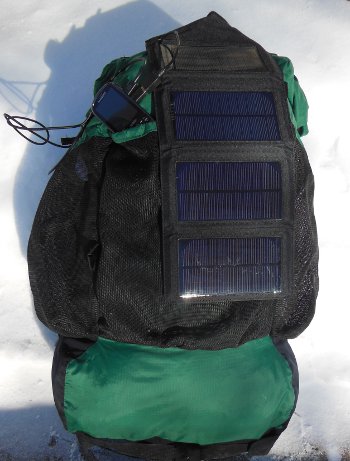
This photo is the StrongVolt charger on my backpack after a recent winter practice hike, and I'd like to tell you a bit more about this charger.
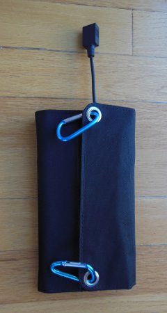
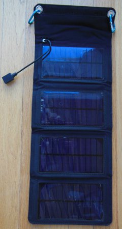
StrongVolt's Solar:7 converts sunlight directly into electricity via four monocrystalline solar panels that fold into a tough, compact package. Electric output is through a USB cable at up to 5.5V which should suffice for your phone, tablet, or GPS.
It's simple to use - just unfold, connect device, and lay it in the sun with the panels facing the sun as directly as possible. There are two reinforced grommets on the case which makes it perfect for hanging from a backpack. That's how I used it so I could charge while hiking and waste no time. I also poked holes in the lower two corners and anchored them to my pack so it did not flop around.
This charger worked well on my long Ice Age Trail hike for my Samsung Gravity phone, keeping it supplied with free power. Since I mostly used my phone in the evening to blog, I didn't need it during the day and could leave it plugged in as I hiked and it charged. I also used it to charge my Nikon CoolPix S9300 camera.
Like any other solar charger, hiking through forest canopy doesn't work very well. Since you'll probably stop for a lunch break around mid-day, when the sun is highest, that's a great time to lay out your charger in a sunny spot and soak up the energy.
StrongVolt also offers 3w, 5w, and 10w portable chargers. The 10w version is just an ounce heavier, and only $15 more than this 7w version.
There are three things to consider when comparing this charger to others I've used.
- It contains no battery storage. You charge a device when sunlight is available. Checking into this with StrongVolt, they do have a 4 oz. battery pack product. That solves this problem - just hook the battery to the charger during the day, then charge your device whenever you want. If you're out on a 3 day or less trip, you might just take the charged battery pack instead.
- It's relatively heavy. At a bit over 11 oz., this is 3 oz. heavier than my other charger (which includes a battery pack and has flexible panels). Including the extra battery pack makes it about twice as heavy as my other one. This is really only a long-distance hiker concern. A half-pound won't bother most people out enjoying a backpacking trip.
- The solar panels are crystalline, rather than flexible which makes them more fragile. Fortunately, the rugged case provides protection at the expense of weight.
Overall, this charger is a nice product. It's well made, inexpensive, and makes use of that solar energy being wasted each day. There's no reason you can't set it in a window at home when you're not out hiking and use it instead of paying for electricity created by polluting power plants.
If you don't have a portable solar charger yet, put it on your birthday list. StrongVolt sells this 7W version for $59.99 and they include free shipping and 100% money back guarantee. That's a good price point compared to other chargers.
  |   |
Disclosure: Strongvolt provided me with a no-cost sample charger to test and share my impressions.
Leave Comment
Posted: 01/23/2014
Posted: 01/23/2014
Mile... Mile and a Half
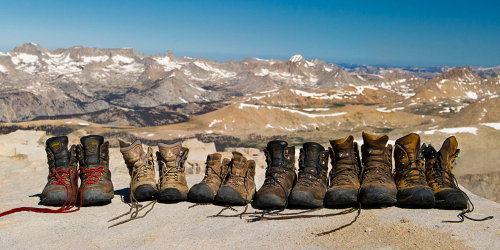

"How much farther?"
"Oh, a mile... mile and half."
If you've ever, ever, ever done any long backpacking trips, you understand that question and response!
At any point on the trail, saying the destination is 8 miles or 5 hours away can be just devastating to morale. A mile... mile and a half isn't so far and we probably don't really know exactly how far it is.
It doesn't really matter anyway. We're out here to get away from deadlines, timelines, calculations, and machinations. So, the title of this entertaining 87 minute film, "Mile... Mile and a Half" perfectly sets the tone for the visually inspiring trek along one of the nation's most beautiful trails - the John Muir Trail.
I've had people mention I should wear a Go camera on my hat while hiking so I could post videos of my hikes on YouTube. My response is "How BORING would that be?" Mile after endless mile of trail with some cool views and quick glimpses of wild animals. To create an interesting movie that documents the challenges, rewards, camaraderie, scenery, and LIFE of a trail requires someone more artistic and imaginative than me.
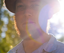
 Fortunately, the team at Passion River Films took on the task. Their film does an excellent job at capturing the feelings of life on a long trail and throws in some spectacular views for armchair hikers.
Creating a film like this requires a lot of equipment. Heavy equipment! When you watch this film, you'll be surprised at the weight these people lugged over the mountains! That's one reason why, by far, my favorite character was Durand Trench, the sound guy. The amount of hi-tech stuff he muled across the Sierras is impressive. Best scene, besides all the times he jumped into frigid lakes, was his attempt to capture frogs singing.
I think Durand would be a way fun guy to hike with!
I certainly don't want to tell their entire story, but the general plot is: a group hikes the rigorous John Muir Trail to the highest point in the lower 48, in a year with extremely deep snowpack, meeting fellow backpackers along the way.
It's a simple plot that allows this bunch of artists to draft hiking into art - pretty cool. I enjoyed the quick 87 minutes, and I think you will too.
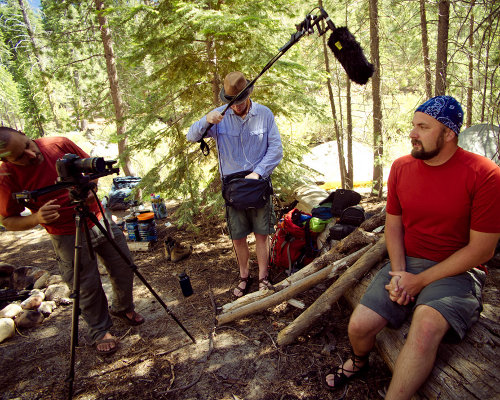

Wanting to get another perspective, since I've not hiked the JMT (yet), I let my Scouting friend that has hiked the trail a couple times watch it. He actually hiked part of the JMT less than 2 weeks before this film crew and wound up bailing out due to deep snow. Luckily, two weeks of July sun melted a lot away.
Anyway, here's what he said:
"Beautifully crafted by a talented group. I enjoyed it a lot because there were numerous spots in the film I had camped, stopped at or had taken photographs. They did a really nice job of catching the scenic qualities of the trail and the diverse types who inhabit the Sierras."
I, personally, would have liked a bit more information about the trail, the folks that built it, the history, the environment, and such. A minor wish.
There was one other bit at the end of the film that I appreciated - a quick acknowledgement that the group failed to adhere to Leave No Trace principles at all times. I admit I kept my eyes open for blatant "bad hiker" behavior in the film, but saw no major problems. By adding that blip, the film might turn some viewer onto LNT and ethical choices in the backcountry.
Buy the film, or get more information, at The Muir Project.
Leave Comment
Posted: 01/23/2014
Posted: 01/23/2014
Older Posts Newer Posts
Find more Hiking Resources at www.HikingDude.com


Follow Me
Recent Comments