
Ice Age Trail Thru-Hike 2013 Journal
 I hiked along the 1,100-mile Ice Age Trail from Sturgeon Bay in NorthEast Wisconsin to the Minnesota border at Interstate Park near St. Croix Falls, WI.
 This is a journal of my trek. I would be happy to answer questions you may have about my trip, or when planning your own adventure. Enjoy your Hike!
Ice Age Trail hike - Day 01 to 07 - East Terminus to West Bend
Ice Age Trail hike - Day 08 to 14 - West Bend to Janesville
Ice Age Trail hike - Day 15 to 30 - Janesville to Gibraltar
Ice Age Trail hike - Day 31 to 40 - Gibraltar to Polar
Ice Age Trail hike - Day 41 to 49 - Polar to Gilman
Ice Age Trail hike - Day 50 to 57 - Gilman to West Terminus
Sat - 08/10/2013
Day 8 - Northern Kettle Moraine
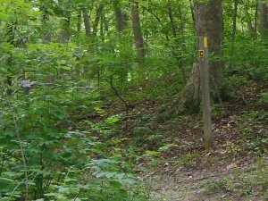 What a huge change from the first week of hiking! My entire day was spent on forest trails through the Northern Kettle Moraine forest. About 120 of the 136 miles through the northern and southern Kettle Moraine forest are on trail, making it the most 'natural' long stretch of the Ice Age Trail the north woods in Langlade county.
Since it's a weekend, I figured there would be many people out enjoying the trails, but it was quite desolate.
Maybe it's the mosquitos out in droves that are keeping folks away. Other than that, it was a terrific day of hiking.
On roads, there are no blazes to follow so navigation is done by matching road intersections on the map with those you encounter. In the forest, yellow blazes on the trees keep you confident that you're on the correct trail. At intersections, it can be tricky, depending on how well the blazes were done. Arrows with confirmation blazes not far down the correct path make navigation much easier.
Tip: [Slackpacking is a way to carry less gear for a day. This morning, I left everything at my folks' home except my essentials - food, bug suit, rain gear, first aid kit - so my pack was only a few pounds. This lets you cover many miles with less effort. You just need someone to move your gear for you, or a place you are staying for a couple days.]
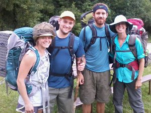 We came to Butler Lake about 11.5 miles into our hike and were looking for a place to take a break. We were greeted with a very nice, open spot with picnic tables and a wonderful, COLD water hand pump - and 4 young backpackers enjoying the Kettle Moraine. We had a nice chat with Tony and friends away from the small swarm of bugs that's been following us.
They continued on their way north and we're southbound.
I'm pretty sure they were jealous of our bug suits - the mosquitos have been bad today!
Mauthe Lake campground is a popular spot. We needed water when we passed through, so stopped to fill up. Gary and his family were camping there and I noticed his Philmont scout ranch t-shirt. Of course, I mentioned it and we were quickly invited to sit down and have a soda. Gary had just returned with his Hartford troop from a great trek in New Mexico.
After a cold coke, we continued the last 9 miles through the forest on a very nice trail with lots of small ups and downs to meet my Dad at the County H trailhead, completing this 28 mile day through the woods.
Sun - 08/11/2013
Day 9 - West Bend Segment
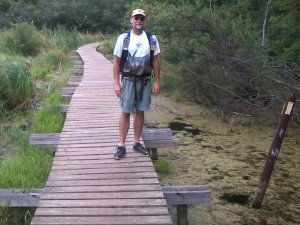 Walking the beautiful Kewaskum and West Bend segments today. Meeting quite a few folks on the trail doing Sunday hikes.
The West Bend segment is a very nice, well-groomed trail and is actually a favorite section for me. This boardwalk over a marsh, a stroll along Silver Creek, and a selection of restaurants for lunch at the Hwy 33 crossing are a few of the highlights.
Today's hike got cut short today when the rain started. We'll have plenty of days to walk in rain, and were looking for an easy day anyway, so we took the afternoon off.
Coincidentally, my Dad picked us up at the Paradise Drive parking lot - the exact same place I was picked up in the rain nearly two years ago when doing a day hike here and hoping to thru-hike the trail some day. :-)
It's been a nice break to visit with my family while also getting some miles done. In a couple days, we'll be back in the 'wild' with full packs.
Tip: [The new Distributed Camping Area site by Sunburst ski hill is too tilted for sleeping. The trail volunteers just completed a big project on the Kewaskum segment so there is brand new trail for you to try out!]
Mon - 08/12/2013
Day 10 - Mammoth Sighting
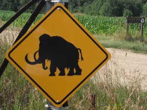 Picking up where we left off in the rain yesterday, we did a 5.5 mile roadwalk to the Cedar Lakes segment - this time in bright sun rather than dreary rain, making it much more enjoyable.
At the east end of the Cedar Lakes Segment, you might sight this mammoth like we did. The short Cedar Lakes segment has some very obvious kames which the trail winds around, through, and over.
Tip: [When you hike this road, be VERY careful along Paradise - no shoulder and very winding.]
 While walking the County NN road south of Big Cedar Lake, keep an eye out for Johnny T's pub that had the first 'welcome ice age hikers' that we've seen. (As it turns out, it was the ONLY Ice Age Trail hiker sign we saw the entire trek. But, it wasn't the only Johnny T's pub along the trail.)
We walked by at 10:30am and they don't open until 11, so we kept on walking.
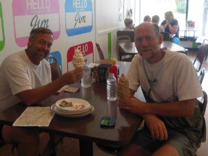 As the trail passes through the nice little town of Slinger, you can see the ski hill, race track, and Jim's restaurant.
If you like soft serve ice cream cones, you do not want to pass up a stop at Jim's. We ordered the small size and this is what we got!
The trail route follows the sidewalk right past Jim's and there is actually a yellow blaze on the light post directly in front of their door.
I wouldn't really recommend the lunch from my single experience, but definitely stop for an ice cream!
Taking a back alley out of Slinger drops the trail into the Pike Lake state park with a great trail, observation tower, and occasional rock art stacked along the trail.
 Some field crossings and short road walks bring you to Holy Hill. The trail follows around the hill, but it's worth it to visit the monastery at the top and climb the 178 stairs to the very top of the tower for great views all around. After hiking for 10 days, the steps were easier than I expected!
Holy Hill is actually a very large kame. Being higher than the land for dozens of miles in all directions, you can see where you've been hiking the past few days and where you're headed.
My dad picked us up on Donegal Rd. for another free night in a soft bed after this 20 mile day.
Tue - 08/13/2013
Day 11 - To Delafield
 Dogs have not been a concern for me hiking in the wilds, but when walking through towns, past farms, and along roads, you meet all sorts of beasts. This morning, Millie decided to walk with us. This big, black dog came racing out of the woods and trotted along with us for almost two miles before we finally convinced her to GO HOME.
The fear was that she'd stay with us our entire 22 miles today and not find her way home. Stupid dog!
Millie was nice and friendly, but stupid. I had plenty of other not so nice dog encounters on this trek and I might share one or two later.
After a few hours of trail walking through the Loew Lake and Monches segments, which included a very nice trail along the Oconomowoc River, a couple of young entrepreneurs were selling their wares along a very fast, very busy Dorn Rd. It was a nice treat to stop and chat, and have a cokie. I didn't buy any jewery, though. :-)
Across the road, three boys were playing baseball. These were the first children to be seen along the trail. Even passing through many small towns, I saw only a couple more kids to the end of the trail.
Lunch was a quick stop at the Marathon gas station at Dorn and Merton - peanut butter/honey on ritz with a cold Mt. Dew - and then on down the road.
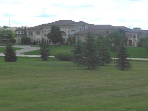
It's very cool how the Ice Age Trail takes you through so many different environments in Wisconsin. In just this one day, I enjoyed quite wild woods, fresh flowing rivers, manicured city trails, a golf course neighborhood ($$$), the Milwaukee polo grounds, an old railroad bed, and a mini-mall. Not quite a wilderness trek, but still very interesting scenery.
This picture is just one house - it even has a big fountain in front! A couple vagabonds meandering through this neighborhood probably made a few folks nervous. :-)
Today, my leg began hurting, very much like it did at the end of the Arizona Trail last year. We'll see how it goes.
This morning, we dropped the van in Delafield then got a ride back north to Donegal Rd. with my mom to start our hike. This way, we can finish at any time and drive ourselves back for our last night at home.
Wed - 08/14/2013
Day 12 - Southern Kettle Moraine
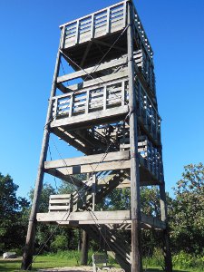 The van is parked in Delafield while we hike towards Janesville. The plan is to move the van down the trail every few days as we hopscotch along, using the van as a food storage unit and mobile control center. This requires finding someone willing to give a ride to a stranger.
It's a pretty
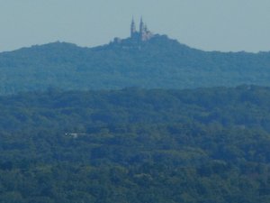
We're on top of the tower at Lapham Peak just south of Delafield - don't know who decides when a hill becomes a peak, but it's an amazing view for 50 miles in all directions!
We can see Holy Hill far in the distance to the north which was our starting point yesterday and about 30 trail miles away. Now, we had southwest through the southern section of the Kettle Moraine forest for the next two days.
With only a bit of rain a couple days, the first two weeks have been spectacular weather! Hiking has been steady and the trail very nice.
The mosquito mesh suits came in handy ALL afternoon as we hiked through forest and savannah with no wind. It actually got a little irksome.
As long as I'm complaining... my right shin has been bothering me and started to swell today. Ibuprofen and a long night resting will hopefully help.
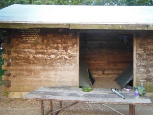 We reached a state forest visitor center and stopped to cook dinner on a picnic table at 6pm.
The facility was closed, so we hoped to hike a bit farther and camp in the woods.
Fortunately, Ranger Wilson was just off-duty and stopped to ask us our plans. He helped us camp legally in the shelter here - for $14.
It took over 1/2 hour of phone calls to his support staff and mosquito bites while waiting to get us set up at Shelter #2 - for $14. I expect it cost much more to help us than the $14 fee.
So, here is our wide-open, mosquito-ridden, mouse-plagued, dusty home for the night - for $14.
(As it turns out, this is the only night we paid for a camping spot the entire trek.)
After the deal was done, we noticed that the town of Palmyra (and probably a free backyard) was only 3 miles farther along. Since it's a mile off-trail, I hadn't thought of it as a destination and thought we'd be on state forest land for the next 15 miles.
Tip: [On the IATA map and guidebook, there is a "Hostel" here but the ranger said it is no longer in business. Also, having a plausible plan about hiking a bit farther out of the jurisdiction of a helpful ranger before camping is a good idea.]
A respectable 28 mile hike today, with nearly all of it on real trail through the forest. The Kettle Moraine is aptly named with many glacial hills to go up, over, down, and around.
Thu - 08/15/2013
Day 13 - Disaster Strikes!
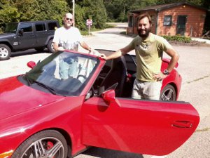 My blog entry for today was simply:
"Paul porsche - please check your car for my phone and call papa bear."
I made that entry at the end of the day from Papa Bear's phone since I no longer had mine. Devastating disaster!
The day was wonderful until the disaster. 15 miles of very hilly, wooded trail through the Kettle Moraine brought us to an alternate route south of Lake La Grange. Some developer had great intentions of building a new neighborhood. The roads were plowed out and land plotted - and there it sits. Now, hikers and deer meander through this ghost town that never even became a town. Quite creepy place.
Just after Lake La Grange, we stopped for a rest break by highway 12. I noticed a hiker heading north on the trail, but he did not notice us and looked like a day hiker. As we continued on, this same hiker came up behind us on his return trip and we started chatting.
He was day-hiking and was parked a couple miles ahead at Whitewater Rec Area. He offered to drive one of us back to Delafield to pick up the van. This would be perfect since we could then drive it ahead to Janesville where I had plans to meet a Scoutig family.
Upon reaching Whitewater an hour later, I found out his vehicle was a very cool, red porsche - I've never been in one! He zipped me up to Delafield and let me out. Just as he was about to pull away, I noticed I did not have my water bottle. Wait! He pulled it out from under the seat and gave it to me, then left in a flash, telling me he'd check out my blog.
Relieved I had my water, I started the van and drove off - only then realizing I didn't have my phone!
Now, I have to explain. This is the first time I've had a cell phone. I borrowed one last year for my Arizona hike, but I've only had one for about three weeks now. I'm not used to always having it with me.
What could I do? I would not be able to blog. Would I have to buy a new phone? How could I get it back?
 I drove back to Papa Bear and we tried to figure it out while we drove to Janesville. The hiker we met was named Paul, but no last name. We did not have his number. We knew he was from Illinois. Our one bit of luck was that Papa Bear had taken two pictures as we were driving away. One picture had the first half of the car's license plate and the other had the second half - we had a license number!
When we reached Janesville, we met Peter and his family. What a great gang! As soon as we arrived, they bustled us over to meet other relatives and have dinner. After visiting, we were shown to the "Coleman Condo" - a Coleman camper that was a perfect home for a couple days.
Peter let me use the internet to search for the license. I paid an online service, searched, and found nothing - cancelled my $5 payment. Oh well. I decided to give Paul a few days to check my blog and see the message to him before taking drastic measures like buying a replacement.
Today saw us complete the Kettle Moraine, covering about 19 miles. It will be the last forest for about 100 miles.
Fri - 08/16/2013
Day 14 - Flooded Trail
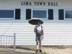 We passed the 300 mile mark today at the Lima Center town hall! Like many small towns along the way, the town hall is pretty much the entire town.
An unexpected discomfort has become a nuisance. The morning dew soaks my shoes, socks, and feet in the first half hour of walking through grassy trails. It's not a problem in the forest or on roads, but most of the lightly used trail across meadows and fields is simply a mown strip. When the trail tread gets worn, it will be much better, but high humidity and cool morning temperatures are perfect for heavy dew. This morning, we had plenty of grass and plenty of dew through the marsh country, so another morning of soggy feet.
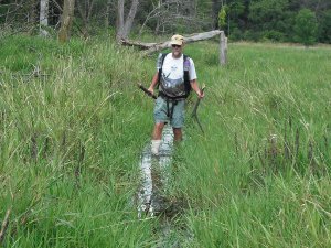 The Storrs Lake segment just east of Milton allowed us to have a fun side-adventure.
The trail became more and more grass-covered, then soft, then soggy, then muddy. At that point, I started cross-stepping on the tall grass to fold it over like a soft platform for each step. That worked for about another 20 or 30 yards.
After that, we searched for high ground to work around the wet area. This effort drew us closer to the lake. Along the way, I picked up some long, dead limbs that we might lay down to step across.
Ultimately, we were defeated - open water lay across the trail and side to side as far as we could see. Our options were to backtrack a couple miles or splash ahead. Splash, we did!
The water was fairly clear and fresh, not stagnant and slimy, so it was a fun walk. We did use the limbs for support as we waded and no one slipped under.
A mile after the water crossing, we came upon a manufacturing building on the outskirts of Milton that had a picnic table and faucet outside in the shade. Quick rinse and then a long rest while our shoes and socks dried in the warm sun and we were on our way.
Tip: [The Storrs Lake segment trail has a real water problem. It was under at least a foot of water for a few hundred feet on the southeast edge of Bowers Lake, even though there's been no rain for quite awhile. Staying on Bowers Road around this 1.5 miles might be a better choice.]
A break at the Milton library was appreciated as the afternoon warmed up. Today's 27 mile walk concluded with Peter picking us up along the road at the end of the day. We spent a wonderful evening with his family and a great night's rest in our luxury accomodations in the Coleman Condo.
Continue with: Ice Age Trail hike - Day 15 to 30 - Janesville to Gibraltar
Find more Hiking Resources at www.HikingDude.com


Follow Me
Recent Comments