
Ice Age Trail Thru-Hike 2013 Journal
 I hiked along the 1,100-mile Ice Age Trail from Sturgeon Bay in NorthEast Wisconsin to the Minnesota border at Interstate Park near St. Croix Falls, WI.
 This is a journal of my trek. I would be happy to answer questions you may have about my trip, or when planning your own adventure. Enjoy your Hike!
Ice Age Trail hike - Day 01 to 07 - East Terminus to West Bend
Ice Age Trail hike - Day 08 to 14 - West Bend to Janesville
Ice Age Trail hike - Day 15 to 30 - Janesville to Gibraltar
Ice Age Trail hike - Day 31 to 40 - Gibraltar to Polar
Ice Age Trail hike - Day 41 to 49 - Polar to Gilman
Ice Age Trail hike - Day 50 to 57 - Gilman to West Terminus
Thu - 09/12/2013
Day 41 - Being Lost
We head off into about 100 miles of forest trail this morning. Of course, that is after a wonderful breakfast from our terrific hosts.
Less than a mile into the woods, something mean and nasty stung my right pointer finger. No idea what it was, but it hurt - I mean really, really hurt. I took some antihistamine right away just in case and hiked on while the swelling continued. (It wound up being swollen for three days but eventually went away).
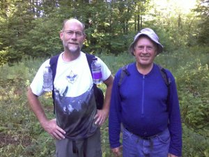 Just as I was putting my first aid kit away, another hiker came up the trail behind us. This was Steady Eddy from Minnesota. He is hiking the trail in an unusual way. He drives to a trailhead and hikes halfway to the next trailhead. Then, he turns around and hikes back to his car. In this manner, he hopes to hike the entire trail, but he'll actually be hiking it all TWICE!
Eddy taught me an important lesson today - Visually Verify!
Eddy hiked along with us for an hour until we reached a spot that Eddy said was Burma Road. He had hiked from the other direction to that point the previous day. I looked at my map and it looked like the general area. This was an old, unused, dirt logging road. The trail turns to the right and follows it for a half mile. There were no blazes showing which way to go. So, I took his word and headed down the road with Papa Bear in the direction he had indicated.
Well, after much longer than expected without seeing any blazes, we finally turned around in frustration and retraced our steps to our last known position on the trail.
It wasn't Burma Road! Upon closer examination where the trail intersected this road, I found an Ice Age Trail sign had fallen in the grass and it pointed the other direction. OOPS!
So, a 90 minute detour was a lesson well learned to check location and direction all the time. Visually verify any directions or advice given to you by well-meaning friends.
We finally found Burma Road another mile down the trail, and kept a better eye out for blazes and signs.
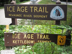 Tip: [Speaking of signs and blazes, this is the Kettlebowl area of the trail. Of the entire trail, this was the one part that had the worst, most confusing, signage. Crisscrossing snowmobile and ATV trails use yellow diamonds, and so does the Ice Age Trail. Keep your eyes and map open and focused!]
The 700 mile mark of the trail is the Kettlebowl ski area parking lot. It was nice to get out of the Kettlebowl tangle and start a new segment.
I found it very interesting how each segment has its own character and charm, just as they each have a different name.
These two segment signs show how clean and manicured one segment is and how the other has had a much rougher time of it the past few years. Especially in the more remote northern areas, gathering enough volunteers to maintain the long miles of trail can be a challenge.
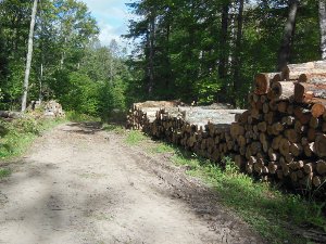 The Old Lumber Camp segment was almost completely easy-to-follow logging road or mowed path. We flushed over a dozen grouse and many deer.
I even found a bear print in the mud! - but no bear. Plus, some wolf prints.
Tonight's campsite is in a very rough logged out forest by Pence Lake, about 28 miles from our starting point. With only trails and forest, there's nothing like pizza and libraries to slow down the hiking.
It's supposed to get pretty cold so that should help with bugs which have continued to thrive the past days.
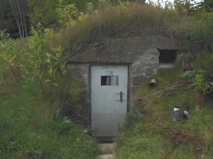
Fri - 09/13/2013
Day 42 - ATV Oasis
 The day started cold and wet, as usual, soaking feet after just a few hundred yards of walking across clear cuts.
There are very few miles of road walking up here so the feet stay wet until the grass and brush dry out in the afternoon.
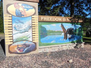
The trail took us by yet another veteran memorial this morning. I've seen dozens of tanks, cannons, and artillery pieces across the state in towns, parks, and grassy lawns.
This one was an entire park - Veterans Memorial Park - and it was a very nice park with brand new cabins, toilets, trails, and clean water. Yet another day not needing to filter water or dig a hole.
 4-H Camp Susan is closed for winter, but the trail goes right through the property. It would be funny to see how the staff reacts to scruffy bums strolling through when they are in session and have youth on site. :-)
For us, it was a wonderful place for a lunch break and dry out tents, socks, and shoes for an hour or so. It was kind of the sun to cooperate with us, too.
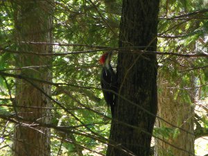
I did see this pileated woodpecker at the camp, but only got a poor picture.
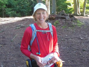 Towards late afternoon, we were taking a break at a picnic table by Townline Lake - one of only two trout lakes in Langlade county - before tackling our last bit of trail for the day. This upcoming section was supposed to be swampy, brushy, and poorly maintained.
A lady walked into the site and asked if we'd seen a gallon water bottle around. We hadn't. It turns out she is Valderi - hiking the trail eastbound, opposite us. She had a tiny pack of mostly a water bag since she is not camping out on the trail each night. She has an online journal of her trip and will write an article about it when finished.
Valderi gave us advice about the trail ahead that she received from the local chapter coordinator. It is supposedly nearly impassable in spots and some people have gotten lost recently.
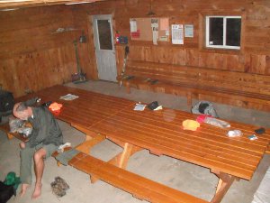 Based on that, we took an alternate route around four miles and one of several reroutes past another spot.
This small change of route helped us reach a very unexpected oasis in the north woods for the night.
The hope was to reach the water and toilet marked on map 31f before dark. We didn't make it. The sun set before we reached Five Cent Road so we hiked along it in the dark. Close to where the map indicated water, a side road headed north so we took it. Just as I figured it was time to turn around, a building materialized out of the gloom. It was a beautiful ATV Club meeting building, and would be our home for the night.
The outhouses were awesome, the well pumped water, and the floor was dry and clean. This was probably the biggest surprise of the trip for me - completely unexpected out in the woods and a welcome respite after 29 miles of hiking.
Sat - 09/14/2013
Day 43 - Top of the World
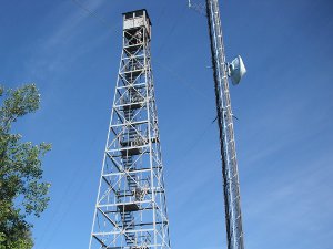 I'm on top of the lookout tower on the high point of the Ice Age Trail in the Harrison Hills segment! It's all downhill to Minnesota from here.
Sweeping views all around, including Rib Mountain way down by Wausau. It's all green now, but in a few weeks it will be a kaleidoscope of color.
The mosquitos found us after the lookout tower so I covered up with bug netting and hiked on. We finished the very Up and Down Harrison Hills segment with a goal of reaching the Underdown Rec Area that had water, and hopefully some place to camp.
Tip: [On map 30f, the Copper Lake Ave intersection with County J actually has a road sign of Axen Road, making the turn easy to miss.]
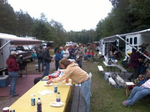 When we arrived, the place was full of horse riders - the Underdown Horse Club was having a ride today and about 100 horses and riders were here!
They welcomed us and invited us to join them for dinner.
They let us lay out our sleeping bags in their brand new storage shed which didn't have a door yet so we don't have to set up tents with rain expected tonight. That was a nice treat after walking 26 miles today.
By the way, horse folks have great potlucks!
Sun - 09/15/2013
Day 44 - Zero Day
First Zero Day of the month. It's been 2 weeks of hiking with no break.
Ed and Louise of the Underdown Horse Club gave us a lift to my van after cleaning up camp this morning. Oh, by the way, it did rain all night and this morning so it was a good thing we stayed dry in the shed overnight.
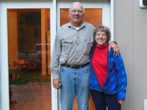 With the freedom that comes with a vehicle, we took showers at a state park (for free since I had my state park sticker from Potawotami), did laundry, visited a library, and ate! We then drove to our next endpoint at the Highway 13 wayside where we met Ruby.
Ruby is a wonderful IAT volunteer and the Northwoods IAT chapter coordinator along with her husband Bruce. The amount of work they put into the trail is amazing! Even more amazing is that there are dozens of others just like them that make this trail possible.
Ruby took us to their cabin where Bruce cooked a terrific halibut dinner and watched the Seahawks game with Papa Bear. Tomorrow, it's back on the "their" trail through Lincoln county.
Mon - 09/16/2013
Day 45 - My Longest Walk
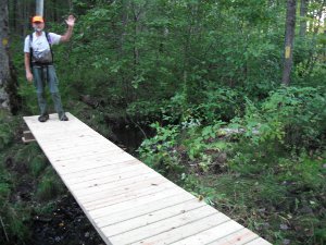 While Ruby drove us back to Underdown Rec Area, Bruce got his trail equipment together. He is leading a group installing a new bridge over a wet, boggy area in the New Wood segment ahead of us on the trail. No rest in the life of a dedicated trail volunteer, I guess.
Late in the day, we got to be the first hikers to use this new bridge as the miles flew past and we covered 34 miles. So, another Thank You to the Lincoln County IAT volunteers.
Much of this area is boggy with the route being mostly blazes through the trees and the trail being wherever you can place your feet safely around lumps, roots, holes, and clumps of moss. It's a challenging change from roads and groomed trails.
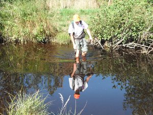 A morning road walk helped keep shoes dry and warm up legs as it was just 39 degrees to start. With a beautiful, clear, blue sky, it soon warmed and was another perfect day for hiking. Heading nearly due west all day also made it feel like we were making progress. A few bits of color are marking the trees, so the next couple weeks will see fall coming on strong.
I was grateful for the nice weather after wading through the first wet water crossing of the trek. There were other tiny streams earlier, but not that required getting wet.
In the New Wood segment, there are 3 large, old white pine trees. Adding up the miles in the trail guide, they are at about the 800 mile mark. Since we passed them today, this is now my longest hike - the Arizona Trail was 800 miles.
Tonight's campsite was on top of a slight rise above the otherwise moist land around the N. Fork of the Copper River. The secluded, dark, and canopied ground bed helped me sleep sooooo well while the temperature dropped into the 20s! The only thing that woke me was a flock of turkeys scurrying through our site with a cacophony of calls and yelps.
Tue - 09/17/2013
Day 46 - Lincoln County
 Slept in this morning since we did so many miles yesterday, it's 29 degrees, and we have a shuttle scheduled for tomorrow.
We started hiking a bit after 8am.
We'll have a very short day tomorrow since we need to move the vehicle and get a shuttle back to the trail - doesn't do any good to hike past the drop-off point.
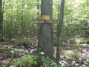
The trail segments in Lincoln county have been great - easy to navigate and nice forests. The volunteers have done a wonderful job. We crossed into Taylor county this morning and it is just as nice as Lincoln.
 We called it a day after just 21 miles, at Rusch Preserve where there are some free campsites and a pump well. The well water is brown. :-(
A plus about stopping here - the morning starts with a 3-mile roadwalk so feet stay dry a little while.
In this established campsite, there is at least one pesky rodent searching for free food. We've no such visitors when camping wild out on the trail.
Even though we've had two sub-freezing nights, mosquitos continue to hound us - but not as aggressively and only in the afternoon and evening. It's enough that I'm still making use of my bug suit this evening.
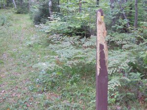 And, there's obvious evidence that this is bear country, but still no actual sighting of one yet.
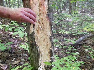
Some hungry bear was searching for insects in this rotting wood.
Tip: [ Many of the IAT blazes in the north woods have been clawed up and destroyed by bears. The IATA isn't sure why, but I think it is because the yellow blaze looks like rotting wood to them so they claw it, looking for insects. You may see posts with no blaze left for navigation. ]
Wed - 09/18/2013
Day 47 - Buzz
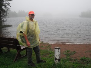 Just after finishing dinner last night, the rain started. It diminished to drizzle around 7am this morning, so we broke camp. The drizzle, fog, and general gloom hung in all morning as we soggily trod to our destination which was the Highway 13 wayside just 12 miles away.
You may wonder how this flimsy, cheap little poncho works. Well, there are a few good reasons to use a poncho rather than raincoat:
- It allows ventilation so I stay cooler.
- It covers my pack so I need no extra pack cover.
- It is extremely lightweight and small.
- It is cheap, about $2, so I carry an extra.
The actual trail was fine today and I spooked a bunch of grouse and a couple deer.
Lots of effort has gone into the Taylor county segments with adequate blazing and navigable trail.
After reaching the van, the rest of the day entailed our usual "vehicle-enabled" activities - lunch at MickeyD's, stop at Medford library, and shuttle van down the trail to Cornell.
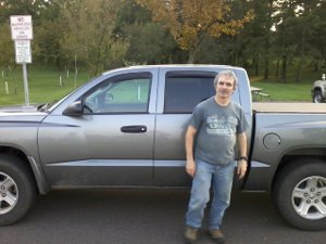 We were fortunate to meet the chapter coordinator, Buzz Meyer.
Buzz gave us a ride and visited with us over a very filling pizza bar at Happy Joe's in Medford. He has lots of trail stories and is a dedicated volunteer - Thanks Buzz!
Buzz dropped us off to tent in the Medford city park, which allows free overnight tenting.
While looking for a spot, I noticed a Boy Scout Troop 536 scout hut and got an idea.
I called my son back home and had him look up the troop's contact info on the Internet. I called the scoutmaster and he let us sleep inside away from the lingering mosquitos this evening. Another dry, warm night without getting the tent dirty or wet - Score!
This troop will be doing a canoe trip in the Mondeaux Flowage this weekend, but we will have already hiked past that area by then.
Yet two more helpful, friendly, kind people to add to my long list on this trip.
Thu - 09/19/2013
Day 48 - Chequamegon
All but the first 5 mile roadwalk today were on trail inside the Chequamegon national forest. I believe this is the first national forest we've passed through, and we'll have another 17 miles tomorrow before we emerge out the other side.
The name is pronounced she-WAM-a-gun (wam from wigwam). Buzz told us a story about how to remember to pronounce it, before he dropped us off at the trailhead early this morning.
Each spring, the Indian chief would decide when the waters were warm enough for bathing. He would put his toe in every morning to test the temperature. When it was finally warm enough to bathe, he'd say 'She warm again'. That's the short version. :-)
Anyway, we hiked into the Chequamegon through thick forest straight west until we hit the Mondeaux Flowage - a north-south reservoir blocking the way. It's not a big deal, though. Just a 4 mile walk around gets you to the other side which is just a 1/4 mile away. :-(
The trail up the east side of the flowage was about the roughest part of the Ice Age Trail. Wet, roots, rocks, and brambles. But, it would have been worth it for nice views of the flowage while hiking. Unfortunately, there were very few of those. It would be tempting to just walk up the Mondeaux Forest Road to the dam instead of the trail.
 Reaching the dam at the north end of the flowage was rewarded with a stop at the Mondeaux Lodge. I had a terrific pizza made by Steve - Papa Bear had one too. Don't get the 16-inch, you'll never finish it!
Steve was great to visit with and has a register to sign. The lodge is a USFS property and very interesting to investigate while your pizza is being made.
Tip: [ It would be a shame to miss stopping here at the lodge on your hike. Try to arrange your hike to hit this spot during open hours. ]
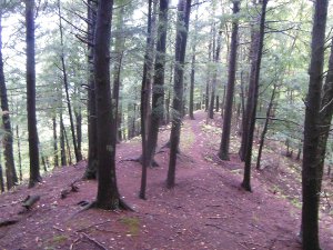 We hiked the top ridge of the Mondeaux Esker and Hemlock Esker - very neat. Actually, the Hemlock Esker was one of my favorite short bits of trail. As you can see, it's obvious that the trail runs along the top of a ridge. But, the ridge was not formed by erosion, but by debris deposits from an ancient glacial-melt river.
When we reached a primitive camp site where we planned to stay, we found it packed full with some outdoors women wilderness camp group. Their two leaders were pretty obvious about not wanting a couple old men invading their space. So, we're down the trail a bit. After a long afternoon of rain, rain, rain it's still raining into the night.
Tomorrow is to be dry, clear, and cool - according to the infallible weatherman on the TV at the Mondeaux Lodge!
That would be nice since my feet did not dry out all day and the high humidity this cool evening is not helping the shoes and socks dry overnight. Due to hiking 30 miles with wet feet the entire way, my feet are now like prunes and lots of skin has rubbed away - no blisters, but raw skin.
Fri - 09/20/2013
Day 49 - Out the Other Side
 I hate weathermen!
This is now the third day of rain, mud, wet foliage, and soggy feet. The rain let up around 7:30 this morning, so we used the short reprieve to break camp quickly.
Squishing feet already tender from the previous wet day into shoes that had no chance to dry overnight was not fun! Once a couple miles had passed, the feet mercifully stopped sending pain signals - they were bloated and numb.
Rain continued sporadically all day, splashing on the forest canopy, but inevitably making its way to the ground and my feet.
The 17 mile hike out of the forest was uneventful - just miles of trees and rain. When we reached Highway 64, we had a 9 mile roadwalk to Gilman. A quick change of socks and check of the feet (ouch, yuch) and we hit the road. We dodged rain clouds the whole way, finally getting some luck on our side.
In metropolitan Gilman, there is one restaurant so we stumbled through the door and found a place to sit. We immediately made friends with a wonderful young lady named Nicki and some other patrons enjoying their dinners.
My burger was hot and filling - perfect!
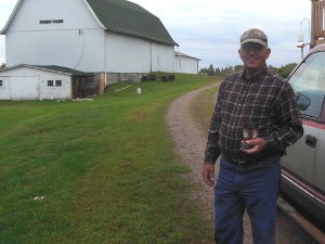 One fellow in the diner quietly listened to our stories and then motioned for me to come over to his table. He asked if we'd like to rest up at his place, get showers, and wash our socks! Ed is a Trail Angel among trail angels!
With our scraped, peeling, and blistered feet, each step was a chore just to reach his truck. A short drive brought us to Ed's goat ranch - yep, a goat ranch in Wisconsin! It was very interesting listening to Ed share his story and show off his goats.
Now that we're clean and dry tonight, things are healing and resting. Tomorrow's hike will be safer, more painless, and enjoyable with rejuvenated bodies, clean socks, and new friends to talk about as we hike along.
Thanks, Ed, for all your trail magic to end this 26 mile day.
Continue with: Ice Age Trail hike - Day 50 to 57 - Gilman to West Terminus
All Comments:
Feb 10, 2017 - Justin
Did you have to reserve the Hillbilly
Hilton when you stayed there or was it
first come first serve?
Feb 10, 2017 - Hiking Dude
@Justin - I didn't stay there, just looked inside. It's an old,
dirty, musty earthen hut and it's open to anyone that wants to use
it.
Ask a Question
Find more Hiking Resources at www.HikingDude.com


Follow Me
Recent Comments