
Ice Age Trail Thru-Hike 2013 Journal
 I hiked along the 1,100-mile Ice Age Trail from August 3 to September 28, 2013 walking from Sturgeon Bay in NorthEast Wisconsin to the Minnesota border at Interstate Park near St. Croix Falls, WI. This took 45 hiking days plus 10 days without hiking due to an extreme heat warning the end of August and 3 more non-hiking rest days.
 These few pages are a composite journal of my trek, composed from my daily writings and supplemented with more pictures and thoughts.
I would be happy to answer questions you may have about my trip, or when planning your own adventure. Every hike is unique, even over the same trail, due to weather, time of year, company, wildlife, and twists of fate. Enjoy your Hike!
Ice Age Trail hike - Day 01 to 07 - East Terminus to West Bend
Ice Age Trail hike - Day 08 to 14 - West Bend to Janesville
Ice Age Trail hike - Day 15 to 30 - Janesville to Gibraltar
Ice Age Trail hike - Day 31 to 40 - Gibraltar to Polar
Ice Age Trail hike - Day 41 to 49 - Polar to Gilman
Ice Age Trail hike - Day 50 to 57 - Gilman to West Terminus
Daily Journal
Here is my daily account of my winding walk across Wisconsin.
You can click any picture to view a larger version of it, if you want.
I'd like to thank my hiking partner, Papa Bear, for the use of many of his photographs.
To get an idea of where I was each day, you might open my Trail Map page.
You can click any picture to view a larger version of it, if you want.
I'd like to thank my hiking partner, Papa Bear, for the use of many of his photographs.
To get an idea of where I was each day, you might open my Trail Map page.
08/02/2013
Day 0 - Packer Country
 My trek actually started a few days before hitting the trail.
Last year, while hiking the Arizona Trail, I met Papa Bear who lives in Seattle. He rode the train out to Minneapolis to hike the Ice Age Trail with me and arrived two days ago. We spent some time purchasing last minute items and reviewing our hike plan.
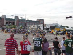
Today, we drove to the trailhead at Potawatomi State Park, crossing the entire state of Wisconsin in just a few hours which will take us the next couple months on foot. Lambeau Field, the home of the Green Bay Packers, was right on the way so we stopped to check it out.
With luck already going our way, this evening was the Packers' traditional bike ride to their training field. Kids wait outside the dressing room and each Packer chooses a bike to ride a few blocks lined with fans. The kid gets to carry the Packer's helmet and run along beside. Tons of fun and a tradition back to the days of Vince Lombardi.
Arriving at Potawatomi, we found the campground full and two young entry gate attendants not keen on allowing us to sleep in the van parked at the trailhead. As a matter of fact, I would need to pay $50 to park my van there for 5 days until I could return to get it. Or, purchase an annual pass for $35. I bought the pass and slept at the trailhead anyway.
Tip: [The 2011 Ice Age Trail Guide says there is long-term parking available at the old ski hill. Yes, but you have to buy a state park pass to park there.]
The adventure starts with a beautiful, starry night and me sleeping under it. I decided to forego setting up my shelter and just sleep in the open. This would be the only night I do this for the entire trail, so I'm glad I did.
The trailhead is secluded and far from the campground, entry gate, and anyone going on an evening walk. Dark, quiet, and a warm breeze make for a terrific, restful night once the excitement of starting a new adventure winds down.
Sat - 08/03/2013
Day 1 - Ice Age Trail Start
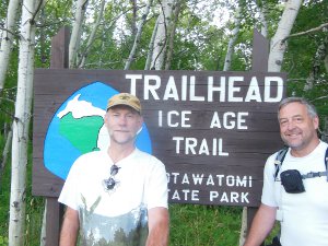 We're on the trail!
Awoke bright and early, checked packs one more time, made sure I had the car keys, and headed down the trail.
We thought this spot was the official Eastern Terminus of the trail. Doesn't it look that way to you? It's a huge sign right at the parking lot and a nice, obvious trail leads away.
A perfect place to take a picture and start your hike!
Two young bucks ready for an exciting adventure with who knows what ahead of them!
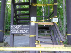 Well, we found out later that there is an official plaque on a rock close to this observation tower just a couple hundred feet down the trail.
The tower was closed (obviously!) so the view, which I'm sure is spectacular, is still a mystery to me.
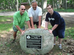 When we returned to pick up my van a few days later, my brother came along and we found the elusive rock.
We took this picture of our "unofficial" start of the hike. At least we still look fresh and ready to go, not to be confused with how we looked upon reaching the Western Terminus a few weeks later.
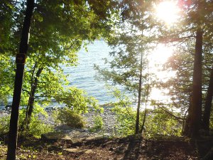 The hike through Potawatomi State Park began at about 6am with a gorgeous, warm sun shining on the water and nothing but easy to follow yellow blazes marking the trail.
 Look carefully in the larger version of this picture and you should see a yellow arrow on the left side. (You can click any photo to see a larger size).
The yellow blazes mark the entire Ice Age Trail. Over the course of my hike, I saw thousands and thousands of yellow blazes, sometimes 2x6 inch plastic strips nailed to trees, sometimes a splotch of yellow paint, sometimes metal signs. You can see pictures of the Yellow Blazes to get an idea.
Many long trails have similar blazes or signage - The Arizona Trail uses white blazes, Superior Hiking Trail uses blue blazes, Appalachian Trail uses white blazes.
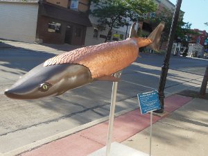 In very little time, we found ourselves on the streets of Sturgeon Bay with it's artwork and obvious tourist industry.
We met some ladies on a morning walk and they told us to try Scaturo's for breakfast. Since it was directly on the route, we followed their advice and thus had our first of many, many, many restaurant meals on this trip.
These art sturgeon's could be found around town. Made for a fun few blocks of walking, even though it was all uphill from the bay to the flat prairie to the south of town.
 The Ice Age Trail makes use of the Ahnapee Trail out of Sturgeon Bay to Algoma. It is fast, flat, easy hiking so we found ourselves intersecting with Highway 42 in the tiny community of Maplewood just a quick 8 miles after breakfast.
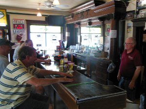
On the corner, in the now quite warm sun, was Richard's Pub & Grill, too inviting to pass by.
Stepping into the cool, dark pub, we were greeted by Richard and three regulars even though it was well before noon. These gentlemen turned out to be the first of many bar regulars we'd meet that proved to be helpful, friendly, and inviting. They even shared their string cheese with us - now THAT's hospitable! Richard was a great host and his establishment was well kept, certainly worth a visit if you walk (or drive) by.

I got a real chuckle from this prayer Richard had posted on the wall, but probably can't use it for meals at home.
We chatted, cooled off, and continued our hike down the trail into the afternoon.
Four hours later, we would find ourselves in Algoma at yet another bar, the Steelhead Saloon, eating fried cheese curds and onion rings!
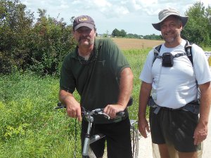 While hiking south towards Algoma, a biker came towards us on the trail. He stopped and asked what we were doing since it looked like we were out for more than a day hike.
As it turns out, Steve is an adventurous sort himself and has biked and motorbiked all over the country. We stood around chatting for a very long time, swapping stories.
We met few people actually out on the trail that stopped and talked, but Steve was a great guy out enjoying a beautiful day on a wonderful, well-used trail.
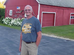 By the end of this first day, the trail had sliced across the peninsula of Door County to Algoma and the shadows were stretching out towards Lake Michigan. It was time to find a place to stay as we left the Ahnapee Trail for a connecting roadwalk.
Walking down a quiet, rural road past small farms, we saw a man in his driveway and waved. He returned the wave which opened up the possibility of a conversation.
Tip: [Most people you meet want to help out. They are just unsure of the safety of talking with a stranger. A wave and smile is often all it takes to break the ice. Ask them if there's any place to put up a tent, and they'll often offer their own yard or field. If not, just continue on.]
Lyle had one of the most perfect small farms I've seen. He let us camp back in his pine forest and use his water spigot. It was the perfect end to a great day and my sleeping bag felt wonderful after covering around 28 miles!
Sun - 08/04/2013
Day 2 - Algoma to Ellisville
 Leaving the sanctuary of Lyle's farm, our morning began with packing up wet, dew-heavy tents and then a road walk on Longfellow Road and Lake Shore Drive. This led us down the shore of Lake Michigan to Father Marquette park at Kewanuee. It was a fresh, cool walk passing the first of thousands of corn fields.
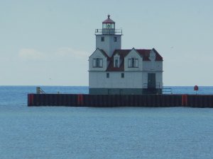
 The park has a great shelter with picnic tables, nice restrooms, and lots of open grass. The open view of Lake Michigan was punctuated with this lighthouse in the bay. It was a perfect place to take an hour break and dry out our tents in the steady wind.
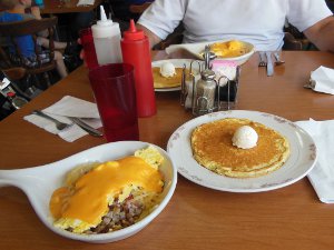 We hiked into Kewaunee and had breakfast at Kunkel's Korner - a pretty cool little diner. I didn't take many pictures of food, but this looked good and tasted even better. We got to chat a bit with some other folks having a late breakfast.
It still feels like I'm a 'poser' - saying I'm hiking the 1,100-mile Ice Age Trail and then admitting I've only walked 35 miles so far. That feeling will eventually leave, but not for many more days.
The nuclear power plant by Kewaunee has closed, resulting in many people losing their jobs. Kewaunee was the first of many dying small towns I would pass through across Wisconsin. Languishing farms, consolidated schools, closed businesses, and boarded up buildings were common sights along the trail.
Those sights were sad and made me figure what I saw here is probably happening in many other areas across the country. If you want to experience small-town America, don't put it off much longer. It appears that all that which makes the midwest special is slowly(?) fading away.
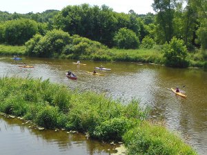 The trail followed the Kewaunee River upstream out of town, so we followed it also. With perfect timing, I crossed the river on a bridge just as a flotilla of kayaks floated downriver towards Kewaunee. It was fun hollering back and forth to them as they passed under the bridge.
After the Kewaunee River segment, a very long roadwalk hops back and forth south to the Tisch Mills trail segment.
Tip: [On road walking portions of the trail, a hiker can choose any route he'd like. In this case, I stayed on County AB straight south to Ellisville, effectively eliminating about 7 miles of walking.]
Tip: [One of the resources I used to prepare for this trek was the Hiker to Hiker Notes document prepared by a wonderful volunteer and made available through the Ice Age Trail Alliance. It lists useful bits of information submitted by other hikers, and not found in the official IAT Guidebook. You need this document if you're thru-hiking the IAT.]

The notes mentioned that one hiker had stayed out back of a bar in Ellisville. Reaching Ellisville made for a 30-mile day, but we arrived at the intersection as the sun was dropping low. Being the only building on road AB, it was not too difficult to find Janda's.
Working the bar was Gator who was also the cook. He sized us up quickly and said, "I bet you want to sleep out back tonight." I guess he's had other hikers stop in.
Leaving our packs by the wall, we sat at the bar and ordered burgers and beer. Chatting with Gator and the locals passed the time until our food was done. Gator makes a goooood burger! Or, I was very hungry.
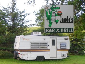 As he got to know us, and evidently figured we were ok, Gator mentioned we could stay inside the old camper parked out back instead of tenting, if we preferred. It sounded great to me!
With darkness enveloping the tiny town (well, actually the three buildings within eyesight), and Sunday being a fairly quiet evening, we enjoyed dry, comfortable beds with no effort of setting up camp. This would become a much more common occurrence over the next weeks than I had ever expected.
It also made me glad to have carried the extra miniscule weight of a couple pairs of disposable ear plugs. :-)
Mon - 08/05/2013
Day 3 - Mishicot Trail Angels
After a great night's rest behind Janda's, we were on the trail (road) at 6am. Rain threatened all morning but only succeeded in keeping the temps down for a perfect day of hiking.
Today was mostly road walking with short trail portions through Tisch Mills and Mishicot.
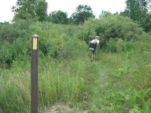 The Tisch Mills segment was the first real Ice Age Trail segment - not using an existing trail or road, just new trail made specifically for the IAT. It was simply a mowed strip through a small prairie and then some brush hacked out of the way along a creek to the hamlet of Tisch Mills.
Being a very new trail, it's had very little foot traffic yet. This means that the ground is not compacted and all the grass, shrubs, brush, and seeds easily grow right in the trail every year. That results in more need for trail vegetation maintenance each year by the dedicated volunteers that keep the Ice Age Trail open.
If a few thousand people hiked the trail, the vegetation in the trail bed would get destroyed, the ground would compact, and the trail would be much easier to find, follow, and enjoy. So, go out there and hike the trail!
Just as we were entering the new Mishicot trail segment, which actually just follows the hedge row between fields of corn and soybean, a truck stopped and the land owner introduced himself - he had just mowed the trail and was glad to see hikers using it. We thanked him for letting the trail pass through his property and for his efforts to keep it clear.
Tip: [Without the generosity of private land owners, the Ice Age Trail will never be complete. Make sure you stay on the trail and express your gratitude whenever you meet a landowner!]
 Entering Mishicot, we had completed about 21 miles of mostly road. I expected we'd need to find some spot along the road heading due east back towards Lake Michigan once it got dark. We might have stayed in Mishicot, but I had lost the info for my contact here.
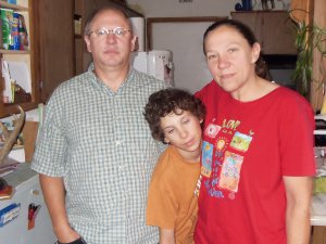
While walking down the sidewalk, a vehicle stopped and a lady asked what we were doing. Kathy is a "wild in her younger days" adventurer with compassion for people exploring the country. She said the town might let us camp in the park and we could check at the town hall a couple blocks away. We planned to take a break anyway and the park might be better than a ditch along the road later. So, While Papa Bear waited in the corner bar, I walked to the town hall and ran into Kathy just coming out as I was entering. She offered to let us stay with her family if the city park was not an option, and gave me her number.
Now, it's pretty difficult to convince your feet to hike another 6 or 8 miles when they know they can stop for the day and everything will be fine. So, here I am, showered, fed, and on a soft bed heading to sleep - thanks to a Trail Angel and her family!
Trail Angels are people that show compassion, pity, sympathy, or some other feeling that compels them to provide assistance. Some trail angels along popular trails leave coolers of soda and water by the trail during hiking season for hikers to drink. Others open their homes, yards, pastures, or private land for hikers to camp on. Others shuttle hikers to trail heads. These Trail Angels provide Trail Magic which is the term for the unexpected help they provide.
Tue - 08/06/2013
Day 4 - Manitowoc Storm
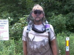
Kathy pampered us with a terrific french toast breakfast using real home-made bread! Then, it was out the door and winding our way along the mile-long Mishicot segment before heading due east on County V for 5 miles, searching for Lake Michigan. There is actually a salmon run that brings fish all the way up to the small dam in Mishicot. Our host's son is quite the fisherman and filled us in on his local exploits.
As soon as we reached the forest of Point Beach, we found the mosquitos - in spades! I splurged $28.50 on bug pants and jacket made out of mesh. This would be the big test to see how well it worked since there was no bug spray as a back-up. The thought was that the suit weighed only 6 ounces, would never run out, is easier to apply and take off, and would not get chemicals all over me, my sleeping bag, and the environment.
Well, it was a success! A thick cloud of mosquitos buzzed me constantly for three hours and I only got a couple bites around my wrists where the elastic was tight. Definitely the best gear purchase for this trip! The suit would be used many days to come.
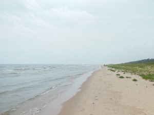 The southern portion of the Point Beach trail drops hikers right onto the sandy Lake Michigan shore for a couple miles. The sand was packed so the walking was not too difficult, and the temperature was cool. It was jus like hiking along the ocean, compete with sea gulls. I could do without the sea gulls, but they kept their distance. I can imagine this could be a miserable stretch in bad weather with no protection from the elements.
This is the last day to enjoy the breeze and views of the big lake, so I'm glad we get to enjoy it all the way down to Manitowoc.
I had found out about another hiker online, named Kehly, attempting to do the entire trail. She had left the eastern terminus about a week before us and was running a blog of her adventure. You can read her posts at Kehly's Hike.
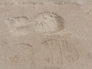 It looked like we would catch up to her any day since our daily miles were quite a bit more than her and she had some problems at the start. I was occasionally checking for signs of other hikers. This sandy shore was a perfect spot for prints, and I saw a few.
Here is my print (lower) next to another, much smaller, print. I was sure this must be her print and we were very close to her. (As it turns out, we had already passed Kehly while she took a day offtrail to recover.)
The trail led us into Two Rivers, the original home of the ice cream Sundae! I didn't find a place to buy one, but the trail did have a detour due to road work. I guess I missed the ice cream parlor. I did stop at McDonald's and the library which is right on the trail through town.
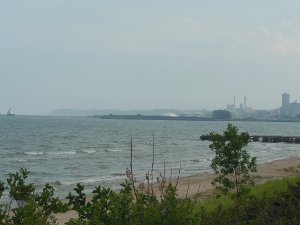 A couple miles through forest south of Two Rivers brought us to a long stroll on paved path and sidewalks right to the yacht club in Manitowoc. This portion of the Ice Age Trail is 24 miles of official trail - that means it's not a connecting route, but is blazed as the actual trail. It's the longest piece until I get to the Kettle Moraine State Forest.
I had sent emails to many Boy Scout troops across the state, letting them know about my hike plans and asking about possibly staying a night or visiting their troop. I was concerned about finding camping sites on the eastern half of the trail.
As it turned out, I camped out only two nights the entire first 15 days on the trail! But, don't worry, I slept outdoors 11 of the next 15. :-) It's not my fault that so many people were so friendly and helpful along the way!
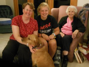 I had the contact information for a scout volunteer in Manitowoc who offered to put us up for the night. I called when we reached town and Margaret came and picked us up. Her husband and scout son were away at Scout Camp for the week, so I wouldn't get to meet them. But, it was wonderful visiting with grandma, mom, and daughter - and their two crazy dogs. The daughter is a great cook and made a super meal for us all.
We had planned to camp in the family's yard, but the forecast was for major storms so she let us stay indoors. That was very fortunate because these storms were intense - tornado winds and heavy rain that destroyed many buildings west and north of Manitowoc. After hiking 27 miles today, it was nice to miss the weather.
Tip: [The rest of the trek trends inland where temperatures will most likely be higher. Doing a west-bound late summer hike on the Ice Age Trail keeps you close to Lake Michigan and generally cooler temperatures for the first 275 miles. This was one reason I chose to hike west-bound.]
Wed - 08/07/2013
Day 5 - Camp Rokilio
 After the huge storm last night, our trail angel friend in Mishicot called to check on us. Kathy is such a great person! She was relieved to hear we weathered the storm indoors.
Out of Manitowoc, there are 33 miles of road to the next trail segment. So, today is fast, easy hiking.
Tip: [Rather than using the prescribed route in the Ice Age Trail guidebook, I chose to cut off a few miles and stay on Custer Street until it runs into English Lake Road which heads due west to intersect with County J south of Valders.]
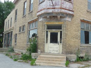
As I mentioned, there are many small towns across Wisconsin that are facing hard times. This closed shop is but one example of the dozens I passed along the Ice Age route. There are still many small businesses making a go of it, but none seemed to be in a growth mode - more like a survival mode. I'm sure my few dollars spent at the few places I visited made no impact, but please try to do business with local companies whenever you can.
 Have you ever had a short cut turn out to be not so short? Well, that was the main excitement for today. On my map, a long southerly road walk included an extra mile jog to the west and back. That seemed silly since the road continued through to the road we would eventually join. So, I pushed ahead just to the west of Pigeon Lake on map 92f (for any hikers out there). Unfortunately, the road on the map doesn't exist. It ends at a camp and a field.
To backtrack would add another two miles, and there was a small dirt road going forward, so we took it cautiously despite the small private property sign. There had been no road traffic for many miles and no one was around. We would take less than 30 minutes. Skirting the camp, some farmer's field, an old quarry, and finally another short dirt road, we made it through. It did save some distance, but not worth the worry.
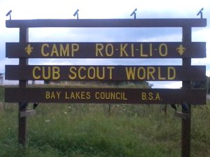
Shortly after this short cut, we reached our destination for the night. Camp Rokilio is a BSA Cub Scout camp on Cedar Lake. I had contacted them before the trip and arranged to stay. What a wonderful camp! Themed buildings for Cubs to spend a great week in places like a castle, wild west, and outer space. Very Cool!
Arriving just in time for dinner, we joined right in and skipped yet another night of our own cooking. After dinner, I was asked to tell the Cub Scouts about my hike so that was fun. I only talked a couple minutes and then they asked questions for about twice as long.
 The staff, even though they were in their last week of summer camp, were very energetic, friendly, and caring for the scouts. We were put up in a staff cabin and had yet another great night of rest, making today's 28 miles of road fade to memory.
Oh, one other highlight of today.
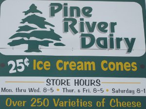
At the intersection of English Lake Rd and Range Line Rd stands the Pine River Dairy - the coolest dairy in the state, if you ask me. They have 25 cent ice cream cones, a viewing window where I watched them making butter, and the cutest, nicest girls in the county, I'm sure.
There's a nice News video about the dairy.
Thu - 08/08/2013
Day 6 - Race Day
We got an early start with a ride from a very helpful scout back to where we left the trail at 6:00am.
The shutter on my camera has gotten stuck, so I'm taking no pictures with it - only my cellphone for now. Fortunately, today's hike included about 5 miles on trail and the other 14 miles on road for a total of 19 miles.
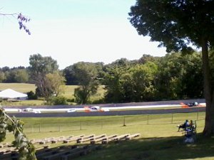 At the bottom of map 19f, there is a strangely shaped loop of road that is disconnected from any other roads. A couple hours after leaving camp, I could hear some very loud mosquitos in the distance. Over the next hour of hiking, it became clear they were racecars at the Elkhart Speedway - amazing how far across the country the sound carries!
After completing the La Budde segment, we altered our roadwalk to the main entrance of the raceway. PapaBear's overwhelming power of suggestion convinced a gate tender to let us visit for free (rather than $30 each, which we wouldn't have paid) so you can see our route goes right through the facility and out the southern gate. It wound up adding < 1/2 mile to our walking. The cars and crews were fun to watch as we strolled through the paddock area. No $3 Pepsis for us, though.
We sped through the first 3 miles of the northern Kettle Moraine forest to meet our ride on time. We'll be staying with my folks for the next few days and slackpacking throught the West Bend area. We all drove back up to Potawatomi to pick up my vehicle, and finally to my folks' home around 8:30pm for a long day with not many trail miles.
Fri - 08/09/2013
Day 7 - Zero Day
A relaxing day to eat, do laundry, eat, check email, eat, and rest up for tomorrow.
About 175 miles of trail are now behind me after a week of walking.
Continue with: Ice Age Trail hike - Day 08 to 14 - West Bend to Janesville
Find more Hiking Resources at www.HikingDude.com


Follow Me
Recent Comments