
Ice Age Trail Thru-Hike 2013 Journal
 I hiked along the 1,100-mile Ice Age Trail from Sturgeon Bay in NorthEast Wisconsin to the Minnesota border at Interstate Park near St. Croix Falls, WI.
 This is a journal of my trek. I would be happy to answer questions you may have about my trip, or when planning your own adventure. Enjoy your Hike!
Ice Age Trail hike - Day 01 to 07 - East Terminus to West Bend
Ice Age Trail hike - Day 08 to 14 - West Bend to Janesville
Ice Age Trail hike - Day 15 to 30 - Janesville to Gibraltar
Ice Age Trail hike - Day 31 to 40 - Gibraltar to Polar
Ice Age Trail hike - Day 41 to 49 - Polar to Gilman
Ice Age Trail hike - Day 50 to 57 - Gilman to West Terminus
Sat - 09/21/2013
Day 50 - Foot Rest
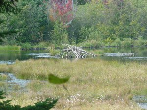 Rather than pushing feet that were still raw today, we chose to have a rest day.
Our trail angel friend, Ed, drove us ahead to the van and we drove it to my in-laws to spend the day recuperating.
One good thing - the weather has finally cleared this evening with stars across the sky, and it is supposed to remain that way for a few days at least (fingers crossed).
Tip: [ The trail will wait for you! Scheduling a rest day every week is a good idea, but it's even better to be flexible. Hiking as much as you can when the weather is good so you can take a day off if really bad weather rolls in will move you farther down the trail, reduce food use, and keep you more comfortable. Not setting a specific end date can also make your trek less stressful. ]
Sun - 09/22/2013
Day 51 - 900 Miles
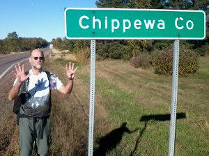 Look at that gorgeous blue sky!!
An early wake-up and long drive back to Gilman to leave the van, got us on the roadwalk from Gilman to Cornell. The county line into Chippewa County is just about 900 miles completed, so I'm holding up 9 fingers. Less than 200 miles to Minnesota now.
It's amazing how much difference a day makes. The rain is gone; the air is cool and crisp; the feet feel much better; and everything is dry. Taking a day off was definitely the right choice!
There is even noticeably more color in the trees along the road and it feels like fall.
Tip: [ The recommended Ice Age Trail route from the Chequamegon to Cornell jogs all over the place on less-traveled back roads but is about 14 mile longer than the direct Highway 64 walk. If you don't mind the traffic, there's a wide shoulder the entire way. ]
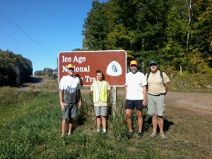 Last year on my Superior Hiking Trail trek, a scout from home and his family surprised me on the trail and hiked with me. Guess what?
Towards the end of our 17 mile roadwalk to Cornell, I saw a vehicle in a parking area along the road with what looked like a couple kids selling lemonade. Papa Bear and I decided we should support the young local entrepreneurs so we walked over. Only then did I recognize it was Benjamin and his family waiting for us to walk by!
They were on a weekend camping trip and followed our progress so they knew we'd be coming by soon.
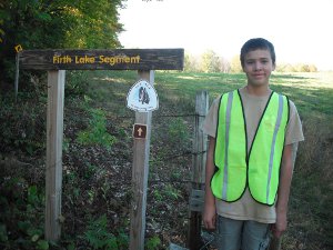 After a short visit and rest, they took our packs while we hiked the rest of the way to the city park. There, we were treated to a marvelous picnic of sandwiches, pop, chips, salad, candy bars, and even pickles - wow!
After lunch, Papa Bear and I finished our roadwalk to the trailhead across the Chippewa River to where Benjamin and his dad waited. They joined us for a 7 mile trail hike over the entire Firth Lake segment.
Benjamin did a great job finding blazes and leading us at a brisk pace. At the far end of the hike, his mom and sister met us for another snack break.
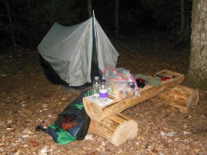 As it was getting late (and we had eaten most of their food, I expect), we finally hoisted our packs now filled with water for tomorrow and left our good friends to their drive home.
It was a most enjoyable afternoon and a real highlight of the trek for me! I am very grateful for such friends!
To top off the day, we found a new distributed camping area only a haf mile down the trail by Picnic Lake. It is a wonderful, flat, clean space nestled off the trail in pine trees. This nice spot allowed us to set up camp just before dark and relax in the cooling evening.
Just one last bonus in this terrific 28 mile day!
Thanks, Benjamin!!!
Mon - 09/23/2013
Day 52 - Weyerhaeuser
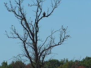 10 miles of trail that meandered between dozens of small lakes and bogs in the Chippewa forest was followed by a 20 mile road walk north to Weyerhaeuser and Highway 8.
I was wondering - Where does "Up NOrth" begin in Wisconsin?
Many weeks ago, in the town of Portage, I saw a sign that says "Where the North Begins" and that tagline is even on their city website.
Other people I've talked with say that Highway 64 is the dividing line across Wisconsin between North and South (We crossed that in Cornell yesterday).
A final group say north of Highway 8 is Up North.
So, tonight we're actually "Up North" by anyone's standards.
In this typical Wisconsin town, there is a gas station and 2 bars. The school closed a few years ago, and most business has dried up.
Dinner consisted of yet another pizza and a long rest in an empty bar, with typical use of the clean bathroom. Yet another day for me without filtering water or digging a cathole.
When we asked about places to camp, the owner says it will be ok if we throw our tents up in the city park, so that's where we're headed next.
Papa Bear has developed a problem with his lower left leg. We bummed an ace bandage from a very helpful lady at the Chippewa Ice Age interpretive center. He hiked all afternoon and has iced it tonight. My feet have healed up just fine and the hike was cool, clear, and steady today.
Tue - 09/24/2013
Day 53 - Yellow Blazes
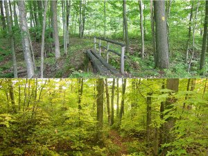 A simply wonderful day of hiking through Wisconsin!
Camp last night was inside a huge open-air shelter, so no wet tents this morning when we broke camp in Weyerhaeuser well before light.
A short roadwalk to the forest trailhead and my concern about heavy dew to soak shoes and socks as on other mornings was unfounded. Feet did get wet, but not soaked.
The trails today led through beautiful woods beginning their fall color change. At times, it was challenging to distinguish yellow blaze from leaf but we had no problems. Some raspberry overgrowth and a few blown down trees made today's 20 mile hike a bit adventurous, but nothing unexpected.
As an extra bonus today, I finally saw a bear! It crossed the road ahead of me at the end of the day while I was driving - but it was a spot we had road walked just a couple hours earlier.
My father-in-law is letting me borrow his vehicle for the rest of the trek. We dropped it off at Murphy Flowage three days ago and then drove my van to Gilman. This evening, when we reached Murphy Flowage, we drove back to Gilman, got my van, and drove both vehicles to my in-laws' home for the night.
The next three days will consist of leaving a vehicle at our destination for the day, driving to the start, slackpacking to the end, retrieving both vehicles, and staying at their home each night.
Wed - 09/25/2013
Day 54 - Pat and Greg
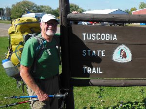 Yet another beautiful, blue-sky day. It makes those days in the Chequamegon seem like a distant bad dream.
Down the long, straight, shaded Tuscobia State Trail, we saw the small silhouette of a person. On this straight, flat trail, you can see at least a mile ahead.
As we hiked along, I believe we quickened our pace in anticipation of meeting up with a fellow hiker. As we gradually gained on him, the image slowly grew until we finally caught up to Pat, another westbound thru-hiker.
We caught him right at the Brill intersection. Our good timing allowed us to stop for a lunch break and visit with Pat.
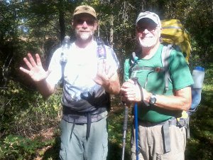 Pat's from Waupaca and has been hiking parts of the trail since April. He plans to finish next week at the West terminus.
The three of us walked together and swapped stories to pass the time as we reached the 1,000-mile mark.
So, here's the pic of Pat and I - that's 10 1000-mile hands. :-)
You can read all about Pat's adventure on his blog.
Pat also knows Kehly who is thru-hiking and has her blog.
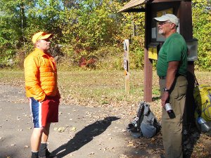 Nearly to Haugen, towards the end of the Tuscobia Trail, a man with a dog came walking up the trail towards us. He recognized us and said he's been following my blog and expected we'd be hiking by sometime today - how cool!
Greg chatted while we hiked toward his vehicle, we were now a group of 4 hikers and a dog. When we got to the trailhead, Greg said he had soda and snacks waiting. What a great treat on a warm afternoon - Thank You, Greg (and your dog Archie)
Pat stopped just past Haugen at a campground and we continued on.
Once past Haugen, the trail passes through BSA Camp Phillips. I've heard of this camp but never visited. It looks like a well-run and very nice camp with waterfront, pioneering, nature trails, and lots more. It was sure great of the BSA to have the trail pass through.
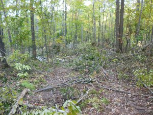 Soon after the camp, there is a big logging operation underway - chopping down everything, including many blazed trees. This was our first real hardship of the trail. We lost about 45 minutes searching for blazes, backtracking, and a little guessing before we finally made it through. The treacherous, churned-up ground made every step sketchy and slow.
As a testament to the outstanding volunteers that maintain the trail, when Kehly hiked through the logging area just three weeks later, new trail flagging had already been put in place. I expect the trail tread will be redone once the logging is complete.
Other than that, just a glorious 30 mile day on a very mellow trail most of the day.
Thu - 09/26/2013
Day 55 - More Hiking
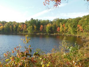 The hike was great today - clear blue sky above colorful trees buffeted by strong breezes. It's starting to sound like a stuck record, isn't it?
Leaves falling around us all day in the sun made a perfect fall hiking day.
The trail was pretty good. We hit one swamped over area of trail and threw down a few logs. There were a few strangely blazed spots that we figured out. We also did a short roadwalk at the end of the day which was not the correct route.
When we came out of the woods on County E (on map 5f), there was absolutely no indication of where to go. No entry point across the road, nor arrows, blazes, or notes pointing north or south. So, we roadwalked around the section on the only connecting road, adding a mile or so. Looking on the IATA website later, we should have gone north to find the new trail.
Fri - 09/27/2013
Day 56 - One More Day
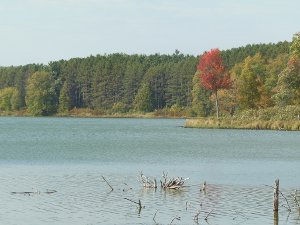 The adventure is almost complete. After the 31 miles today, there's only 23 more miles to finish tomorrow - from Luck to St. Croix Falls. We covered a lot of ground today since the weather was great and tomorrow promises rain. We'd also like to reach the terminus in time to tour the Ice Age center before closing.
I got to enjoy many miles of colorful forest today, and we passed the northernmost point of the trail - just another little milestone.
We met another Ice Age volunteer running on the trail today. John stopped and chatted awhile and then ran on. We saw our first bowhunters also.
Sat - 09/28/2013
Day 57 - Last Steps
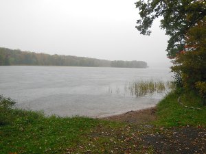 Not to change the routine, our day started very early. It began with a short drive to Luck where we left the van and hiked on with hopes of meeting someone that would give us a lift back to pick it up.
It's not a long day, just 23 miles, but there are some reasons to get moving: the Ice Age Center in Interstate Park closes at 4pm and we really want to visit it; the forecast is for rain today but it has been fluctuating between 20% and 70%; I'm ready to get home. So, we hike on into the damp gloom of pre-dawn.
All morning, the rain clouds scuttle by, miraculously missing us on the entire Gandy Dancer Trail which is a wide, groomed, bike trail with easy hiking and not much scenery. A 4 mile roadwalk gets us to the St. Croix River where our luck finally gives out.
Through the chilly mist and rain, I can see Minnesota just across the river. Umbrellas come out and we hike on.
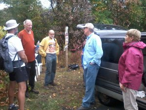 While navigating through St. Croix Falls, we stumble upon a volunteer trail crew preparing a new stretch of trail for a work party to take place next week. These hard-working folks are soggy, muddy, and all smiles despite the weather. They chat with us for nearly an hour and one is heading up to Luck late in the afternoon - perfect! He'll meet us at the Ice Age Center and give us a ride - all we have to do is reach the end of the trail.
Papa Bear and I got to be the first hikers to use this new section of trail even though it wasn't done yet - pretty cool!
I planned to come back over and help with the work party and see Pat whom we had met on the trail three days earlier. Unfortunately, the government shutdown caused all IATA activities to be cancelled since it is part of the NPS system (or something like that).
One of the volunteers was Chet Anderson, known as Gray Ghost. He has many, many miles of hiking experience which you can read about at Gray Ghost. I had run into Chet and Ole Smokey Lonesome last fall on the Superior Hiking Trail - great guy!
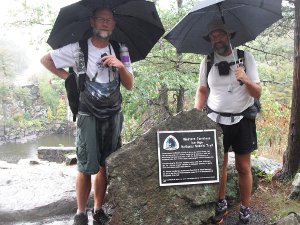 We slogged our way through town as cars sped by, kicking up spray from the wet pavement. Entering Interstate Park, I was excited - the end was right here. Don't fall for that one!
The last mile or so takes F-O-R-E-V-E-R winding through the park!
Upon finally reaching the western terminus with its plaque on a big rock, I had one more surprise. My good friend, Duncan, was waiting! He had driven over from home to congratulate us on our completion. This was the same man that hiked with us by Cornell.
All the pictures I've seen of people at the end of the trail are sunny, cheerful, and a big celebration. No one finishes in cold rain with the trail inches deep in water, soaking wet feet, and soggy clothes. Well, we did!
A few pictures and congratulations, and then into the Ice Age center to get out of the cold rain and warm up.
No need to find a plce to camp tonight. No planning tomorrow's hike. No wondering what excitement the trail will bring. Just profound gratitude to all the folks that make this trail possible and my opportunity to enjoy it - end to end.
All Comments:
Feb 08, 2016 - twisted
excellent story
thanks for the info
m headin out, westbound, April 10th
trail journals.com/twisted
thanks for the info
m headin out, westbound, April 10th
trail journals.com/twisted
Ask a Question
Find more Hiking Resources at www.HikingDude.com


Follow Me
Recent Comments